Kalashtar Rural District
Kalashtar Rural District
Persian: دهستان كلشتر | |
|---|---|
 Kalashtar Rural District | |
| Coordinates: 36°43′09″N 49°28′19″E / 36.71917°N 49.47194°E[1] | |
| Country | Iran |
| Province | Gilan |
| County | Rudbar |
| District | Central |
| Capital | Jamalabad-e Kuseh |
| Population (2016)[2] | |
| • Total | 4,289 |
| Time zone | UTC+3:30 (IRST) |
Kalashtar Rural District (Persian: دهستان كلشتر)[3] is in the Central District of Rudbar County, Gilan province, Iran.[4] Its capital is the village of Jamalabad-e Kuseh.[5] The previous capital of the rural district was the village of Kalashtar.[6]
Demographics
[edit]Population
[edit]At the time of the 2006 National Census, the rural district's population was 5,327 in 1,432 households.[7] There were 5,329 inhabitants in 1,560 households at the following census of 2011.[8] The 2016 census measured the population of the rural district as 4,289 in 1,287 households. The most populous of its 27 villages was Aliabad, with 1,605 people.[2]
See also
[edit]References
[edit]- ^ OpenStreetMap contributors (14 October 2024). "Kalashtar Rural District (Rudbar County)" (Map). OpenStreetMap (in Persian). Retrieved 14 October 2024.
- ^ a b Census of the Islamic Republic of Iran, 1395 (2016): Gilan Province. amar.org.ir (Report) (in Persian). The Statistical Center of Iran. Archived from the original (Excel) on 4 December 2020. Retrieved 19 December 2022.
- ^ Iranian National Committee for Standardization of Geographical Names website (in Persian)
- ^ Habibi, Hassan (21 October 2015) [Approved 21 June 1369]. Approval of the organization and chain of citizenship of the elements and units of the national divisions of Gilan province centered on the city of Rasht. rc.majlis.ir (Report) (in Persian). Ministry of the Interior, Defense Political Commission of the Government Board. Proposal 3233.1.5.53; Notification 82846/T135K. Archived from the original on 12 October 2016. Retrieved 12 December 2023 – via Islamic Parliament Research Center.
- ^ Habibi, Hassan (c. 2023) [Approved 26 June 1373]. Creating reforms in the rural districts of Gilan province. lamtakam.com (Report) (in Persian). Ministry of the Interior, Political-Defense Commission of the Government Council. Proposal 1.4.42.676. Archived from the original on 13 December 2023. Retrieved 13 December 2023 – via Lam ta Kam.
- ^ Mousavi, Mirhossein (16 January 1392) [Approved 18 May 1366]. Creation and formation of 10 rural districts including villages, farms and places in Rudbar County under Gilan province. rc.majlis.ir (Report) (in Persian). Ministry of the Interior, Council of Ministers. Proposal 53.1.1674; Notification 116862/T896. Archived from the original on 5 April 2013. Retrieved 13 December 2023 – via Research Center of the System of Laws of the Islamic Council of the Farabi Library of Mobile Users.
- ^ Census of the Islamic Republic of Iran, 1385 (2006): Gilan Province. amar.org.ir (Report) (in Persian). The Statistical Center of Iran. Archived from the original (Excel) on 20 September 2011. Retrieved 25 September 2022.
- ^ Census of the Islamic Republic of Iran, 1390 (2011): Gilan Province. irandataportal.syr.edu (Report) (in Persian). The Statistical Center of Iran. Archived from the original (Excel) on 8 October 2023. Retrieved 19 December 2022 – via Iran Data Portal, Syracuse University.
| Capital | 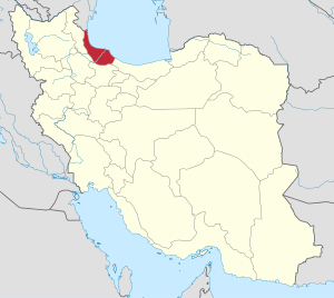 | |
|---|---|---|
| Counties and cities | ||
| Sights |
| |
| Populated places | ||
| Capital | |||||||||||||||||||||||||||||||||||||||||||||
|---|---|---|---|---|---|---|---|---|---|---|---|---|---|---|---|---|---|---|---|---|---|---|---|---|---|---|---|---|---|---|---|---|---|---|---|---|---|---|---|---|---|---|---|---|---|
| Districts |
| ||||||||||||||||||||||||||||||||||||||||||||
This Rudbar County location article is a stub. You can help Wikipedia by expanding it. |