Tanjungpinang
Tanjungpinang | |
|---|---|
| City of Tanjung Pinang Kota Tanjungpinang | |
| Regional transcription(s) | |
| • Jawi | تنجوڠ ڤينڠ |
| • Chinese | 丹戎檳榔 |
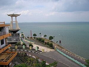
| From top, left to right: City view from Dompak Island, house of governor of the Riau Islands, tombs of Riau kings, Raja Haji Fisabilillah Monument, and Sultan Sulaiman Badrul Alamsyah Museum | |
| Motto(s): Jujur Bertutur Bijak Bertindak | |
 Location within Riau Islands | |
| Coordinates: 0°55′08″N 104°27′19″E / 0.918773°N 104.455415°ECoordinates: 0°55′08″N 104°27′19″E / 0.918773°N 104.455415°E | |
| Country | |
| Province | |
| Founded | 6 January 1784[1] |
| Incorporated | 21 June 2001[2] |
| Government | |
| • Mayor | Rahma |
| Area | |
| • Total | 812.7 km2 (313.8 sq mi) |
| • Land | 144.6 km2 (55.8 sq mi) |
| Elevation | 18 m (59 ft) |
| Population (2020 Census) | |
| • Total | 227,663 |
| • Density | 280/km2 (730/sq mi) |
| Time zone | UTC+7 (Indonesia Western Time) |
| Area code | (+62) 771 |
| Website | tanjungpinangkota |
Tanjungpinang, also written as Tanjung Pinang, is the capital city of the Indonesian province of Riau Islands. It covers a land area of 144.56 km2, mainly on the southern Bintan Island, as well as other smaller islands such as Dompak Island and Penyengat Island.[3] With a population of 227,663 at the 2020 Census,[4] it is the second largest city of the province, after Batam.[5] Tanjungpinang is a historic city of the Malay culture, having served as the capital of both Johor Sultanate and Riau-Lingga Sultanate.
Tanjungpinang – whose name is taken from the position of a beach tree that juts into the sea – occupies a strategic location on the south of Bintan Island, guarding the mouth of the Bintan River. Tanjungpinang has ferry and speedboat connections to Batam, Singapore (40 km away), and Johor Bahru. The city is also served by Raja Haji Fisabilillah International Airport, located about 7 km east of the city center.
탄중피낭은 수세기 동안 수마트라, 말라카, 네덜란드, 영국, 일본의 지배를 받았다. 이러한 접촉들은 각각 그것의 문화에 영향을 미쳤고, 또한 말레이 문화와 무역 교통의 중심지가 되었다. 18세기에는 조호르-리오-링가 제국의 수도였다.
역사
탄중피낭이라는 이름은 바다로 돌출해 있는 해변 너트 나무의 위치에서 따온 것이다.[further explanation needed] 빈탄강으로 갈 항해사들의 안내서인 케이프 안에 있는 나무들.[clarification needed] 탄중피낭 강은 빈탄으로 들어가는 입구로 벤탄 제국은[clarification needed] 현재 부킷바투의 분할에 기반을 두고 있었다.
초기 역사
탄중피낭의 역사는 3세기 초 인도-중국 교역로의 교역소로 번창했던 역사를 추적할 수 있다. 중국과 무역을 키워온 수마트라에 본부를 둔 제국인 스리비자야는 7세기부터 13세기까지 말레이 군도의 대부분을 지배하게 되었다. 이 지역에서 해적행위가 증가하면서 쇠퇴했고, 12세기에 이르러 빈탄섬은 중국인에 의해 "해적섬"으로 알려지게 되었다.
말레이 실록에 따르면 팔렘방 해고를 피해 도망친 스리비자야 왕자인 세리 테리 부아나가 빈탄에 몇 년간 머물면서 신가푸라 왕국(싱가포르)을 건국하기 전 힘을 모았다. 1세기 후, 이 도시 역시 경쟁국들에 의해 축출되었고, 그것의 왕은 말라카에 새로운 도시를 세웠다. 말라카 술탄국(1400–1511)은 리아우 군도를 포함한 영토인 이 지역의 위대한 제국 중 하나가 되었다. 말라카는 1511년 포르투갈군에 포로로 잡혔고, 추방당한 술탄 마흐무드 샤는 빈탄에 그의 수도를 세웠으며, 그곳에서 포르투갈인에 대한 공격과 봉쇄를 조직하였다. 1526년, 말레이군을 진압하려는 여러 번의 시도 끝에 포르투갈군은 빈탄을 땅으로 쳐부수었다.
Johor Sultanate
Alauddin Riayat Shah II, a son of Mahmud Shah, established the Johor Sultanate in 1528. Former-Malaccan territories were quickly brought under Johor's influence, including Bintan, where an important trading port called Bandar Riau was opened. As it prospered and a war with the Jambi Sultanate threatened Johor in 1722, the capital was moved to Riau, which became a centre of trade and Islamic studies much as Malacca had been.
A conflict with the Dutch, who had taken Malacca from the Portuguese, culminated with a Dutch fleet of 13 vessels besieging and attacking Riau. On 6 January 1784, they were met in battle by Malay and Bugis forces, and repelled with the destruction of the Dutch command ship Malaka's Wal Faren. Malay forces continued to harass the Dutch, and blockaded Malacca, but a defeat and succession crisis shifted power against them. The capital was moved from Riau to Lingga in 1788. The change of capitals has led to the Johor Sultanate sometimes being called the Johor–Riau–Lingga Empire.
The British gained control of Malacca from the Dutch in 1795. Attempting to increase their influence over the Straight of Malacca, the two powers each crowned a different candidate as Sultan of Johor–Riau during a succession crisis (1812–1818). This led to the partition of Johor–Riau under the Anglo-Dutch Treaty of 1824, which placed the territory south of the straight under Dutch control as the Riau–Lingga Sultanate.
Dutch colony and independence
The Malay were not consulted in these agreements, and relations worsened. On 11 February 1911, the Dutch deposed the sultan for defying the colonial masters, and officially annexed the sultanate which was then administered from Tanjungpinang as the Riau Residency of the Dutch East Indies. A military base was also constructed at Tanjungpinang.
During World War II, the Japanese occupiers made Tanjungpinang the government centre for the Riau Islands. Control returned to the Dutch following the Japanese surrender, and the Dutch officially withdrew in 1950. Riau became one of the last territories merged into Indonesia, known as the daerah-daerah pulihan (recovered regions). Tanjungpinang briefly became the capital of Riau Province, until the capital was moved to Pekanbaru in 1960. A law passed in 2001 defined Tanjungpinang as an autonomous city, and it became the capital of Riau Islands Province.
관리
도시(Bintan Regency와 행정적으로 분리된)는 4개 구역(케카마탄)으로 나뉘며, 그 구역과 2010년 및 2020년 인구조사 인구수를 표로 작성한다.[6][7]
| 이름 | 면적 km2 단위로 | 인구 2010년 인구 조사 | 인구 인구조사 2020 | 의 번호 마을 | 게시하다 코드 |
|---|---|---|---|---|---|
| 부킷베스타리 | 45.64 | 54,157 | 54,410 | 5 | 29122-124 |
| 탄중피낭 티무르 (동탄중피낭) | 58.95 | 70,867 | 109,780 | 5 | 29122-125 |
| 탄중피낭코타 (다운타운 탄중피낭) | 35.42 | 17,026 | 19,226 | 4 | 29111-115 |
| 탄중피낭바랏 (서탄중피낭) | 4.55 | 45,309 | 44,247 | 4 | 29111-113 |
기후
탄중피낭은 열대우림 기후(Af)로 연중 강한 비가 내린다.
| 탄중피낭의 기후 데이터 | |||||||||||||
|---|---|---|---|---|---|---|---|---|---|---|---|---|---|
| 월 | 얀 | 2월 | 3월. | 4월. | 5월 | 준. | 줄리 | 8월 | 9월. | 10월 | 11월 | 12월 | 연도 |
| 평균 높은 °C(°F) | 30.0 (86.0) | 30.5 (86.9) | 30.9 (87.6) | 31.2 (88.2) | 31.3 (88.3) | 31.2 (88.2) | 30.7 (87.3) | 30.9 (87.6) | 30.8 (87.4) | 30.9 (87.6) | 30.5 (86.9) | 30.2 (86.4) | 30.8 (87.4) |
| 일평균 °C(°F) | 25.8 (78.4) | 26.1 (79.0) | 26.4 (79.5) | 26.7 (80.1) | 26.9 (80.4) | 26.8 (80.2) | 26.4 (79.5) | 26.5 (79.7) | 26.6 (79.9) | 26.6 (79.9) | 26.3 (79.3) | 26.2 (79.2) | 26.4 (79.6) |
| 평균 낮은 °C(°F) | 21.7 (71.1) | 21.8 (71.2) | 21.9 (71.4) | 22.2 (72.0) | 22.6 (72.7) | 22.5 (72.5) | 22.2 (72.0) | 22.1 (71.8) | 22.4 (72.3) | 22.3 (72.1) | 22.2 (72.0) | 22.2 (72.0) | 22.2 (71.9) |
| 평균 강수량 mm(인치) | 295 (11.6) | 177 (7.0) | 213 (8.4) | 271 (10.7) | 244 (9.6) | 215 (8.5) | 213 (8.4) | 195 (7.7) | 227 (8.9) | 253 (10.0) | 305 (12.0) | 347 (13.7) | 2,955 (116.5) |
| 출처: | |||||||||||||
인구통계학
종교
이슬람교는 이 도시의 지배적인 종교로, 전체 인구의 78.57%가 자신을 이슬람교도로 인식하고 있다. 기타 종교로는 전체 인구의 13.58%를 차지하는 불교, 7.56%를 차지하는 기독교, 0.02%를 차지하는 힌두교, 0.27%를 차지하는 유교가 있다.
랜드마크
탄중피낭에는 말레이 음악과 춤의 무대 공연을 위한 문화센터가 자리 잡고 있다. 그 센터는 정기적으로 축제와 음악과 춤과 같은 다른 공연들을 조직한다. 유명한 사찰들은 탄중피낭 중앙 외곽에 있는 센가랑이라는 작은 마을에 위치해 있다.
Penyengat Island
The old ruler's palace and royal tombs, including the grave of Raja Ali Haji (who was the creator and author of the first Malay grammar book), are one of the many legacies left by the Riau–Lingga Sultanate. The old vice-royal mosque, the Masjid Raya, is still in use.
Notes
- ^ Sani, Muhammad (8 February 2013). Untung Sabut Muhammad Sani (in Indonesian). Gramedia Pustaka Utama. ISBN 978-602-03-5358-6.
- ^ RI, Setjen DPR. "J.D.I.H. - Dewan Perwakilan Rakyat". www.dpr.go.id (in Indonesian). Retrieved 3 June 2020.
- ^ "Kabupaten - Kementerian Dalam Negeri - Republik Indonesia". 31 October 2013. Archived from the original on 31 October 2013. Retrieved 3 June 2020.
- ^ Badan Pusat Statistik, Jakarta, 2021.
- ^ "Badan Pusat Statistik Provinsi Kepulauan Riau". kepri.bps.go.id. Retrieved 3 June 2020.
- ^ Biro Pusat Statistik, Jakarta, 2011.
- ^ Badan Pusat Statistik, Jakarta, 2021.
- ^ "Tanjung Pinang climate: Average Temperature, weather by month, Tanjung Pinang water temperature - Climate-Data.org". en.climate-data.org. Retrieved 3 June 2020.
- ^ "Riau Islands Province in Figures 2017". BPS Kepulauan Riau. Retrieved 22 July 2018.
External links
Tanjungpinang travel guide from Wikivoyage
- Official website


