Goodmayes
Appearance
| Goodmayes | |
|---|---|
 Goodmayes High Road in 2005 | |
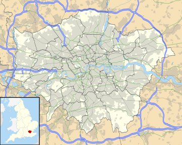
| Location within Greater London | |
| Population | 13,069 (2011 Census. Ward)[1] |
| OS grid reference | TQ465865 |
| • Charing Cross | 11 mi (18 km) WSW |
| London borough | |
| Ceremonial county | Greater London |
| Region | |
| Country | England |
| Sovereign state | United Kingdom |
| Post town | ILFORD |
| Postcode district | IG3 |
| Post town | ROMFORD |
| Postcode district | RM6 |
| Dialling code | 020 |
| Police | Metropolitan |
| Fire | London |
| Ambulance | London |
| UK Parliament | |
| London Assembly | |
Goodmayes is a district in North East London, England. It is a suburban development in the London Borough of Redbridge and forms part of the Ilford post town, situated approximately two miles to the east of Ilford town centre. Historically part of Essex, it was part of the Municipal Borough of Ilford until 1965 when it was incorporated into Greater London.[2]
References
[change | change source]- ↑ "Redbridge Ward population 2011". Neighbourhood Statistics. Office for National Statistics. Archived from the original on 21 October 2016. Retrieved 18 October 2016.
- ↑ "Ilford Historical Society". Ilford Historical Society.
