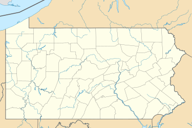
New Alexandria, Pennsylvania
Borough of New Alexandria, Pennsylvania | |
|---|---|
Borough | |
| Nickname: New Alex | |
 Location of New Alexandria in Westmoreland County, Pennsylvania. | |
| Coordinates: 40°23′50″N 79°25′25″W / 40.39722°N 79.42361°W | |
| Country | United States |
| State | Pennsylvania |
| County | Westmoreland |
| Settled | 1760 (stagecoach stop) |
| Incorporated | April 10, 1834 |
| Government | |
| • Type | Borough Council |
| • Mayor | Tim Ruane |
| Area | |
• Total | 0.85 sq mi (2.19 km2) |
| • Land | 0.85 sq mi (2.19 km2) |
| • Water | 0.00 sq mi (0.00 km2) |
| Elevation | 1,096 ft (334 m) |
| Population | |
• Total | 501 |
| • Density | 591.50/sq mi (228.36/km2) |
| Time zone | UTC-5 (Eastern (EST)) |
| • Summer (DST) | UTC-4 (EDT) |
| Zip code | 15670 |
| FIPS code | 42-53160 |
| Website | www |
New Alexandria is a borough that is located in Westmoreland County, Pennsylvania, United States. The population was 560 at the time of the 2010 census.
History
[edit]Settled in 1760 along the banks of the Historic Loyalhanna Creek, this community began as a wagon rest stop for travelers, soldiers and militiamen during the American Revolution. New Alexandria was incorporated by an Act of Assembly passed on April 10, 1834.
Formerly known as Denniston's Town, New Alexandria's population has not increased greatly over the years.
Geography
[edit]New Alexandria is located at 40°23′50″N 79°25′25″W / 40.39722°N 79.42361°W (40.397254, -79.423591),[3] along U.S. Route 22 approximately midway between Pittsburgh and Johnstown. It is also located approximately seven miles north of Latrobe.
According to the United States Census Bureau, the borough has a total area of 0.8 square miles (2.1 km2), all land.
Demographics
[edit]| Census | Pop. | Note | %± |
|---|---|---|---|
| 1840 | 427 | — | |
| 1850 | 300 | −29.7% | |
| 1860 | 295 | −1.7% | |
| 1870 | 305 | 3.4% | |
| 1880 | 335 | 9.8% | |
| 1890 | 338 | 0.9% | |
| 1900 | 364 | 7.7% | |
| 1910 | 505 | 38.7% | |
| 1920 | 587 | 16.2% | |
| 1930 | 615 | 4.8% | |
| 1940 | 639 | 3.9% | |
| 1950 | 523 | −18.2% | |
| 1960 | 685 | 31.0% | |
| 1970 | 690 | 0.7% | |
| 1980 | 697 | 1.0% | |
| 1990 | 571 | −18.1% | |
| 2000 | 595 | 4.2% | |
| 2010 | 560 | −5.9% | |
| 2020 | 501 | −10.5% | |
| Sources:[4][5][6][2] | |||
At the time of the 2000 census, there were 595 people, 254 households, and 186 families living in the borough. The population density was 704.2 inhabitants per square mile (271.9/km2). There were 271 housing units at an average density of 320.7/sq mi (123.8/km2). The racial makeup of the borough was 99.50% White, 0.17% Asian, and 0.34% from two or more races.[5]
Of the 254 households 28.3% had children under the age of 18 living with them, 60.2% were married couples living together, 9.4% had a female householder with no husband present, and 26.4% were non-families. 24.0% of households were one person and 11.4% were one person aged 65 or older. The average household size was 2.34 and the average family size was 2.76.
The age distribution was 19.2% under the age of 18, 7.1% from 18 to 24, 27.6% from 25 to 44, 26.7% from 45 to 64, and 19.5% 65 or older. The median age was 43 years. For every 100 females, there were 97.7 males. For every 100 females age 18 and over, there were 94.7 males.
The median household income was $37,656, and the median family income was $41,477. Males had a median income of $35,625 versus $26,250 for females. The per capita income for the borough was $17,893. About 2.8% of families and 4.4% of the population were below the poverty line, including 5.0% of those under age 18 and 1.8% of those age 65 or over.
Notable people
[edit]- Agnes Sligh Turnbull, writer.
- William Speer, pioneer missionary.
- Blackie Watt, racing driver.
References
[edit]- ^ "ArcGIS REST Services Directory". United States Census Bureau. Retrieved October 12, 2022.
- ^ a b "Census Population API". United States Census Bureau. Retrieved Oct 12, 2022.
- ^ "US Gazetteer files: 2010, 2000, and 1990". United States Census Bureau. 2011-02-12. Retrieved 2011-04-23.
- ^ "Census of Population and Housing". U.S. Census Bureau. Retrieved 11 December 2013.
- ^ a b "U.S. Census website". United States Census Bureau. Retrieved 2008-01-31.
- ^ "Incorporated Places and Minor Civil Divisions Datasets: Subcounty Resident Population Estimates: April 1, 2010 to July 1, 2012". Population Estimates. U.S. Census Bureau. Archived from the original on 11 June 2013. Retrieved 11 December 2013.


