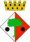
Begues
Appearance
Begues | |
|---|---|
 Detail of the door of the church of St. Christopher, Begues | |
| Coordinates: 41°20′02″N 1°55′19″E / 41.334°N 1.922°E | |
| Country | |
| Community | |
| Province | Barcelona |
| Comarca | Baix Llobregat |
| Government | |
| • Mayor | Mercè Esteve Pi (2015)[1] |
| Area | |
• Total | 50.4 km2 (19.5 sq mi) |
| Elevation | 399 m (1,309 ft) |
| Population (2018)[3] | |
• Total | 6,961 |
| • Density | 140/km2 (360/sq mi) |
| Demonym(s) | Beguetà, beguetana |
| Website | begues |
Begues (Catalan pronunciation: [ˈbeɣəs]) is a municipality in the comarca of Baix Llobregat in Catalonia, Spain. It is situated in the south-west of the comarca, and its municipal territory covers most of the Garraf massif including the peaks of el Montau (658 m) and La Morella (594 m).
Begues is an important tourist centre, and it is connected with Avinyonet del Penedès and with Gavà by a local road.
Demography
[edit]| 1900 | 1930 | 1950 | 1970 | 1986 | 2020 |
|---|---|---|---|---|---|
| 1077 | 1003 | 968 | 1403 | 1534 | 7300 |
References
[edit]- ^ "Ajuntament de Begues". Generalitat of Catalonia. Retrieved 2015-11-13.
- ^ "El municipi en xifres: Begues". Statistical Institute of Catalonia. Retrieved 2015-11-23.
- ^ Municipal Register of Spain 2018. National Statistics Institute.
- Panareda Clopés, Josep Maria; Rios Calvet, Jaume; Rabella Vives, Josep Maria (1989). Guia de Catalunya, Barcelona: Caixa de Catalunya. ISBN 84-87135-01-3 (Spanish). ISBN 84-87135-02-1 (Catalan).
External links
[edit]- Government data pages (in Catalan)


