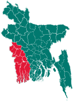
Jibannagar Upazila
Jibannagar
জীবননগর | |
|---|---|
 Khaza Paresh Dargah | |
 | |
| Coordinates: 23°25′N 88°49.2′E / 23.417°N 88.8200°E | |
| Country | |
| Division | Khulna |
| District | Chuadanga |
| Area | |
• Total | 199.25 km2 (76.93 sq mi) |
| Population | |
• Total | 197,785 |
| • Density | 990/km2 (2,600/sq mi) |
| Time zone | UTC+6 (BST) |
| Postal code | 7230[2] |
| Website | Official Map of Jibannagar |
Jibannagar (Bengali: জীবননগর) is an upazila of Chuadanga District[3] in the Division of Khulna, Bangladesh.
Geography
[edit]Jibannagar is located at 23°25′00″N 88°49′15″E / 23.4167°N 88.8208°E. It has 44,185 households and total area 199.25 km2. Jibannagar Upazila has an area of 199.32 km2. The main rivers located in Jibannagar are Bhairab River and Kobadak River.
Jibannagar Upazila is bounded by Chuadanga Sadar Upazila on the north, Kotchandpur Upazila, in Jhenaidah District, on the east, Maheshpur Upazila, in Jhenaidah District, on the south, and Hanskhali CD Block, in Nadia District, West Bengal, India, on the west.[3]
Demographics
[edit]As of the 2011 Census of Bangladesh, Jibannagar upazila had 44,185 households and a population of 179,581. 35,555 (19.80%) were under 10 years of age. Jibannagar had a literacy rate of 46.14%, compared to the national average of 51.8%, and a sex ratio of 999 females per 1000 males. 38,152 (21.25%) of the population lived in urban areas.[5][6]
As of the 1991 Bangladesh census, Jibannagar had a population of 125,102. Males constituted 51.32% of the population, and females made up 48.68%. This upazila's eighteen-up population was 61,511.[7]
Administration
[edit]Jibannagar, originally a Thana, was turned into an upazila in 1983.[3]
Jibannagar Upazila is divided into Jibannagar Municipality and seven union parishads: Andulbaria, Banka, Hasadah, KDK, Raypur, Shimanto, and Uthali. The union parishads are subdivided into 76 mauzas and 82 villages.[5]
Jibannagar Municipality is subdivided into 9 wards and 9 mahallas.[5]
Schools
[edit]
Some notable schools of the upazila are:
- Kashipur Secondary School
- Jibonnagar Thana Pilot Girls School
- Monohorpur secondary School
- B C K M P Secondary School
- Roypur Secondary School
- Hasadah Secondary School
- Uthali Secondary School
- Shaplakali Ideal School
- Jibannagar Degree College
- Jibannagar Girls' Degree College
- Dhopakhali High School
- Jibonnagar Thana Modal High School
- Karatoa High School
- Shahapur High school
- Minajpur Secondary school
- Rainbow Grammar School
See also
[edit]References
[edit]- ^ National Report (PDF). Population and Housing Census 2022. Vol. 1. Dhaka: Bangladesh Bureau of Statistics. November 2023. p. 399. ISBN 978-9844752016.
- ^ "Bangladesh Postal Code". Dhaka: Bangladesh Postal Department under the Department of Posts and Telecommunications of the Ministry of Posts, Telecommunications and Information Technology of the People's Republic of Bangladesh. 21 October 2024.
- ^ a b c Iman Siddiqui (2012), "Jibannagar Upazila", in Sirajul Islam and Ahmed A. Jamal (ed.), Banglapedia: National Encyclopedia of Bangladesh (Second ed.), Asiatic Society of Bangladesh
- ^ Population and Housing Census 2022 - District Report: Chuadanga (PDF). District Series. Dhaka: Bangladesh Bureau of Statistics. June 2024. ISBN 978-984-475-254-2.
- ^ a b c "Bangladesh Population and Housing Census 2011 Zila Report – Chuadanga" (PDF). bbs.gov.bd. Bangladesh Bureau of Statistics.
- ^ "Community Tables: Chuadanga district" (PDF). bbs.gov.bd. Bangladesh Bureau of Statistics. 2011. p. 103.
- ^ "Population Census Wing, BBS". Archived from the original on 2005-03-27. Retrieved November 10, 2006.
