Category:Tomasee
Jump to navigation
Jump to search
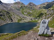
English: Tomasee (Romansh: Lai da Tuma or Lag da Toma) is a lake at Piz Badus, above the village of Disentis in Grisons, Switzerland. It is the source of the Anterior Rhine.
lake in Graubünden, Switzerland | |||||
| Upload media | |||||
| Instance of | |||||
|---|---|---|---|---|---|
| Location | Tujetsch, Surselva Region, Grisons, Switzerland | ||||
| Width |
| ||||
| Length |
| ||||
| Area |
| ||||
| Elevation above sea level |
| ||||
| Inflows | |||||
| Outflows | |||||
| Drainage basin | |||||
| Basin country | |||||
 | |||||
Media in category "Tomasee"
The following 56 files are in this category, out of 56 total.
-
676-PazolaRhein.jpg 140 × 140; 55 KB
-
Abfluss des Rein da Tuma aus dem Tumasee.jpg 2,816 × 2,112; 2.5 MB
-
Above Tomasee.JPG 2,592 × 1,944; 1.65 MB
-
At the Slopes of Badus.jpg 1,500 × 2,000; 1.24 MB
-
Badushütte, Maighelshütte, Tomasee.JPG 4,912 × 3,264; 6.97 MB
-
CH-NB - Tomasee, mit Quellflüssen des Vorderrheins - Collection Gugelmann - GS-GUGE-BLEULER-2b-1.tif 5,700 × 4,311, 2 pages; 38.12 MB
-
CH-NB-Album -Mit schweizerischen und ausländischen Ansichten--nbdig-18629-page051.tif 3,289 × 2,418; 4.29 MB
-
ETH-BIB-Val Maighels, Tumasee-LBS H1-027293.tif 6,769 × 4,670; 90.48 MB
-
ETH-BIB-Val Maighels, Tumasee-LBS H1-027311.tif 8,546 × 5,933; 145.1 MB
-
GR-102-04.jpg 500 × 333; 64 KB
-
GR-102-05.jpg 300 × 450; 44 KB
-
GR-102-06.jpg 300 × 450; 41 KB
-
GR-102-07.jpg 300 × 450; 40 KB
-
Johann Ludwig Bleuler – Rheinfolge, Tomasee – WAF 300 J FL.jpg 3,989 × 2,941; 3.22 MB
-
Lac de Toma OSM.png 614 × 433; 210 KB
-
Lai da Tuma (Tomasee) - Spring of Rhein.jpg 6,000 × 3,375; 18.1 MB
-
Lai da Tuma Tujetsch 2022-10-01 01.jpg 8,368 × 5,584; 33.98 MB
-
Lai da Tuma Tujetsch 2022-10-01 02.jpg 8,368 × 5,584; 34.69 MB
-
Lai da Tuma Tujetsch 2022-10-01 03.jpg 8,368 × 5,584; 37.69 MB
-
Lai da Tuma Tujetsch 2022-10-01 04.jpg 8,368 × 5,584; 37.22 MB
-
Lai da Tuma Tujetsch 2022-10-01 05.jpg 8,368 × 5,584; 37.17 MB
-
Lai da Tuma Tujetsch 2022-10-01 06.jpg 8,368 × 5,584; 39.58 MB
-
Lai da Tuma Tujetsch 2022-10-01 07.jpg 8,368 × 5,584; 38.71 MB
-
Lai da Tuma Tujetsch 2022-10-01 08.jpg 8,368 × 5,584; 41.4 MB
-
Lai da Tuma Tujetsch 2022-10-01 09.jpg 8,368 × 5,584; 40.58 MB
-
Lai da Tuma Tujetsch 2022-10-01 10.jpg 8,368 × 5,584; 38.17 MB
-
Lai da Tuma Tujetsch 2022-10-01 11.jpg 8,368 × 5,584; 40.76 MB
-
Lai da Tuma Tujetsch 2022-10-01 12.jpg 8,368 × 5,584; 38.97 MB
-
Lai da Tuma Tujetsch 2022-10-01 13.jpg 8,368 × 5,584; 38.94 MB
-
Lai da Tuma Tujetsch 2022-10-01 14.jpg 8,368 × 5,584; 41.96 MB
-
Lai da Tuma Winter.jpg 1,500 × 1,125; 655 KB
-
Lai da Tuma,Tumalake on 2,345 metres.JPG 2,112 × 2,816; 2.37 MB
-
Piz Badus.jpg 1,280 × 853; 795 KB
-
Rheinquelle Plakette Tomasee 2021.jpg 4,000 × 3,000; 4.74 MB
-
Rhine source.JPG 1,600 × 1,200; 916 KB
-
Tomasee 1.JPG 4,912 × 3,264; 7.59 MB
-
Tomasee 2.JPG 4,912 × 3,264; 7.69 MB
-
Tomasee 2021a.jpg 4,000 × 3,000; 4.83 MB
-
Tomasee 2021b.jpg 4,000 × 3,000; 4.65 MB
-
Tomasee 2021c.jpg 4,000 × 3,000; 4.61 MB
-
Tomasee 2021d.jpg 4,000 × 3,000; 4.57 MB
-
Tomasee 2021e.jpg 4,000 × 3,000; 4.63 MB
-
Tomasee 2021f.jpg 4,000 × 3,000; 4.83 MB
-
Tomasee 2021g.jpg 4,000 × 3,000; 4.69 MB
-
Tomasee 2021h.jpg 4,000 × 3,000; 4.81 MB
-
Tomasee 2021i.jpg 3,000 × 4,000; 4.08 MB
-
Tomasee 3.JPG 4,912 × 3,264; 7.03 MB
-
Tomasee 4.JPG 4,912 × 3,264; 7.59 MB
-
Tomasee Ausfluss.JPG 4,912 × 3,264; 7.47 MB
-
Tomasee Panorama.jpg 9,541 × 3,392; 25.1 MB
-
Tomasee Vier-Quellen-Weg Quelle Rhein.jpg 5,184 × 3,456; 9.07 MB
-
Tomasee Vier-Quellen-Weg.jpg 5,066 × 2,909; 6.45 MB
-
Tomasee vom Wanderweg aus.jpg 5,312 × 2,988; 5.59 MB
-
Tomasee Wegweiser.jpg 3,360 × 5,184; 10.01 MB
-
Tomasee.jpg 2,272 × 1,704; 884 KB
-
Zufluss Tomasee 2021a.jpg 4,000 × 3,000; 4.84 MB


