Category:Maps of the history of France
Jump to navigation
Jump to search
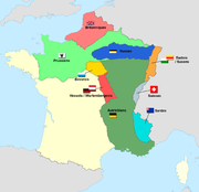
Use the appropriate category for maps showing all or a large part of France. See subcategories for smaller areas:
| If the map shows | Category to use |
|---|---|
| France on a recently created map | Category:Maps of France or its subcategories |
| France on a map created more than 70 years ago | Category:Old maps of France or its subcategories |
| the history of France on a recently created map | Category:Maps of the history of France or its subcategories |
| the history of France on a map created more than 70 years ago | Category:Old maps of the history of France or its subcategories |
Wikimedia category | |||||
| Upload media | |||||
| Instance of | |||||
|---|---|---|---|---|---|
| Category combines topics | |||||
 | |||||
Subcategories
This category has the following 71 subcategories, out of 71 total.
!
*
A
- Maps of Austrasia (18 F)
B
C
D
F
G
H
K
M
- Maps of Neustria (3 F)
P
R
S
T
- Territorial evolution of France (1 P, 48 F)
V
W
Media in category "Maps of the history of France"
The following 128 files are in this category, out of 128 total.
-
218 of 'An Introduction to the study of the Middle Ages, 375-814' (11250508415).jpg 1,297 × 1,993; 549 KB
-
France in 1314.jpg 726 × 1,324; 295 KB
-
1672marcosdacunhaesouza.jpg 433 × 542; 67 KB
-
France vs United Provinces 1672 - 1697.jpg 1,500 × 1,957; 523 KB
-
Carte De France Région.jpg 736 × 1,007; 119 KB
-
Francio 1552-1798.png 667 × 522; 65 KB
-
Carte d'occupation france 1815.jpg 614 × 620; 36 KB
-
Carte d'occupation france 1815.png 1,439 × 1,392; 283 KB
-
Carte Armée d'armistice.jpg 4,271 × 3,745; 3.9 MB
-
400 Germania I II Belgica I II.png 522 × 461; 263 KB
-
Abbayes du massif vosgien.jpg 1,747 × 2,037; 896 KB
-
Artois en 1787.png 5,846 × 4,133; 3.49 MB
-
Pays traditionnels d'Artois.png 6,000 × 4,166; 1.27 MB
-
Attempted invasion of Savoy in 1834.png 821 × 584; 190 KB
-
Auvergne mérovingienne - Division de 511.png 534 × 688; 107 KB
-
BarragesCarteCassini.jpg 1,024 × 645; 275 KB
-
Battle of Groix locator.png 433 × 367; 7 KB
-
Battle of Kanlıgeçit.png 484 × 273; 148 KB
-
Bourgogne Franque au IXe siècle.svg 512 × 556; 79 KB
-
Britonia6hcentury-ar.jpg 1,670 × 2,928; 375 KB
-
Britonia6hcentury.png 1,670 × 2,928; 542 KB
-
Brockhaus and Efron Encyclopedic Dictionary b72 582-3.jpg 1,333 × 2,123; 895 KB
-
BudS - Geschichte Europas - 0526.jpg 8,140 × 6,583; 3.11 MB
-
BudS - Geschichte Europas - 0568.jpg 8,139 × 6,434; 2.96 MB
-
BudS - Geschichte Europas - 0751.jpg 9,273 × 7,791; 8.79 MB
-
BudS - Geschichte Europas - 0843.jpg 9,903 × 8,376; 10.64 MB
-
Campagnes du Nord.jpg 934 × 585; 142 KB
-
Carte de la cité des Arvernes à l'échelle de la France.png 1,095 × 1,024; 291 KB
-
Carte du pays de droit coutumier et du pays de droit écrit (fr).png 1,796 × 1,797; 407 KB
-
Carte du pays de droit coutumier et du pays de droit écrit (no text).png 1,796 × 1,797; 278 KB
-
Carte du pays de droit coutumier et du pays de droit écrit (ru).png 1,796 × 1,797; 308 KB
-
Carte du pays de droit coutumier et du pays de droit écrit.png 1,796 × 1,797; 425 KB
-
Carte zone Limoges juin 1944.jpg 1,100 × 740; 342 KB
-
CCCLG-01-Gascogne.png 1,360 × 763; 194 KB
-
CHANU FAMILLES.JPG 4,320 × 3,240; 1.49 MB
-
Circuit rrhoffmanndangoulesme.jpg 521 × 550; 68 KB
-
Conquesta de Navarra ca.png 598 × 482; 91 KB
-
Conquista de Navarra cy.svg 598 × 482; 454 KB
-
Conséquences territoriales du traité de Vienne (1738).png 2,012 × 1,761; 222 KB
-
Dominios de Felipe II-it.png 800 × 494; 67 KB
-
Détail des cantons du district de Toul tel que défini en 1789.jpg 1,570 × 2,409; 1.02 MB
-
Expédition d'Irlande Map.PNG 433 × 367; 11 KB
-
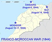
First Franco-Moroccan War 1844.jpg 720 × 581; 72 KB
-
First French Empire (ColonialEXP).png 6,256 × 3,403; 1.38 MB
-
Flag map of France (1789).png 1,224 × 1,338; 800 KB
-
Flag-map of Kingdom of France (1503).png 1,334 × 1,044; 60 KB
-
Flag-map of Kingdom of France (1643).png 1,012 × 1,036; 686 KB
-
Fourth french republic.png 2,000 × 2,000; 604 KB
-
France (1945-1949).png 1,920 × 1,615; 533 KB
-
France (1949-1956).PNG 450 × 456; 63 KB
-
France (1956-1958).png 450 × 456; 67 KB
-
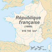
France 1800.png 1,795 × 1,796; 152 KB
-
France 1939.png 1,425 × 625; 33 KB
-
France 1939.svg 1,503 × 923; 1.41 MB
-
France at 1935.jpg 1,165 × 1,144; 431 KB
-
Francie neolit.png 575 × 479; 58 KB
-
Frankrig 732.PNG 280 × 278; 39 KB
-
French constitutional referendum, 1958 results.png 2,000 × 2,000; 317 KB
-
Frontiere francaise 985 1947 small.gif 466 × 430; 1.19 MB
-
Gabelle en 1789.jpg 523 × 547; 133 KB
-
Gaule Belgica.png 787 × 799; 231 KB
-
Guerres huguenotes.png 1,052 × 744; 174 KB
-
Guerres huguenotes2.png 1,052 × 744; 176 KB
-
Guerres huguenotes3.png 1,052 × 744; 174 KB
-
Histoire du nord carte 1.png 588 × 290; 23 KB
-
Histoire du nord carte 2.png 588 × 292; 32 KB
-
Historical map of the Saarland 1793.gif 995 × 540; 38 KB
-
Huguenot in 17c.png 526 × 556; 41 KB
-
Igamies 1948.png 407 × 413; 24 KB
-
Imperi Pirenenc.png 991 × 1,126; 411 KB
-
Influence française XXIe.jpg 1,024 × 666; 155 KB
-
Irredentism France.png 2,560 × 1,958; 653 KB
-
Karte Hoch und Niederburgund EN.png 2,000 × 2,126; 538 KB
-
Karte Steinkohlenbecken Nordfrankreich - Belgien.jpg 3,330 × 1,430; 1.67 MB
-
Karte von Armorica.png 766 × 899; 177 KB
-
L'Historiographie du royaume de France (BM 1893,0331.109).jpg 2,500 × 1,957; 1.26 MB
-
La Reunion Bul Map.png 4,402 × 4,500; 493 KB
-
La Rochelle Bul Map.png 3,082 × 2,952; 272 KB
-
Le Jeu de France (BM 1893,0331.92).jpg 2,500 × 1,801; 980 KB
-
Lorraine Bul Map.png 2,005 × 1,966; 38 KB
-
Map France 1030-ru.png 618 × 384; 144 KB
-
Map of France late 1944 early1946.svg 940 × 477; 745 KB
-
MapFrenchFleeten.jpg 800 × 541; 57 KB
-
Maquis de la lance.jpg 2,503 × 2,626; 1.11 MB
-
Military Administration in France (1942) zone sud.png 2,000 × 2,027; 523 KB
-
Mulgouw2.jpg 1,181 × 1,144; 201 KB
-
Nordwestblock.png 632 × 435; 113 KB
-
Normannen im Westfrankenreich.png 922 × 952; 300 KB
-
North West France 1150-es.svg 412 × 367; 7.37 MB
-
North West France 1150.png 860 × 761; 1.59 MB
-
Oranje1547 2.PNG 153 × 201; 43 KB
-
Orolaunum.PNG 435 × 497; 257 KB
-
Peace of Pyrenees Bul Map.png 3,850 × 4,500; 680 KB
-
Pontigny1180.png 2,664 × 2,456; 4.11 MB
-
Portail rome antique fr.gif 800 × 800; 50 KB
-
Possessions del Comte de Foix.png 685 × 824; 45 KB
-
Putz24.jpg 1,704 × 1,513; 274 KB
-
Rasez-conflent.png 400 × 450; 24 KB
-
Reino Franco.png 497 × 548; 192 KB
-
Republic of France (1914).svg 450 × 456; 468 KB
-
Roman Empire Map-ar.png 1,600 × 1,096; 195 KB
-
Roman Empire Map-ja.png 800 × 548; 94 KB
-
Roman Empire Map.png 800 × 548; 44 KB
-
Sister Republics Bul map.png 4,666 × 4,500; 901 KB
-
Spruner-Menke Handatlas 1880 Karte 52.jpg 3,494 × 2,980; 1.46 MB
-
Sykes picot-he.jpg 452 × 433; 45 KB
-
Sykes picot.jpg 452 × 433; 51 KB
-
Sénéchaussées de l'Anjou en 1789.JPG 695 × 445; 76 KB
-
Territòris dau còmte de Fois 2.png 905 × 527; 174 KB
-
Territòris dau còmte de Tolosa en 1209 v2.png 905 × 526; 142 KB
-
Territòris dau vescòmte Trencavel 2.png 905 × 527; 172 KB
-
The Occupation of France (1942-1946).png 1,055 × 658; 163 KB
-
Tribes of Western Europe.jpg 2,000 × 2,077; 812 KB
-
TrueFrance1959.PNG 250 × 115; 6 KB
-
Vandal alan kingdom 526 fr.png 1,036 × 900; 94 KB
-
Vandal alan kingdom 526-el.png 1,036 × 900; 63 KB
-
Vandal alan kingdom 526-it.png 1,036 × 900; 51 KB
-
Vandal alan kingdom 526.png 1,036 × 900; 87 KB
-
Verdes - Carnutes.svg 596 × 600; 31 KB
-
Vesontio plan.png 923 × 778; 1.07 MB
-
Vichy france map.png 1,425 × 625; 50 KB
-
Viking expansion.png 507 × 310; 109 KB
-
World war one French general eaths location map.png 2,000 × 1,923; 671 KB
-
Ֆրանսիան 1337-1453 թթ.png 425 × 519; 91 KB
-
الفتوحات الإسلامية في شمال أفريقيا وجنوب غرب أوربا.gif 556 × 800; 83 KB


