Category:Hallertau
Jump to navigation
Jump to search
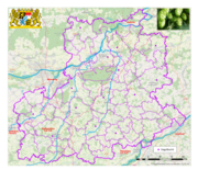
Deutsch: Die Hallertau ist das größte zusammenhängende Hopfenanbaugebiet der Welt und liegt in Bayern.
area in Bavaria, Germany | |||||
| Upload media | |||||
| Instance of | |||||
|---|---|---|---|---|---|
| Location |
| ||||
 | |||||
Subcategories
This category has the following 5 subcategories, out of 5 total.
Media in category "Hallertau"
The following 54 files are in this category, out of 54 total.
-
Au i d H - Grubanger v SW, Raureif 02.jpg 4,608 × 3,456; 3.28 MB
-
Buchfink kneipt.jpg 5,184 × 3,456; 5.64 MB
-
Faltenstiefel.jpg 1,552 × 1,812; 850 KB
-
Goebelsbach2.jpg 1,274 × 800; 283 KB
-
Grenze der Hallertau.png 3,666 × 3,156; 9.33 MB
-
Hallertau hopfenernte.JPG 2,816 × 2,112; 2.23 MB
-
Hallertau im September.jpg 2,045 × 1,350; 348 KB
-
Hallertau03 wiki.png 2,864 × 2,949; 14.55 MB
-
HallertauerGilet.jpg 600 × 875; 162 KB
-
HallertauerJoppe.jpg 507 × 775; 97 KB
-
Holledau - Hopfenfeld - Panorama.jpg 10,675 × 1,004; 23.66 MB
-
Hopfen gehäuft.JPG 3,456 × 2,592; 4.55 MB
-
Hopfenanbau.jpg 1,320 × 868; 672 KB
-
Hopfenausputzen Hallertau.JPG 2,000 × 1,168; 1.66 MB
-
Hopfenausputzen Hallertau2.JPG 2,000 × 1,076; 1.74 MB
-
Hopfendirndl.jpg 600 × 902; 228 KB
-
Hopfenernte in der Holledau (Hallertau).JPG 3,008 × 2,000; 5.72 MB
-
Hopfenfeld in Bayern 1.jpg 5,094 × 3,174; 11.6 MB
-
Hopfenfeld in Bayern 2.jpg 1,640 × 1,756; 2.2 MB
-
Hopfengarten-Juni.jpg 768 × 1,024; 307 KB
-
Hopfengarten-Winter.jpg 587 × 346; 51 KB
-
Hopfengarten.JPG 2,816 × 2,112; 2.25 MB
-
Hopfengarten.jpg 800 × 600; 404 KB
-
Hopfenmaschine2.JPG 2,816 × 2,112; 2.14 MB
-
Hopfenreben.JPG 2,816 × 2,112; 2.23 MB
-
Hopfenreißgerät.JPG 2,816 × 2,112; 2.16 MB
-
Hopfensiegel.JPG 776 × 791; 223 KB
-
Hopfenzupfen Gemälde an Hopfenhalle Siegenburg Ldkrs Kelheim Niederbayern.JPG 3,086 × 880; 1.69 MB
-
Hopfenzupfer 1930.jpg 1,368 × 939; 226 KB
-
Humulus Lupulus Hopfendolde-mit-hopfengarten.jpg 2,560 × 1,920; 1.69 MB
-
Häckselabfall Hopfenernte.jpg 1,896 × 1,232; 508 KB
-
Häckselabfall.JPG 2,816 × 2,112; 2.28 MB
-
Junger hopfen.JPG 2,816 × 2,112; 2.27 MB
-
Karte Holledau 2006.png 1,000 × 736; 312 KB
-
Kloster Geisenfeld Stich.jpg 450 × 336; 82 KB
-
Kloster Scheyern 1.jpg 1,400 × 635; 135 KB
-
Lage der Hallertau in Bayern.png 1,052 × 1,072; 2.53 MB
-
DEU Obersüßbach COA.svg 512 × 603; 79 KB
-
Wappen von Obersüßbach.png 241 × 270; 13 KB
-
Rohrbach, PAF - Fahlenbach - Wolnzach - Königsfeld v NW 250923 - 02.jpg 5,387 × 3,544; 1.38 MB
-
Schweitenkirchen - Dürnzhausen südl - Schweitenkirchen v NO.jpg 3,796 × 1,626; 838 KB
-
Schweitenkirchen - Gundelshausen v O.jpg 1,674 × 2,062; 674 KB
-
Schweitenkirchen - Stelzenberg v NW.jpg 2,920 × 1,431; 548 KB
-
Schweitenkirchen - Sünzhausen nw Ri Abens.jpg 2,048 × 1,536; 654 KB
-
Simon Wittmann Hopfenbaubegründer Hallertau Mühlausen (Neustadt Donau).JPG 2,440 × 3,352; 5.64 MB
-
Stock(Hopfen)garten Anf 19.Jh.jpeg 742 × 1,160; 473 KB
-
Trachtenhut Hallertau.jpg 1,511 × 1,861; 1.06 MB
-
Unterrichtungstafel Hopfenland Hallertau (2009).jpg 1,613 × 1,672; 669 KB
-
Wappen Landkreis Pfaffenhofen an der Ilm.png 193 × 205; 83 KB
-
Wappen Rohrbach Ilm.svg 651 × 701; 11 KB
-
Wappen von Mindelstetten.png 263 × 287; 13 KB
-
Winterträume.jpg 5,184 × 3,456; 2.85 MB
-
Wolnzach - Gosseltshausen v W, Abendsonne 01.jpg 2,272 × 1,704; 1.03 MB


