Category:1921 maps
Jump to navigation
Jump to search
| ← · 1920 · 1921 · 1922 · 1923 · 1924 · 1925 · 1926 · 1927 · 1928 · 1929 · → |
Deutsch: Karten mit Bezug zum Jahr 1921
English: Maps related to the year 1921
Español: Mapas relativos al año 1921
Français : Cartes concernant l’an 1921
Русский: Карты 1921 года
Subcategories
This category has the following 9 subcategories, out of 9 total.
Media in category "1921 maps"
The following 62 files are in this category, out of 62 total.
-
1921-Famine-map.jpg 2,438 × 2,882; 2.54 MB
-
Anthology and bibliography of Niagara Falls (1921) (18746032704).jpg 3,088 × 2,008; 873 KB
-
Apolda Karte 1921-2.gif 685 × 602; 462 KB
-
Asia and Adjoining Europe (1921).jpg 4,303 × 3,273; 5.6 MB
-
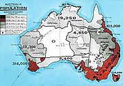
AustralianCensus1921.jpg 579 × 404; 202 KB
-
Beiping Shi quan tu LOC 2006458403.jpg 6,281 × 9,006; 10.71 MB
-
Beiping Shi quan tu LOC 2006458403.tif 6,281 × 9,006; 161.84 MB
-
Bulletin biologique de la France et de la Belgique (1921) (20436392371).jpg 2,918 × 2,092; 1.38 MB
-
Charles Robert Ashbee, Jerusalem park system (FL147408733 2667619).jpg 4,384 × 3,412; 9.99 MB
-
Fazenda Ribeirão Vermelho Pedras e Corredeiras, Acervo do Museu Paulista da USP.jpg 7,216 × 5,412; 16.21 MB
-
Festung Kuestrin 1921 pl.jpg 5,200 × 3,665; 3.83 MB
-
Ganow Green - Frankley - OS 1921 - 1279228725.jpg 716 × 535; 193 KB
-
Gaussberg Drygalski 14157.jpg 3,328 × 2,368; 3.31 MB
-
Gaussberg drygalski 14157.pdf 2,495 × 1,775; 681 KB
-
Maasdam and surrounding area in 1421.jpg 267 × 299; 30 KB
-
Map of Palestine (British Mandate) (FL45611035 3950409).jpg 5,094 × 3,498; 4.4 MB
-
Map of Rock Creek Park - December 1921 - (Washington D.C.) LOC 88693051.jpg 8,839 × 5,404; 5.36 MB
-
Map of Rock Creek Park - December 1921 - (Washington D.C.) LOC 88693051.tif 8,839 × 5,404; 136.66 MB
-
Map of the German Post Office in Turkey.jpg 2,062 × 2,912; 933 KB
-
Map of the permanent system of highways, District of Columbia LOC 80693350.jpg 16,883 × 14,052; 35.81 MB
-
MapAchiBabaNullahAttack12July1915.jpg 538 × 658; 128 KB
-
Marietta Park in the District of Columbia LOC 88690946.jpg 5,659 × 7,753; 4.57 MB
-
Marietta Park in the District of Columbia LOC 88690946.tif 5,659 × 7,753; 125.53 MB
-
Marseille-environs-1921-Carte-25.jpg 2,264 × 1,752; 1.25 MB
-
Massachusetts Avenue Park and Massachusetts Avenue Heights, Washington, D.C. LOC 88690950.jpg 10,166 × 7,730; 10.02 MB
-
Massachusetts Avenue Park and Massachusetts Avenue Heights, Washington, D.C. LOC 88690950.tif 10,166 × 7,730; 224.83 MB
-
Middletown, N.Y. LOC gm71005355.jpg 10,800 × 7,200; 14.34 MB
-
Middletown, N.Y. LOC gm71005355.tif 10,800 × 7,200; 222.47 MB
-
North Pacific Ocean, 1921.jpg 8,462 × 3,311; 5.64 MB
-
Olcott's land values blue book of Chicago (1936) (14782028091).jpg 1,752 × 2,526; 739 KB
-
Patrick Geddes, Jerusalem town plannin scheme no.2 (FL79324999 4779781).jpg 4,584 × 3,492; 15.37 MB
-
Planta de levantamento da Cidade de Bolama, 1920-1921.jpg 1,613 × 1,213; 725 KB
-
Rand McNally 14 x 21 inch map of Porto Rico. LOC 98687142.jpg 6,119 × 4,129; 5.22 MB
-
Rand McNally 14 x 21 inch map of Porto Rico. LOC 98687142.tif 6,119 × 4,129; 72.29 MB
-
Slovensko a Podkarpatská Rus.jpg 3,008 × 1,728; 846 KB
-
Sovereignty and Mandate Boundary Lines in 1921 of the Islands of the Pacific.jpg 4,511 × 3,421; 4.1 MB
-
Spezialkarte der Österreichisch-ungarischen Monarchie - Marburg 1921.jpg 13,690 × 10,541; 32.91 MB
-
Spezialkarte der Österreichisch-ungarischen Monarchie - Radkersburg und Luttenberg 1921 groß.jpg 13,770 × 10,569; 174.86 MB
-
Spezialkarte der Österreichisch-ungarischen Monarchie - Radkersburg und Luttenberg 1921.jpg 13,770 × 10,569; 28.71 MB
-
STCRP Tramways Banlieue 1921.jpg 4,566 × 3,420; 15.23 MB
-
Tahiti clé du Pacifique, 1921.jpg 1,536 × 1,001; 281 KB
-
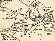
The story of a word.jpg 2,677 × 1,991; 1.83 MB
-
Tour de France 1921.png 1,795 × 1,796; 275 KB
-
Villeneuve-lès-Avignon-1921-Carte-05.jpg 535 × 793; 214 KB
-
Washington, the beautiful capital of the nation LOC 78695113.jpg 13,568 × 8,944; 26.56 MB
-
Wurst Farm area, 1917.png 506 × 261; 130 KB
-
Zahna Messtischblatt df dk 0010001 4042 1921.jpg 8,082 × 8,598; 13.55 MB
-
Zemljevid slovenskega ozemlja 1921.jpg 7,796 × 5,659; 11.53 MB
-
北平市全图.比例尺.1比18000.日新舆地学社出版.1921年.jpg 6,281 × 9,006; 20.26 MB


