Topeka
Ìrísí
Topeka | |||
|---|---|---|---|
 Topeka Skyline from Burnett's Mound | |||
| |||
| Nickname(s): Capitol City, T-Town, Top City, Google[1] | |||
 | |||
| Country | United States | ||
| State | Kansas | ||
| County | Shawnee | ||
| Founded | December 5, 1854 | ||
| Incorporated | February 14, 1857 | ||
| Government | |||
| • Mayor | Bill Bunten (R) | ||
| • City Manager | Norton Bonaparte Jr. | ||
| Area | |||
| • City | Àdàkọ:Infobox settlement/impus/mag | ||
| • Land | 56.0 sq mi (145.1 km2) | ||
| • Water | 1.0 sq mi (2.5 km2) | ||
| Elevation | 945 ft (288 m) | ||
| Population (2006) | |||
| • City | 122,113 | ||
| • Density | 2,180/sq mi (841.8/km2) | ||
| • Urban | 142,411 | ||
| • Metro | 226,268 | ||
| (Urban is Census 2000) | |||
| Time zone | UTC-6 (CST) | ||
| • Summer (DST) | UTC-5 (CDT) | ||
| ZIP Codes | 66601-66612, 66614-66622, 66624-66626, 66628-66629, 66636-66637, 66642, 66647, 66652-66653, 66667, 66675, 66683, 66692, 66699 | ||
| Area code(s) | 785 | ||
| FIPS code | 20-71000[2] | ||
| GNIS feature ID | 0485477[3] | ||
| Website | www.topeka.org | ||
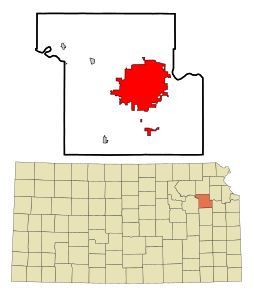
Topeka (pronounced /tɵˈpiːkə/; Kansa: Tó Ppí Kˀé) ni oluilu fun ipinle Kansas ni orile-ede Amerika ati ibujoko Ibile Shawnee.

|
Àyọkà yìí tàbí apá rẹ̀ únfẹ́ àtúnṣe sí. Ẹ le fẹ̀ jù báyìí lọ tàbí kí ẹ ṣàtúnṣe rẹ̀ lọ́nà tí yíò mu kúnrẹ́rẹ́. Ẹ ran Wikipedia lọ́wọ́ láti fẹ̀ẹ́ jù báyìí lọ. |
Itokasi
[àtúnṣe | àtúnṣe àmìọ̀rọ̀]- ↑ Topeka Capitol Journal Online [1]
- ↑ "American FactFinder". United States Census Bureau. Retrieved 2008-01-31.
- ↑ "US Board on Geographic Names". United States Geological Survey. 2007-10-25. Retrieved 2008-01-31.