RAF 코우든
RAF Cowden| RAF 코우든 | |
|---|---|
| 그레이트 카우든, 영국 요크셔 동부 라이딩 | |
 RAF Cowden 공군 무기 범위 | |
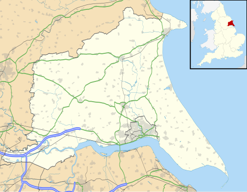 RAF 코우든 RAF Cowden의 위치 | |
| 좌표 | 53°50′53″n 0°06′47″W/53.848°N 0.113°W좌표: 53°50′53″N 0°06′47″W / 53.848°N 0.113°W |
| 격자 참조 | TA241412 |
| 유형 | 폭격 범위 |
| 면적 | 600에이커(240 ha) |
| 사이트 정보 | |
| 에 개방하다 일반 대중 | 예, EOD 작업에 의해 제한됨 |
| 사이트 기록 | |
| 빌드됨 | 1940 |
| 사용중 | 1940-45년 c.군대 사용 1959–1998년 ( 공군 사용 |
| 운명 | 닫힘, 부분적 교정 |
RAF Cowden은 영국 요크셔의 이스트 라이딩 알드브러 마을 근처에 있는 영국 공군 폭격장소였다.이 부지는 1959년부터 1998년 사이에 RAF를 비롯한 공군이 사용했지만, 2차 세계대전 당시 육지의 일부가 육군에 의해 훈련용으로 사용되었다.폐쇄 이후 북해에 의한 절벽 침식으로 노후 폭탄이 드러나 폭발물 처리(EOD)팀이 수차례 현장을 방문해야 했다.
역사
요크셔 해안은 적어도 5개의 공중 폭격과 총기 난사 범위가 있는 곳으로, 하나는 RAF 마스케에서 1차 세계대전 중,[1] 하나는 1920년대에 사용되기 시작한 스킵시에,[2][3] 다른 하나는 제2차 세계대전 때 북프로딩엄과 로오스에서,[4] 그리고 코우덴에서는 냉전 사정거리가 있다.그레이트 카우덴의 토지는 1940년 알드브로우 RAC 탱크 레인지에 요청되었고, 이 레인지에는 일부 거주민의 영구적인 제거가 수반되었다.[5]그레이트 코우든과 리틀 코우든의 마을에 남겨진 건물들은 그 사정거리 조성의 일환으로 파괴되었다.[6]이 사거리는 2차 세계대전 당시 훈련용으로 광범위하게 사용돼 나중에 버려졌지만, 1953년 전쟁사무소가 이 사거리를 개발하기 위해 200에이커(81ha)가 넘는 토지를 매입했다.[7][8]
부지는 총 600에이커(240ha)에 달하며,[note 1] 1959년부터 1998년 사이에 영국 공군과 나토 공군의 폭격장으로 사용되었다.[10][11]코우덴은 2개의 목표 철도와 육지와 바다까지 뻗은 범위의 다양한 정적 목표물을 갖추고 있었다.그러나 이 철도는 탱크 훈련에만 사용된 것으로 여겨졌다.[12]조종사들은 종종 Hornsea Mere를 랜드마크이자 레인지로 안내하기 위한 경유지로서 RAF Cowden 상공을 동쪽으로 달리곤 했다.[13]레인지에는 TA232415, TA232414, TA240406, TA244401에 위치한 4개의 "보강 콘크리트 사분면 타워"가 장착되었다.1992년까지 그 탑들 중 오직 한 곳만이 여전히 서 있었고, 파괴될 위험이 낮은 것으로 여겨졌다.[14]그러나 1994년 6월부터 1997년 7월까지 현장의 침식 속도는 90피트(27.4m)에 달했다.[15]
1980년대 동안, 건물 연구소는 그 부지에 말뚝을 위한 시험 센터를 가지고 있었다.시험대는 저지대 진흙 속에까지 있었다.[16][17]1998년 절벽 가장자리의 침식으로 인해 그 부지는 폐쇄되었다.[18]북해의 조치로 현장이 침식되고 있어 해변은 폐쇄되는 경우가 많고 폭발물 처리반이 폭탄을 처리하고 있다.[19][20]RAF는 2013년까지 EoD팀을 현장에 상주시켰고, 그 대신 정기적인 방문이 실시되었다.[21]
2001년 4월에는 발과 구강병에 걸린 소의 불에 탄 사체에서 나온 재를 보관할 수 있는 곳으로 조사되기도 했다.[22]또한 2001년에는 사거리에 있는 A-10 탱크버스터 항공기에 의해 우라늄(DU) 포탄이 고갈되었다는 군 참전용사와 현지인들의 주장이 제기되었다.국방부는 영국 내 두 곳, 즉 컴브리아 에스크메어와 스코틀랜드 커크커드브라이트만이 DU를 발사하는 데 사용됐다며 이를 부인했다.[23]동시에 현장을 자연보호구역으로 전환하려는 욕구가 생겨 현장에 남아 있는 5131(BD) 중대대대(RAF)가 긴 비활성화 및 파괴 프로그램을 시작해야 했다.[24]
2021년 2월, 한 민간 기업이 4년 동안 부지로부터 군수품 허가를 위한 150만 파운드의 계약을 체결했다.이 계약은 국방인프라기구(DIO)가 민간 기업에 수여하는 첫 번째 계약이다.[25]2021년 5월까지, 그들은 1만 개 이상의 물품이나 징역을 치렀고 65만 개로 예상되는 물품들은 여전히 폐기 대기 중이다.[21]
2022년부터 부지 폐기를 앞두고 있다.[26]
사고
1961년 3월, 제1 비행대의 호커 헌터가 그 사거리를 뛰어 넘는 접근 중 멈췄다.바다에 추락해 조종사가 숨졌다.기체(XE604)는 지워졌다.[27]
이름
제2차 세계대전 당시 육군이 사용하던 중 이 부지는 알드브로 RAC로 알려졌다.항공무기사거리로 사용되던 당시엔 RAF Cowden,[28] RAF Cowden Sands,[12] RAF Great Cowden,[29] RAF Cowden AWR,[30] AWR Cowden,[31] Cowden Air Range,[32] Cowden Range 등으로 다양하게 알려져 있었다.[33]
메모들
참조
- ^ McEntee-Taylor, Carole (2015). From Colonial Warrior to Western Front Flyer : the Five Wars of Sydney Herbert Bywater Harris. Barnsley, South Yorkshire: Pen & Sword. p. 159. ISBN 978-1-47382-359-4.
- ^ Halpenny, Bruce Barrymore (1990). Action stations (2 ed.). Wellingborough: Stephens. p. 5. ISBN 0-85059-532-0.
- ^ "North division: Skipsea British History Online". www.british-history.ac.uk. Retrieved 6 February 2021.
- ^ "RANGES (Code B, 62): Roos: practice bombing range requirements". alpha.nationalarchives.gov.uk. Retrieved 6 February 2021.
- ^ Brigham, Buglas & George 2008 페이지 87.
- ^ "Rapid coastal zone assessment survey Yorkshire and Lincolnshire: from Bempton to Donna Nook" (PDF). historicengland.org.uk. Historic England. p. 105. Retrieved 6 February 2021.
- ^ "North division: Mappleton British History Online". www.british-history.ac.uk. Retrieved 6 February 2021.
- ^ "Tank Range, Yorkshire - Wednesday 24 May 1950 - Hansard - UK Parliament". hansard.parliament.uk. Retrieved 6 February 2021.
- ^ "Estate Baseline 2009" (PDF). assets.publishing.service.gov.uk. p. 12. Retrieved 6 February 2021.
- ^ "Military clears 1,000 bombs off East Yorkshire beach". BBC News. 7 August 2020. Retrieved 6 February 2021.
- ^ Riley, Anna; Gray, Charles (7 August 2020). "Pictures show 170 bombs found hidden on Yorkshire beach overnight - A 600-acre area of the beach was formerly used by the RAF and US Air Force as a practice bombing range until 1998". infoweb.newsbank.com. Retrieved 6 February 2021.
- ^ a b Historic England. "Great Cowden Air Gunnery Range (915915)". Research records (formerly PastScape). Retrieved 4 February 2021.
- ^ Delve, Ken (2006). Northern England : Co. Durham, Cumbria, Isle of Man, Lancashire, Merseyside, Manchester, Northumberland, Tyne & Wear, Yorkshire. Marlborough: Crowood Press. p. 294. ISBN 1-86126-809-2.
- ^ Historic England. "Quadrant Tower (915927)". Research records (formerly PastScape). Retrieved 6 February 2021.
- ^ "Compensation in the matter of a notice of reference between..." (PDF). urban rim.org.uk. Lands Tribunal. p. 28. Retrieved 6 February 2021.
- ^ Sands, M J, ed. (1992). Piling, European practice and worldwide trends : proceedings of a conference organized by the Institution of Civil Engineers, and held in London on 7-9 April 1992. London: T. Telford. p. 246. ISBN 0-7277-1698-0.
- ^ Hobbs, P R N; Jones, L D; Kirkham, M P (2015). "Slope Dynamics Project Report: Holderness Coast - Aldbrough, Drilling & Instrumentation, 2012- 2015" (PDF). nora.nerc.ac.uk. British Geological Survey. p. 36. Retrieved 6 February 2021.
- ^ Burkeman, Oliver (1 September 2000). "Erosion tips RAF shells on to beach". The Guardian. Retrieved 6 February 2021.
- ^ "The beach where it's not safe to pick up the shells". The Yorkshire Post. 26 July 2012. Retrieved 6 February 2021.
- ^ "Cowden Beach closed for safety reasons". GOV.UK. 10 July 2020. Retrieved 6 February 2021.
- ^ a b Wood, Alexandra (29 August 2021). "Huge task to clear up explosives on beach". The Yorkshire Post. p. 9. ISSN 0963-1496.
- ^ "Site is tested as burial ground". infoweb.newsbank.com. 21 April 2001. Retrieved 6 February 2021.
- ^ "Radioactive ammunition could have been used at coastal range". infoweb.newsbank.com. 5 February 2001. Retrieved 6 February 2021.
- ^ Bentham, Martin (29 April 2001). "Bombs cleared from beach wanted as nature reserve". The Telegraph. Retrieved 6 February 2021.
- ^ Wood, Alexandra (6 February 2021). "Bombs on beach to be dealt with by private firm". The Yorkshire Post. p. 11. ISSN 0963-1496.
- ^ "Disposal database: House of Commons report". Retrieved 26 November 2021.
- ^ Ranter, Harro. "Accident Hawker Hunter FGA Mk 9 XE604, 02 Mar 1961". aviation-safety.net. Retrieved 6 February 2021.
- ^ "RAF Cowden". discovery.nationalarchives.gov.uk. Retrieved 6 February 2021.
- ^ Brigham, Buglas & George 2008 페이지 104.
- ^ Whidborne, R. StJ (1994). Report on the accident involving Royal Air Force Tornado GR1, ZG 754 and Bell 206B JetRanger III, G-BHYW at Farleton Knott near Kendal, Cumbria on 23 June 1993. London: H.M.S.O. p. 4. ISBN 0-11-551283-7.
- ^ "Competing For Quality". hansard.parliament.uk. Retrieved 5 February 2021.
- ^ Fletcher, Harry R (1993). Air Force bases : Air bases outside the United States of America, vol. II. Washington D C: USAF. p. 128. OCLC 71400593.
- ^ "Cowden Range Byelaws" (PDF). Assets.publishing.service.gov.uk. p. 1. Retrieved 6 February 2021.
원천
- Brigham, T; Buglas, J; George, R (2008). "Rapid Coastal Zone Assessment Yorkshire & Lincolnshire, Bempton to Donna Nook" (PDF). archaeologydataservice.ac.uk. Humber Field Archaeology & English Heritage. Retrieved 4 February 2021.
외부 링크
| 위키미디어 커먼스는 RAF Cowden과 관련된 미디어를 보유하고 있다. |
| 형태 및 단위 |
|  | ||||||
|---|---|---|---|---|---|---|---|---|
| 가지 및 구성 요소 | ||||||||
| 예비군 | ||||||||
| 연합 민간단체 | ||||||||
| 장비 | ||||||||
| 인원 | ||||||||
| 약속 | ||||||||
| 기호 및 균일 | ||||||||
| 플라잉 스테이션스 |
| | ||||
|---|---|---|---|---|---|---|
| 논플라잉 스테이션 |
| |||||
| 메모들 |
| |||||