Nothing Special   »   [go: up one dir, main page]

2002

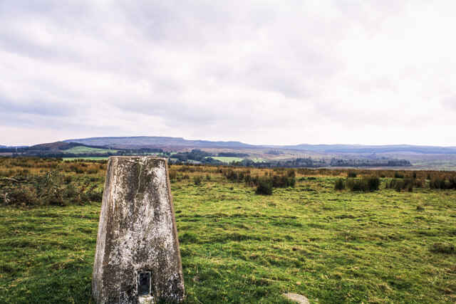
NS4884 : Low level moorland, at Aucheneck?

taken 23 years ago, near to Croftamie, Stirling, Scotland
Low level moorland,  at Aucheneck?
Low level moorland, at Aucheneck?
The flat moorland with scattered rushes has no obvious name which might be applied to it at any scale of OS mapping. The OS do however know the trig point as Aucheneck, so perhaps that name can serve for the area generally.
The view across the ground is to the south where the minor rises of the Kilpatrick Hills break the skyline.

Creative Commons Licence [Some Rights Reserved]   © Copyright Trevor Littlewood and licensed for reuse under this Creative Commons Licence.
Geographical Context: Lowlands Historic sites and artefacts Moorland Primary Subject: Moorland other tags: Grassy Moorland with Rushes Trig Point Click a tag, to view other nearby images.
This photo is linked from: Automatic Clusters: · Aucheneck Trig Point [5] ·
1:50,000 Modern Day Landranger(TM) Map © Crown Copyright
+
+
1:50,000 Modern Day Landranger(TM) Map © Crown Copyright
TIP: Click the map for more Large scale mapping
Grid Square
NS4884, 36 images   (more nearby 🔍)
Photographer
Trevor Littlewood   (more nearby)
Date Taken
Tuesday, 8 October, 2002   (more nearby)
Submitted
Wednesday, 25 November, 2020
Subject Location
OSGB36: geotagged! NS 4832 8474 [10m precision]
WGS84: 56:1.8879N 4:26.1471W
Camera Location
OSGB36: geotagged! NS 4832 8484
View Direction
SOUTH (about 180 degrees)
Clickable map
+
NW N NE
W Go E
SW S SE
Image Type (about): geograph  (Fourth Visitor for NS4884)
This page has been viewed about 31 times
You are not logged in | login | register