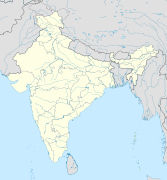
ไฟล์:India relief location map.jpg
หน้าตา

ขนาดของตัวอย่างนี้: 557 × 600 พิกเซล ความละเอียดอื่น: 223 × 240 พิกเซล | 446 × 480 พิกเซล | 713 × 768 พิกเซล | 951 × 1,024 พิกเซล | 1,500 × 1,615 พิกเซล
ดูภาพที่มีความละเอียดสูงกว่า (1,500 × 1,615 พิกเซล, ขนาดไฟล์: 1.91 เมกะไบต์, ชนิดไมม์: image/jpeg)
ประวัติไฟล์
คลิกวันที่/เวลาเพื่อดูไฟล์ที่ปรากฏในขณะนั้น
| วันที่/เวลา | รูปย่อ | ขนาด | ผู้ใช้ | ความเห็น | |
|---|---|---|---|---|---|
| ปัจจุบัน | 20:56, 14 ตุลาคม 2563 | 1,500 × 1,615 (1.91 เมกะไบต์) | NordNordWest | upd Telangana/Andhra Pradesh | |
| 22:48, 17 กรกฎาคม 2563 | 1,500 × 1,615 (1.91 เมกะไบต์) | NordNordWest | + Ladakh | ||
| 22:51, 31 กรกฎาคม 2559 | 1,500 × 1,615 (1.93 เมกะไบต์) | Julieta39 | According with User:NordNordWest: Thick grey line = de facto & de jure recognised borders; slim grey line = de facto contested borders; broken grey line = claimed borders. | ||
| 19:30, 31 กรกฎาคม 2559 | 1,500 × 1,615 (1.9 เมกะไบต์) | NordNordWest | Reverted to version as of 20:09, 5 June 2014 (UTC); no text in location maps, has to work in all languages | ||
| 23:50, 30 กรกฎาคม 2559 | 1,500 × 1,615 (1.94 เมกะไบต์) | Julieta39 | More clarely : Thick grey line = de facto & de jure recognised borders ; Slim grey line = de facto contested borders ; Broken grey line = claimed borders (cbI = by India, cbP = by Pakistan, cbC = by China). | ||
| 03:09, 6 มิถุนายน 2557 | 1,500 × 1,615 (1.9 เมกะไบต์) | NordNordWest | + Telangana | ||
| 21:21, 7 มิถุนายน 2554 | 1,500 × 1,615 (1.95 เมกะไบต์) | NordNordWest | + missing Nagaland | ||
| 22:31, 23 เมษายน 2553 | 1,500 × 1,615 (2 เมกะไบต์) | Uwe Dedering | {{Information |Description={{en|1=Location map of India. Equirectangular projection. Strechted by 106.0%. Geographic limits of the map: * N: 37.5° N * S: 5.0° N * W: 67.0° E * E: 99.0° E Made with Natural Earth. Free vector and raster map data @ natur |
หน้าที่มีภาพนี้
หน้าต่อไปนี้ โยงมาที่ภาพนี้:
- กลุ่มอาคารกอทิกวิกตอเรียและอลังการศิลป์แห่งมุมไบ
- กลุ่มโบราณสถานแห่งขชุราโห
- กลุ่มโบราณสถานแห่งมหาพลิปุรัม
- ควาลิยัร
- จัณฑีครห์แคปิตอลคอมเพล็กซ์
- ชันตรมันตระ (ชัยปุระ)
- ชาวเซนทิเนล
- ถ้ำอชันตา
- ทะเลสาบโลนาร์
- ทะเลแลกคาดิฟ
- ท่าอากาศยานนานาชาติฉัตรปตี ศิวาจี มหาราช
- นาลันทา
- นาศิก
- ปัฏฏทกัลลุ
- ปาฏลีบุตร
- ป้อมอาครา
- พระแท่นวัชรอาสน์
- พิพิธภัณฑ์ปัฏนา
- ภารหุต
- ภุช
- ภูมรมนเทียร
- มสรูรมนเทียร
- มหาโจฬมนเทียร
- มหาโพธิวิหาร
- มัสยิดชญานวาปี
- มุรุท-ชันชีรา
- ยอดเขาคังเช็นเจองา
- รานี กี วาว
- รูปกุณฑ์
- รูปปั้นโคมเตศวร
- วิกรมศิลา
- สถูปบ้านนางสุชาดา
- สถูปสาญจี
- สาวัตถี
- หมู่ถ้ำธมนาร
- หมู่ถ้ำบาฆ
- หมู่ป้อมเนินแห่งรัฐราชสถาน
- หัมปี
- อมรกัณฏกะ
- อมราวตีสถูป
- อุทยานแห่งชาติกาซีรังคา
- อุทยานแห่งชาติจิตวัน
- อุทยานโบราณคดีจัมปาเนร์-ปาวาครห์
- เขาคิชฌกูฏ (ภูเขาในศาสนาพุทธ)
- เพิงหินภีมเพฏกา
- เวสาลี
- เสาอโศก
- แผ่นดินไหวในรัฐสิกขิม พ.ศ. 2554
- แผ่นดินไหวในอิมผาล พ.ศ. 2559
- โกลหาปูระ
- โธฬาวีรา
- ไอโหเฬ
- แม่แบบ:Location map India
- มอดูล:Location map/data/India
- มอดูล:Location map/data/India/doc
การใช้ไฟล์ข้ามโครงการ
วิกิอื่นต่อไปนี้ใช้ไฟล์นี้:
- การใช้บน ace.wikipedia.org
- การใช้บน af.wikipedia.org
- การใช้บน als.wikipedia.org
- การใช้บน am.wikipedia.org
- การใช้บน anp.wikipedia.org
- การใช้บน ar.wikipedia.org
- การใช้บน ast.wikipedia.org
- การใช้บน as.wikipedia.org
- การใช้บน azb.wikipedia.org
- การใช้บน az.wikipedia.org
- Kəşmir vadisi
- Şablon:Yer xəritəsi Hindistan
- Benqal körfəzi
- Andaman dənizi
- Bandipur Milli Parkı
- Lakkadiv dənizi
- Səkkizinci Dərəcə boğazı
- Doqquzuncu Dərəcə boğazı
- Onuncu Dərəcə boğazı
- Dunkan boğazı
- Polk boğazı
- Caldapara Milli Parkı
- Cafna yarımadası
- Kathiyavar yarımadası
- Hindustan
- Tar (səhra)
- Andaman adaları
- Nikobar adaları
- Mahatma Qandi Dəniz Milli Parkı
- Şrixarikota
- Bombey adası
- Sundarban
ดูการใช้ข้ามโครงการเพิ่มเติมของไฟล์นี้


