Liège (province): Difference between revisions
replace geobox with infobox template and fix fallout |
Update |
||
| Line 23: | Line 23: | ||
| area_footnotes = <ref>{{Cite web|url=https://bestat.statbel.fgov.be/bestat/crosstable.xhtml?view=90c1e218-dc4f-4827-824d-9b25abfefe59|title=Be.STAT}}</ref> |
| area_footnotes = <ref>{{Cite web|url=https://bestat.statbel.fgov.be/bestat/crosstable.xhtml?view=90c1e218-dc4f-4827-824d-9b25abfefe59|title=Be.STAT}}</ref> |
||
| population_footnotes = <ref>{{Cite web|url=https://statbel.fgov.be/nl/themas/bevolking/structuur-van-de-bevolking|title = Structuur van de bevolking | Statbel}}</ref> |
| population_footnotes = <ref>{{Cite web|url=https://statbel.fgov.be/nl/themas/bevolking/structuur-van-de-bevolking|title = Structuur van de bevolking | Statbel}}</ref> |
||
| population_total = |
| population_total = 1,110,989 |
||
| population_as_of = 1 January |
| population_as_of = 1 January 2022 |
||
| population_density_km2 = |
| population_density_km2 = 288 |
||
| blank_name_sec2 = [[Human Development Index|HDI]] (2019) |
| blank_name_sec2 = [[Human Development Index|HDI]] (2019) |
||
| blank_info_sec2 = 0.903<ref name="GlobalDataLab">{{Cite web|title=Sub-national HDI - Area Database - Global Data Lab|url=https://globaldatalab.org/shdi/shdi/BEL/?levels=1%2B4&interpolation=1&extrapolation=0&nearest_real=0&years=2019|url-status=live}}</ref><br/>{{color|green|very high}} · [[List of Belgian provinces by Human Development Index|8th of 11]] |
| blank_info_sec2 = 0.903<ref name="GlobalDataLab">{{Cite web|title=Sub-national HDI - Area Database - Global Data Lab|url=https://globaldatalab.org/shdi/shdi/BEL/?levels=1%2B4&interpolation=1&extrapolation=0&nearest_real=0&years=2019|url-status=live}}</ref><br/>{{color|green|very high}} · [[List of Belgian provinces by Human Development Index|8th of 11]] |
||
Revision as of 22:04, 14 October 2022
Liège (French)
| |
|---|---|
 Flag  Coat of arms | |
 | |
| Coordinates: 50°38′N 05°34′E / 50.633°N 5.567°E | |
| Country | |
| Region | |
| Capital (and largest city) | Liège |
| Government | |
| • Governor | Hervé Jamar |
| Area | |
| • Total | 3,857 km2 (1,489 sq mi) |
| Population (1 January 2022)[2] | |
| • Total | 1,110,989 |
| • Density | 288/km2 (750/sq mi) |
| HDI (2019) | 0.903[3] very high · 8th of 11 |
| Website | Official site |
Liège (Walloon: Lîdje; Dutch: Luik; German: Lüttich) is the easternmost province of the Walloon Region, in Belgium. Its capital is the city of Liège.
It is an area of French and German ethnic groups. Most of its inhabitants speak French and a minority of them speaks German.
History

The present province comes from a department created by the French government in the late eighteenth century, the Department of Ourte. In 1815, after the defeat of Napoleon, the eastern part (Eupen, Malmedy, Saint-Vith and four other German municipalities) was given to the Prussian empire.[4]
While maintaining the French administrative borders, King William I of the Netherlands gave back the more traditional names of the provinces instead of the names used by the French. He named the province as Liège, remembering the old principality of Liège, although the region did not correspond much to the old principality.
In 1919, after the Prussian defeat, the cantons Eupen, Malmedy and Saint-Vith were again part of the province of Liège.[4]
Geography
The province of Liège is in southeastern Belgium and borders on (clockwise from the North) the Netherlands, Germany, Luxembourg and in Belgium the provinces of Luxembourg, Namur, Walloon Brabant (Wallonia), and those of Flemish Brabant and Limburg (Flanders).
The province has an area of 3,862 km2 (1,491 sq mi),[5] with a population of 1,098,688[6] and a density of 284.5 inhabitants per km². The province is divided into four arrondissements (arrondissementen in Dutch) with 84 municipalities, 75 French-speaking municipalities and 9 German-speaking municipalities.
With 694 m (2,277 ft), the Signal de Botrange is the highest point of the province and of Belgium.[7] It is in Waimes, Verviers district.[8]
Rivers
The main river is the Meuse (Dutch: Maas) river; its source is in France, in Champagne-Ardenne and then flows through Belgium by the provinces of Namur and Liège. After 950 km (590 mi), it flows into the North Sea.[5]
Other rivers in the province are:[5]
- Ourthe, tributary of the Meuse.
- Vesdre, also a tributary of the Meuse.
- Amblève, tributary of the Ourthe.
- Warche, tributary of the Amblève.
- Geer, another tributary of the Meuse.
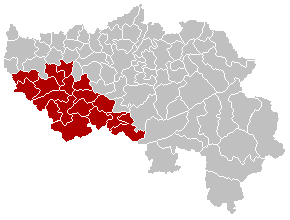
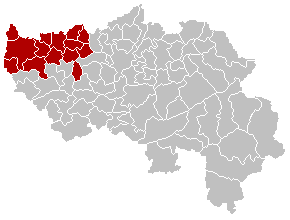
Administrative divisions
The province of Liège is divided into 4 arrondissements (Huy, Liège, Verviers and Waremme) and a total of 84 municipalities.
(names are in the following table)
| Huy | Liège | Verviers | Waremme |
|---|---|---|---|
|

|

|
|
Population by arrondissement
Population on 1 January of each year.[9]
| Arrondissement | 2007 | 2008 | 2009 | 2010 | 2011 | 2012[6] |
|---|---|---|---|---|---|---|
| Huy | 104,756 | 105,770 | 106,793 | 107,832 | 108,960 | 109,728 |
| Liège | 594,579 | 597,478 | 600,269 | 604,062 | 609,392 | 612,740 |
| Verviers | 274,973 | 276,569 | 278,142 | 280,203 | 282,293 | 283,668 |
| Waremme | 73,106 | 73,905 | 74,831 | 75,588 | 76,558 | 77,264 |
| Province of Liège | 1,047,414 | 1,053,722 | 1,060,035 | 1,067,685 | 1,077,203 | 1,083,400 |
References
- ↑ "Be.STAT".
- ↑ "Structuur van de bevolking | Statbel".
- ↑ "Sub-national HDI - Area Database - Global Data Lab".
{{cite web}}: CS1 maint: url-status (link) - ↑ 4.0 4.1 "Histoire". Province de Liège (in French). Retrieved 2 September 2013.
- ↑ 5.0 5.1 5.2 "Géographie". Province de Liège (in French). Retrieved 2 September 2013.
- ↑ 6.0 6.1 Population per municipality as of 1 January 2016 (XLS; 397 KB)
- ↑ "Signal de Botrange". Peakbagger.com. Retrieved 2 September 2013.
- ↑ "84 communes". Province de Liège (in French). Retrieved 2 September 2013.
- ↑ Institut National de Statistique - Direction générale Statistique et Information économique
Other websites
- Official web site of the Liège province (in French)
- Bureau des Relations Extérieures de la Province de Liège Archived 2005-02-09 at the Wayback Machine (in French, Dutch, German and English)
| International | |
|---|---|
| National | |
| Geographic | |
| Other | |