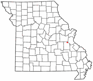
Richwoods, Missouri
Richwoods, Missouri | |
|---|---|
 Location of Richwoods, Missouri | |
| Coordinates: 38°09′37″N 90°49′41″W / 38.16028°N 90.82806°W | |
| Country | United States |
| State | Missouri |
| County | Washington |
| Settled | 1830 |
| Elevation | 810 ft (250 m) |
| ZIP code | 63071 |
| Area code | 573 |
| GNIS feature ID | 725284[1] |
Richwoods is an unincorporated community in northeastern Washington County, Missouri, United States. It is located on Missouri Route A one mile east of Missouri Route 47,[2] approximately 15 miles west of De Soto and 19 miles south of St. Clair.
History
[edit]The first settlement at Richwoods was made ca. 1830.[3] The community was named for the dense forest near the original town site.[4] A post office has been in operation at Richwoods since 1832.[5]

Education
[edit]The Richwoods area is served by the Richwoods School District (R-7). They offer pre-school and kindergarten through eighth grade. After the completion of the eighth grade, students may choose to attend high schools in the following areas: Potosi, Grandview, Kingston, DeSoto, St. Clair, or Sullivan.[6]
Churches and cemeteries
[edit]- The Book of Acts Church
- Church Apostolic
- Richwoods 1st Free Will Baptist Church
- Cross Roads Baptist Church
- The Way of Life Tabernacle
- Horine Methodist church and cemetery[7]
The St. Stephen Catholic Church parish and cemetery was established in 1841.[8] St. Stephen Cemetery is located behind the church and rectory.
References
[edit]- ^ a b U.S. Geological Survey Geographic Names Information System: Richwoods, Missouri
- ^ Richwoods, MO, 7.5 Minute Topographic Quadrangle, USGS, 1981
- ^ "Washington County Place Names, 1928–1945". The State Historical Society of Missouri. Archived from the original on June 24, 2016. Retrieved December 30, 2016.
- ^ Eaton, David Wolfe (1918). How Missouri Counties, Towns and Streams Were Named. The State Historical Society of Missouri. p. 370.
- ^ "Post Offices". Jim Forte Postal History. Retrieved December 30, 2016.
- ^ "Richwoods School District-Home of the Wildcats". Archived from the original on August 29, 2007. Retrieved September 30, 2007.
- ^ http://www.mogenweb.org/washington/cemetery/horine.html[permanent dead link]
- ^ "St. Stephen Church Richwoods". Archived from the original on July 28, 2011. Retrieved May 10, 2010.

