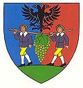
Poysdorf
Appearance
Poysdorf | |
|---|---|
 Panorama of Poysdorf | |
| Coordinates: 48°40′N 16°36′E / 48.667°N 16.600°E | |
| Country | Austria |
| State | Lower Austria |
| District | Mistelbach |
| Government | |
| • Mayor | Thomas Grießl (ÖVP) |
| Area | |
• Total | 97.26 km2 (37.55 sq mi) |
| Elevation | 225 m (738 ft) |
| Population (2018-01-01)[2] | |
• Total | 5,527 |
| • Density | 57/km2 (150/sq mi) |
| Time zone | UTC+1 (CET) |
| • Summer (DST) | UTC+2 (CEST) |
| Postal code | 2170 |
| Area code | 02552 |
| Website | www.poysdorf.at |
Poysdorf is a town in the district of Mistelbach in the Austrian state of Lower Austria.
Population
[edit]| Year | Pop. | ±% |
|---|---|---|
| 1869 | 7,071 | — |
| 1880 | 7,524 | +6.4% |
| 1890 | 7,836 | +4.1% |
| 1900 | 8,006 | +2.2% |
| 1910 | 8,238 | +2.9% |
| 1923 | 7,744 | −6.0% |
| 1934 | 8,074 | +4.3% |
| 1939 | 8,257 | +2.3% |
| 1951 | 7,715 | −6.6% |
| 1961 | 6,785 | −12.1% |
| 1971 | 6,159 | −9.2% |
| 1981 | 5,641 | −8.4% |
| 1991 | 5,447 | −3.4% |
| 2001 | 5,606 | +2.9% |
| 2011 | 5,498 | −1.9% |
Sights
[edit]- Vino Versum Poysdorf, a museum about wine and the history of Poysdorf as one of the leading wine towns in Austria.
Climate
[edit]| Climate data for Poysdorf 1981-2010 | |||||||||||||
|---|---|---|---|---|---|---|---|---|---|---|---|---|---|
| Month | Jan | Feb | Mar | Apr | May | Jun | Jul | Aug | Sep | Oct | Nov | Dec | Year |
| Record high °C (°F) | 17.7 (63.9) |
18.4 (65.1) |
24.2 (75.6) |
27.3 (81.1) |
33.2 (91.8) |
37.1 (98.8) |
37.1 (98.8) |
38.4 (101.1) |
31.5 (88.7) |
27.5 (81.5) |
20.4 (68.7) |
15.2 (59.4) |
38.4 (101.1) |
| Mean daily maximum °C (°F) | 2.1 (35.8) |
4.4 (39.9) |
9.6 (49.3) |
15.9 (60.6) |
21 (70) |
24 (75) |
26.7 (80.1) |
26.3 (79.3) |
20.8 (69.4) |
14.6 (58.3) |
7.5 (45.5) |
2.7 (36.9) |
14.6 (58.3) |
| Daily mean °C (°F) | −1.2 (29.8) |
0.2 (32.4) |
4.5 (40.1) |
9.9 (49.8) |
15.1 (59.2) |
18.1 (64.6) |
20.3 (68.5) |
19.6 (67.3) |
14.6 (58.3) |
9.2 (48.6) |
4 (39) |
−0.1 (31.8) |
9.5 (49.1) |
| Mean daily minimum °C (°F) | −3.9 (25.0) |
−2.8 (27.0) |
0.7 (33.3) |
4.6 (40.3) |
9.3 (48.7) |
12.3 (54.1) |
14.1 (57.4) |
13.9 (57.0) |
10.1 (50.2) |
5.6 (42.1) |
1.4 (34.5) |
−2.5 (27.5) |
5.2 (41.4) |
| Record low °C (°F) | −27.4 (−17.3) |
−23.8 (−10.8) |
−17 (1) |
−6.4 (20.5) |
−1 (30) |
0.7 (33.3) |
1.5 (34.7) |
5 (41) |
0.5 (32.9) |
−7.4 (18.7) |
−14.4 (6.1) |
−23 (−9) |
−27.4 (−17.3) |
| Average precipitation mm (inches) | 30 (1.2) |
30 (1.2) |
42 (1.7) |
37 (1.5) |
64 (2.5) |
65 (2.6) |
67 (2.6) |
58 (2.3) |
58 (2.3) |
32 (1.3) |
41 (1.6) |
39 (1.5) |
562 (22.1) |
| Average snowfall cm (inches) | 12 (4.7) |
10 (3.9) |
5 (2.0) |
0 (0) |
0 (0) |
0 (0) |
0 (0) |
0 (0) |
0 (0) |
0 (0) |
3 (1.2) |
10 (3.9) |
41 (16) |
| Average relative humidity (%) (at 14:00) | 75.9 | 66.8 | 59 | 50.6 | 52.3 | 53 | 49.9 | 48.7 | 55 | 61.6 | 73.5 | 79.1 | 60.4 |
| Mean monthly sunshine hours | 61 | 95 | 139 | 199 | 239 | 235 | 256 | 248 | 179 | 132 | 63 | 46 | 1,893 |
| Source: Central Institute for Meteorology and Geodynamics[3] | |||||||||||||
References
[edit]- ^ "Dauersiedlungsraum der Gemeinden Politischen Bezirke und Bundesländer - Gebietsstand 1.1.2018". Statistics Austria. Retrieved 10 March 2019.
- ^ "Einwohnerzahl 1.1.2018 nach Gemeinden mit Status, Gebietsstand 1.1.2018". Statistics Austria. Retrieved 9 March 2019.
- ^ "Klimamittel - ZAMG" (in German). Central Institute for Meteorology and Geodynamics. Retrieved 31 May 2020.
External links
[edit]Wikimedia Commons has media related to Poysdorf.

