List of airports in Bhutan: Difference between revisions
Content deleted Content added
Gulumeemee (talk | contribs) Reverted possible vandalism |
|||
| Line 6: | Line 6: | ||
== Airports == |
== Airports == |
||
Airport names shown |
Airport names shown in '''bold''' have scheduled passenger service on commercial airlines. |
||
{| class="wikitable sortable" |
{| class="wikitable sortable" |
||
| Line 73: | Line 73: | ||
* [[List of airports by ICAO code: V]] |
* [[List of airports by ICAO code: V]] |
||
== References == |
|||
{{reflist}} |
|||
* {{cite web | url = http://www.icao.int/safety/ism/Accident%20Incident%20Reporting%20Guidance/LocationIndicatorsByState.pdf | title = ICAO Location Indicators by State | format = [[PDF]] | publisher = [[International Civil Aviation Organization]] | date = 17 September 2010}} |
|||
* {{cite web | url = http://www.unece.org/fileadmin/DAM/cefact/locode/bt.htm | title = UN Location Codes: Bhutan (includes IATA codes) | work = [[UN/LOCODE]] 2011-2 | publisher = [[United Nations Economic Commission for Europe|UNECE]] | date = 28 February 2012}} |
|||
* [http://www.worldaerodata.com/countries/Bhutan.php Airports in Bhutan] World Aero Data |
|||
* [http://www.gcmap.com/search?Q=country:BT Airports in Bhutan] Great Circle Mapper |
|||
* [http://www.fallingrain.com/world/BT/airports.html Airports in Bhutan] FallingRain.com |
|||
<!--Navigation box--><br /> |
|||
{{Airports in Bhutan}} |
|||
{{Asia in topic|List of airports in}} |
|||
<!--Categories--> |
|||
[[Category:Airports in Bhutan| ]] |
|||
[[Category:Lists of airports by country|Bhutan]] |
|||
[[Category:Bhutan transport-related lists|Airports]] |
[[Category:Bhutan transport-related lists|Airports]] |
||
[[Category:Lists of buildings and structures in Bhutan|Airports]] |
[[Category:Lists of buildings and structures in Bhutan|Airports]] |
||
Revision as of 11:31, 4 July 2017
This is a list of airports in Bhutan, sorted by location.
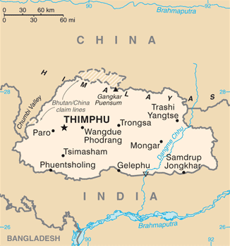
Bhutan, officially the Kingdom of Bhutan, is a landlocked country in South Asia, located at the eastern end of the Himalaya Mountains and bordered to the south, east and west by the Republic of India and to the north by Tibet. Bhutan was separated from the nearby state of Nepal to the west by the Indian state of Sikkim, and from Bangladesh to the south by West Bengal. The capital city is Thimphu.
Airports
Airport names shown in bold have scheduled passenger service on commercial airlines.
| Location | ICAO | IATA | Airport name | Coordinates | Runway | Elev. | Constructed | Status |
|---|---|---|---|---|---|---|---|---|
| Gelephu | VQGP | GLU | Gelephu Airport | 26°53′04″N 090°27′51″E / 26.88444°N 90.46417°E | 11/29: 1500 m Asphalt |
290 m | 2008 | Flights suspended |
| Jakar | VQBT | BUT | Bathpalathang Airport | 27°33′52″N 090°44′43″E / 27.56444°N 90.74528°E | 14/33: 1200 m Asphalt |
2473 m | 2011 | Operational |
| Paro | VQPR | PBH | Paro Airport | 27°24′12″N 089°25′29″E / 27.40333°N 89.42472°E | 15/33: 1964 x 29 m Asphalt |
2235 m | 1968 | Operational |
| Trashigang | VQTY | YON | Yongphulla Airport (Yonphula Airport) |
27°15′22″N 091°30′55″E / 27.25611°N 91.51528°E | 12/30: 1266 x 37 m Asphalt |
2743 m | 2010 | Flights suspended |
Bagdogra Airport (26°40′52″N 088°19′43″E / 26.68111°N 88.32861°E) in neighbouring India is also accessible for flights to Bhutan.
See also
References
- "ICAO Location Indicators by State" (PDF). International Civil Aviation Organization. 17 September 2010.
- "UN Location Codes: Bhutan (includes IATA codes)". UN/LOCODE 2011-2. UNECE. 28 February 2012.
- Airports in Bhutan World Aero Data
- Airports in Bhutan Great Circle Mapper
- Airports in Bhutan FallingRain.com