Hamilton County, Florida: Difference between revisions
m Reverted edits by 86.13.76.143 (talk) to last version by Broadbot |
|||
| Line 69: | Line 69: | ||
=== Tourism links === |
=== Tourism links === |
||
* [http://www.hamiltoncountyonline.com/ Hamilton County Tourism Development Council] |
* [http://www.hamiltoncountyonline.com/ Hamilton County Tourism Development Council] |
||
* [http://www.suwanneeonline.com/Hamilton Suwannee Online] |
|||
{{Hamilton County, Florida}} |
{{Hamilton County, Florida}} |
||
Revision as of 17:18, 13 June 2008
Hamilton County | |
|---|---|
 Seal | |
 Location within the U.S. state of Florida | |
 Florida's location within the U.S. | |
| Coordinates: 30°29′N 82°57′W / 30.49°N 82.95°W | |
| Country | |
| State | |
| Founded | 26 December 1827 |
| Seat | Jasper |
| Area | |
| • Total | 519 sq mi (1,340 km2) |
| • Water | 4 sq mi (10 km2) 0.86% |
| Population (2000) | |
| • Total | 13,327 |
| • Density | 30/sq mi (10/km2) |
| Website | www |
Hamilton County is a county located in the U.S. state of Florida. As of 2000, the population is 13,327. The U.S. Census Bureau 2005 estimate for the county is 13,983 [1]. Its county seat is Jasper, FloridaTemplate:GR.
History
Hamilton County was created in 1827. It was named for Alexander Hamilton, first United States Secretary of the Treasury.
Geography
According to the U.S. Census Bureau, the county has a total area of 519 square miles (1,345 km²), of which, 515 square miles (1,333 km²) of it is land and 4 square miles (12 km²) of it (0.86%) is water.
Also, the Suwannee River forms the borders it shares with all of the neighboring Florida counties - Suwannee County, Columbia County, and Madison County.
Adjacent counties
- Echols County, Georgia - north
- Columbia County, Florida - east
- Suwannee County, Florida - south
- Madison County, Florida - west
- Lowndes County, Georgia - northwest
Demographics
As of the censusTemplate:GR of 2000, there were 13,327 people, 4,161 households, and 2,995 families residing in the county. The population density was 26 people per square mile (10/km²). There were 4,966 housing units at an average density of 10 per square mile (4/km²). The racial makeup of the county was 58.79% White, 37.72% Black or African American, 0.42% Native American, 0.20% Asian, 0.02% Pacific Islander, 1.69% from other races, and 1.17% from two or more races. 6.36% of the population were Hispanic or Latino of any race.
There were 4,161 households out of which 32.90% had children under the age of 18 living with them, 50.30% were married couples living together, 16.80% had a female householder with no husband present, and 28.00% were non-families. 24.10% of all households were made up of individuals and 9.10% had someone living alone who was 65 years of age or older. The average household size was 2.60 and the average family size was 3.07.
In the county the population was spread out with 23.50% under the age of 18, 10.80% from 18 to 24, 31.80% from 25 to 44, 22.80% from 45 to 64, and 11.20% who were 65 years of age or older. The median age was 35 years. For every 100 females there were 135.00 males. For every 100 females age 18 and over, there were 145.40 males.
The median income for a household in the county was $25,638, and the median income for a family was $30,677. Males had a median income of $26,999 versus $20,552 for females. The per capita income for the county was $10,562. About 21.70% of families and 26.00% of the population were below the poverty line, including 35.70% of those under age 18 and 16.10% of those age 65 or over.
Cities and towns
References
External links
Government links/Constitutional offices
- Hamilton County Board of County Commissioners
- Hamilton County Supervisor of Elections
- Hamilton County Property Appraiser
- Hamilton County Sheriff's Office
- Hamilton County Tax Collector
Special districts
Judicial branch
- Hamilton County Clerk of Courts
- Public Defender, 3rd Judicial Circuit of Florida serving Columbia, Dixie, Hamilton, Lafayette, Madison, Suwannee, and Taylor Counties
- Office of the State Attorney, 3rd Judicial Circuit of Florida
- Circuit and County Court for the 3rd Judicial Circuit of Florida
Tourism links
Municipalities and communities of Hamilton County, Florida, United States | ||
|---|---|---|
| City | 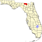 | |
| Towns | ||