Ford County, Kansas: Difference between revisions
→Communities: remove |
→Communities: update section intro |
||
| (33 intermediate revisions by 16 users not shown) | |||
| Line 1: | Line 1: | ||
{{short description|County in Kansas, United States}} |
|||
{{Use mdy dates|date=April 2024}} |
|||
{{Infobox U.S. county |
{{Infobox U.S. county |
||
|county = Ford County |
|county = Ford County |
||
| Line 13: | Line 15: | ||
|area_water_sq_mi = 0.8 |
|area_water_sq_mi = 0.8 |
||
|area percentage = 0.07% |
|area percentage = 0.07% |
||
|census estimate yr = 2018 <!-- "census yr" (for decade census) otherwise "census estimate yr" --> |
|||
|population_footnotes = <ref name="QF"/> |
|||
|pop = 33888 |
|||
| |
|population_as_of = 2020 |
||
|population_total = 34287 |
|||
|pop_est_footnotes = |
|||
|pop_est_as_of = |
|||
|population_est = |
|||
|population_density_sq_mi = 31.2 |
|||
|district = 1st |
|district = 1st |
||
|time zone = Central |
|time zone = Central |
||
|website = {{URL|http://www.fordcounty.net/|fordcounty.net}} |
|website = {{URL|http://www.fordcounty.net/|fordcounty.net}} |
||
}} |
}} |
||
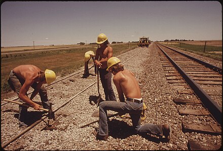
[[File:RAILROAD WORK CREW IMPROVES THE TRACKS AND BED OF THE ATCHISON, TOPEKA AND SANTA FE RAILROAD NEAR BELLEFONT, KANSAS... - NARA - 556012.jpg|thumb|right|Railroad crew works on the [[Atchison, Topeka and Santa Fe Railway|Atchison, Topeka and Santa Fe]] tracks near Bellefont, 1974. Photo by [[Charles O'Rear]].]] |
|||
'''Ford County''' |
'''Ford County''' is a [[County (United States)|county]] located in the [[U.S. state]] of [[Kansas]]. Its [[county seat]] and most populous city is [[Dodge City, Kansas|Dodge City]].<ref name="GR6">{{cite web |url=http://www.naco.org/Counties/Pages/FindACounty.aspx |access-date=June 7, 2011 |title=Find a County |publisher=National Association of Counties |url-status=dead |archive-url=https://web.archive.org/web/20150509170006/http://www.naco.org/Counties/Pages/FindACounty.aspx |archive-date=May 9, 2015 }}</ref> As of the [[2020 United States Census|2020 census]], its population was 34,287.<ref name="QF">{{cite web |title=QuickFacts; Ford County, Kansas; Population, Census, 2020 & 2010 |url=https://www.census.gov/quickfacts/fact/table/fordcountykansas/POP010220 |publisher=United States Census Bureau |access-date=August 16, 2021 |archive-url=https://web.archive.org/web/20210816064553/https://www.census.gov/quickfacts/fact/table/fordcountykansas/POP010220 |archive-date=August 16, 2021 |url-status=live}}</ref> The county was named in honor of [[James Hobart Ford|James Ford]], a brevet brigadier general during the American Civil War.<ref>{{cite book | url=https://archive.org/details/bub_gb_9V1IAAAAMAAJ | title=The Origin of Certain Place Names in the United States | publisher=Govt. Print. Off. | author=Gannett, Henry | year=1905 | pages=[https://archive.org/details/bub_gb_9V1IAAAAMAAJ/page/n127 128]}}</ref> |
||
==History== |
|||
{{See also|History of Kansas}}One of the earliest military posts in Kansas, Fort Atkinson, was located in Ford County. Fort Dodge, established in 1864, was on the north bank of the [[Arkansas River]], about five miles southeast of what would become [[Dodge City, Kansas|Dodge City]]. During the California Gold Rush in 1849, thousands of gold seekers passed through the area along the Santa Fe Trail, but few settled there. |
|||
Ford County was established in 1867 and named for Colonel James H. Ford of the Second Colorado Cavalry, who was in charge of the construction of Fort Dodge after the Civil War.<ref>{{Cite book |last=Cutler |first=William |url=https://www.kancoll.org/books/cutler/ford/ford-co-p1.html |title=History of the State of Kansas |year=1883 |isbn=9780722248751}}</ref> The region had been frequently traveled by pioneers along the Santa Fe Trail since the early 19th century.<ref name=":0">{{Cite web |title=Ford County, Kansas – Legends of Kansas |url=https://legendsofkansas.com/ford-county-kansas/ |access-date=April 4, 2024}}</ref> |
|||
The town of Dodge City was established in 1872 upon the completion of the [[Atchison, Topeka and Santa Fe Railway|Atchison, Topeka & Santa Fe Railroad]]. Before the buffalo were wiped out, their hides were extensively shipped from Dodge City. Dodge City would later develop into a rough and tumble cowtown during the peak cattle drive years of 1875-1885.<ref name=":0" /><ref>{{Cite web |last=Gribben |first=Brian |title=Research Guides: Kansas Heritage: Ford County |url=https://fhsuguides.fhsu.edu/kansasheritage/fordcounty |access-date=April 4, 2024 |website=fhsuguides.fhsu.edu |language=en}}</ref> |
|||
==Geography== |
==Geography== |
||
According to the [[U.S. Census Bureau]], the county has a total area of {{convert|1099|sqmi}}, of which {{convert|1098|sqmi|abbr=on}} are land and {{convert|0.8|sqmi}} (0.07%) is covered by water.<ref name="GR1">{{cite web|url=https://www.census.gov/geographies/reference-files/time-series/geo/gazetteer-files.html|publisher=[[United States Census Bureau]]|access-date= |
According to the [[U.S. Census Bureau]], the county has a total area of {{convert|1099|sqmi}}, of which {{convert|1098|sqmi|abbr=on}} are land and {{convert|0.8|sqmi}} (0.07%) is covered by water.<ref name="GR1">{{cite web|url=https://www.census.gov/geographies/reference-files/time-series/geo/gazetteer-files.html|publisher=[[United States Census Bureau]]|access-date=April 23, 2011|date=February 12, 2011|title=US Gazetteer files: 2010, 2000, and 1990}}</ref> |
||
===Adjacent counties=== |
===Adjacent counties=== |
||
| Line 34: | Line 48: | ||
* [[Meade County, Kansas|Meade County]] (southwest) |
* [[Meade County, Kansas|Meade County]] (southwest) |
||
* [[Gray County, Kansas|Gray County]] (west) |
* [[Gray County, Kansas|Gray County]] (west) |
||
===Transit=== |
|||
* [[D-TRAN]] |
|||
* [[Dodge City station]] |
|||
===Major highways=== |
===Major highways=== |
||
| Line 44: | Line 62: | ||
==Demographics== |
==Demographics== |
||
[[Image:USA Ford County, Kansas age pyramid.svg|thumb|175px|left|[[Population pyramid]] based on 2000 census age data]] |
|||
{{US Census population |
{{US Census population |
||
|1870= 427 |
|1870= 427 |
||
| Line 60: | Line 79: | ||
|2000= 32458 |
|2000= 32458 |
||
|2010= 33848 |
|2010= 33848 |
||
|2020= 34287 |
|||
|estyear=2018 |
|||
|estyear=2023 |
|||
|estimate=33888 |
|||
|estimate=33980 |
|||
|estref=<ref name="USCensusEst2018">{{cite web|url=https://www.census.gov/programs-surveys/popest/data/tables.2018.html|title=Population and Housing Unit Estimates|access-date=December 20, 2019}}</ref> |
|||
|estref=<ref name="USCensusEst2023">{{cite web|url=https://www.census.gov/programs-surveys/popest/data/tables.html|title=Annual Estimates of the Resident Population for Counties: April 1, 2020 to July 1, 2023|publisher=United States Census Bureau|access-date=April 3, 2024}}</ref> |
|||
|align-fn=center |
|align-fn=center |
||
|footnote=U.S. Decennial Census<ref>{{cite web|url=https://www.census.gov/programs-surveys/decennial-census.html|title=U.S. Decennial Census|publisher=United States Census Bureau|access-date=July 24, 2014}}</ref><br />1790-1960<ref>{{cite web|url=http://mapserver.lib.virginia.edu|title=Historical Census Browser|publisher=University of Virginia Library|access-date=July 24, 2014}}</ref> 1900-1990<ref>{{cite web|url=https://www.census.gov/population/cencounts/ks190090.txt|title=Population of Counties by Decennial Census: 1900 to 1990|publisher=United States Census Bureau|access-date=July 24, 2014}}</ref><br />1990-2000<ref>{{cite web|url=https://www.census.gov/population/www/cen2000/briefs/phc-t4/tables/tab02.pdf|title=Census 2000 PHC-T-4. Ranking Tables for Counties: 1990 and 2000|publisher=United States Census Bureau|access-date=July 24, 2014}}</ref> 2010- |
|footnote=U.S. Decennial Census<ref>{{cite web|url=https://www.census.gov/programs-surveys/decennial-census.html|title=U.S. Decennial Census|publisher=United States Census Bureau|access-date=July 24, 2014}}</ref><br />1790-1960<ref>{{cite web|url=http://mapserver.lib.virginia.edu|title=Historical Census Browser|publisher=University of Virginia Library|access-date=July 24, 2014}}</ref> 1900-1990<ref>{{cite web|url=https://www.census.gov/population/cencounts/ks190090.txt|title=Population of Counties by Decennial Census: 1900 to 1990|publisher=United States Census Bureau|access-date=July 24, 2014}}</ref><br />1990-2000<ref>{{cite web|url=https://www.census.gov/population/www/cen2000/briefs/phc-t4/tables/tab02.pdf |archive-url=https://web.archive.org/web/20100327165705/http://www.census.gov/population/www/cen2000/briefs/phc-t4/tables/tab02.pdf |archive-date=March 27, 2010 |url-status=live|title=Census 2000 PHC-T-4. Ranking Tables for Counties: 1990 and 2000|publisher=United States Census Bureau|access-date=July 24, 2014}}</ref> 2010-2020<ref name="QF"/> |
||
}} |
}} |
||
[[Image:USA Ford County, Kansas age pyramid.svg|thumb|150px|left|[[Population pyramid]]]] |
|||
The Dodge City [[Micropolitan Statistical Area]] includes all of Ford County. |
The Dodge City [[Micropolitan Statistical Area]] includes all of Ford County. |
||
As of the [[2010 United States Census|2000 census]],<ref name="GR2">{{cite web |url=https://www.census.gov |publisher=[[United States Census Bureau]] |access-date= |
As of the [[2010 United States Census|2000 census]],<ref name="GR2">{{cite web |url=https://www.census.gov |publisher=[[United States Census Bureau]] |access-date=October 19, 2018 |title=U.S. Census website }}</ref> 33,848 people, 10,852 households, and 7,856 families were residing in the county. The [[population density]] was {{convert|30|/mi2|/km2|disp=preunit|people|people|abbr=on}}. The 11,650 housing units averaged {{convert|11|/mi2|/km2|}}. The [[Race (United States Census)|racial makeup]] of the county was 75.3% [[White American|White]], 2.1% [[African American]], 1.0% [[Native Americans in the United States|Native American]], 1.4% [[Asian American|Asian]], 0.2% [[Pacific Islander American|Pacific Islander]], 17.8% from other races, and 2.7% from [[Multiracial|two or more races]]. [[Hispanic and Latino Americans]] of any race were 51.2% of the population. |
||
Of the 10,852 [[household]]s, 40.90% had children under the age of 18 living with them, 57.90% were married couples living together, 9.20% had a female householder with no husband present, and 27.60% were not families. About 22.70% of all households were made up of individuals, and 9.50% had someone living alone who was 65 years of age or older. The average household size was 2.92, and the average family size was 3.42. |
Of the 10,852 [[household]]s, 40.90% had children under the age of 18 living with them, 57.90% were married couples living together, 9.20% had a female householder with no husband present, and 27.60% were not families. About 22.70% of all households were made up of individuals, and 9.50% had someone living alone who was 65 years of age or older. The average household size was 2.92, and the average family size was 3.42. |
||
In the county, the age distribution was 31.10% under |
In the county, the age distribution was 31.10% under 18, 11.20% from 18 to 24, 29.40% from 25 to 44, 17.30% from 45 to 64, and 11.00% who were 65 or older. The median age was 30 years. For every 100 females, there were 107.20 males. For every 100 females age 18 and over, there were 105.30 males. |
||
The [[Median household income|median income for a household]] in the county was $37,860, and for a family was $42,734. Males had a median income of $27,189 versus $22,165 for females. The [[per capita income]] for the county was $15,721. About 9.90% of families and 12.40% of the population were below the [[poverty line]], including 15.40% of those under age 18 and 8.40% of those age 65 or over. |
The [[Median household income|median income for a household]] in the county was $37,860, and for a family was $42,734. Males had a median income of $27,189 versus $22,165 for females. The [[per capita income]] for the county was $15,721. About 9.90% of families and 12.40% of the population were below the [[poverty line]], including 15.40% of those under age 18 and 8.40% of those age 65 or over. |
||
| Line 81: | Line 100: | ||
===Presidential elections=== |
===Presidential elections=== |
||
Ford County has been strongly Republican for most of its history, especially in recent elections. Only eight Democratic presidential candidates from 1880 to 2020 have carried the county, the most recent being [[Jimmy Carter]] in 1976. |
Ford County has been strongly Republican for most of its history, especially in recent elections. Only eight Democratic presidential candidates from 1880 to 2020 have carried the county, the most recent being [[Jimmy Carter]] in 1976. |
||
{{Hidden |
{{Hidden |
||
| |
|headercss = background: #ccccff; font-size: 100%; width: 100%; |
||
|contentcss = text-align: left; font-size: 100%; width: 100%; |
|||
|title = Presidential election results |
|||
|header = Presidential election results |
|||
}} |
|||
|content = |
|||
{| align="center" border="2" cellpadding="4" cellspacing="0" style="margin: 1em 1em 1em 0; border: 1px #aaa solid; border-collapse: collapse; font-size: 95%;" |
|||
| |
{{PresHead|place=Ford County, Kansas|source=<ref>{{Cite web|url=http://uselectionatlas.org/RESULTS|title = Dave Leip's Atlas of U.S. Presidential Elections}}</ref>}} |
||
<!-- PresRow should be {{PresRow|Year|Winning party|GOP vote #|Dem vote #|3rd party vote #|State}} --> |
|||
|- bgcolor=lightgrey |
|||
{{PresRow|2020|Republican|5,803|2,947|165|Kansas}} |
|||
! Year |
|||
{{PresRow|2016|Republican|5,114|2,149|511|Kansas}} |
|||
! [[Republican Party (United States)|Republican]] |
|||
{{PresRow|2012|Republican|5,602|2,600|160|Kansas}} |
|||
! [[Democratic Party (United States)|Democratic]] |
|||
{{PresRow|2008|Republican|5,730|2,991|143|Kansas}} |
|||
! [[Third Party (United States)|Third Parties]] |
|||
{{PresRow|2004|Republican|6,632|2,286|98|Kansas}} |
|||
|- |
|||
{{PresRow|2000|Republican|6,050|2,566|301|Kansas}} |
|||
| style="text-align:center;" {{Party shading/Republican}}|'''[[United States presidential election in Kansas, 2020|2020]]''' |
|||
{{PresRow|1996|Republican|5,681|2,628|958|Kansas}} |
|||
| style="text-align:center;" {{Party shading/Republican}}|'''65.1%''' ''5,803'' |
|||
{{PresRow|1992|Republican|4,342|2,635|3,379|Kansas}} |
|||
| style="text-align:center;" {{Party shading/Democratic}}|33.1% ''2,947'' |
|||
{{PresRow|1988|Republican|5,685|3,817|195|Kansas}} |
|||
| style="text-align:center; background:honeyDew;"|1.85% ''165'' |
|||
{{PresRow|1984|Republican|6,935|2,914|98|Kansas}} |
|||
|- |
|||
{{PresRow|1980|Republican|5,686|3,194|781|Kansas}} |
|||
| style="text-align:center;" {{Party shading/Republican}}|'''[[United States presidential election in Kansas, 2016|2016]]''' |
|||
{{PresRow|1976|Democratic|4,679|4,934|214|Kansas}} |
|||
| style="text-align:center;" {{Party shading/Republican}}|'''66.3%''' ''5,114'' |
|||
{{PresRow|1972|Republican|6,232|2,804|249|Kansas}} |
|||
| style="text-align:center;" {{Party shading/Democratic}}|27.8% ''2,149'' |
|||
{{PresRow|1968|Republican|4,645|3,191|961|Kansas}} |
|||
| style="text-align:center; background:honeyDew;"|5.9% ''455'' |
|||
{{PresRow|1964|Democratic|3,481|5,221|59|Kansas}} |
|||
|- |
|||
{{PresRow|1960|Republican|5,200|3,792|25|Kansas}} |
|||
| style="text-align:center;" {{Party shading/Republican}}|'''[[United States presidential election in Kansas, 2012|2012]]''' |
|||
{{PresRow|1956|Republican|5,561|2,710|49|Kansas}} |
|||
| style="text-align:center;" {{Party shading/Republican}}|'''67.0%''' ''5,602'' |
|||
{{PresRow|1952|Republican|6,359|2,748|114|Kansas}} |
|||
| style="text-align:center;" {{Party shading/Democratic}}|31.1% ''2,600'' |
|||
{{PresRow|1948|Democratic|4,089|4,396|177|Kansas}} |
|||
| style="text-align:center; background:honeyDew;"|1.9% ''160'' |
|||
{{PresRow|1944|Republican|4,110|2,994|77|Kansas}} |
|||
|- |
|||
{{PresRow|1940|Republican|4,356|3,954|72|Kansas}} |
|||
| style="text-align:center;" {{Party shading/Republican}}|'''[[United States presidential election in Kansas, 2008|2008]]''' |
|||
{{PresRow|1936|Democratic|3,378|5,335|17|Kansas}} |
|||
| style="text-align:center;" {{Party shading/Republican}}|'''64.6%''' ''5,730'' |
|||
{{PresRow|1932|Democratic|3,335|4,442|238|Kansas}} |
|||
| style="text-align:center;" {{Party shading/Democratic}}|33.7% ''2,991'' |
|||
{{PresRow|1928|Republican|4,893|1,870|72|Kansas}} |
|||
| style="text-align:center; background:honeyDew;"|1.6% ''143'' |
|||
{{PresRow|1924|Republican|3,449|1,551|948|Kansas}} |
|||
|- |
|||
{{PresRow|1920|Republican|3,305|1,879|155|Kansas}} |
|||
| style="text-align:center;" {{Party shading/Republican}}|'''[[United States presidential election in Kansas, 2004|2004]]''' |
|||
{{PresRow|1916|Democratic|2,337|3,044|420|Kansas}} |
|||
| style="text-align:center;" {{Party shading/Republican}}|'''73.6%''' ''6,632'' |
|||
{{PresRow|1912|Democratic|529|1,125|1,104|Kansas}} |
|||
| style="text-align:center;" {{Party shading/Democratic}}|25.4% ''2,286'' |
|||
{{PresRow|1908|Republican|1,333|1,089|80|Kansas}} |
|||
| style="text-align:center; background:honeyDew;"|1.1% ''98'' |
|||
{{PresRow|1904|Republican|1,148|526|98|Kansas}} |
|||
|- |
|||
{{PresRow|1900|Republican|653|610|31|Kansas}} |
|||
| style="text-align:center;" {{Party shading/Republican}}|'''[[United States presidential election in Kansas, 2000|2000]]''' |
|||
{{PresRow|1896|Democratic|555|643|15|Kansas}} |
|||
| style="text-align:center;" {{Party shading/Republican}}|'''67.9%''' ''6,050'' |
|||
{{PresRow|1892|Republican|648|0|565|Kansas}} |
|||
| style="text-align:center;" {{Party shading/Democratic}}|28.8% ''2,566'' |
|||
{{PresFoot|1888|Republican|882|630|169|Kansas}} |
|||
| style="text-align:center; background:honeyDew;"|3.4% ''301'' |
|||
}}<!-- End of Hidden template --> |
|||
|- |
|||
| style="text-align:center;" {{Party shading/Republican}}|'''[[United States presidential election in Kansas, 1996|1996]]''' |
|||
| style="text-align:center;" {{Party shading/Republican}}|'''61.3%''' ''5,681'' |
|||
| style="text-align:center;" {{Party shading/Democratic}}|28.4% ''2,628'' |
|||
| style="text-align:center; background:honeyDew;"|10.3% ''958'' |
|||
|- |
|||
| style="text-align:center;" {{Party shading/Republican}}|'''[[United States presidential election in Kansas, 1992|1992]]''' |
|||
| style="text-align:center;" {{Party shading/Republican}}|'''41.9%''' ''4,342'' |
|||
| style="text-align:center;" {{Party shading/Democratic}}|25.4% ''2,635'' |
|||
| style="text-align:center; background:honeyDew;"|32.6% ''3,379'' |
|||
|- |
|||
| style="text-align:center;" {{Party shading/Republican}}|'''[[United States presidential election in Kansas, 1988|1988]]''' |
|||
| style="text-align:center;" {{Party shading/Republican}}|'''58.6%''' ''5,685'' |
|||
| style="text-align:center;" {{Party shading/Democratic}}|39.4% ''3,817'' |
|||
| style="text-align:center; background:honeyDew;"|2.0% ''195'' |
|||
|- |
|||
| style="text-align:center;" {{Party shading/Republican}}|'''[[United States presidential election in Kansas, 1984|1984]]''' |
|||
| style="text-align:center;" {{Party shading/Republican}}|'''69.7%''' ''6,935'' |
|||
| style="text-align:center;" {{Party shading/Democratic}}|29.3% ''2,914'' |
|||
| style="text-align:center; background:honeyDew;"|1.0% ''98'' |
|||
|- |
|||
| style="text-align:center;" {{Party shading/Republican}}|'''[[United States presidential election in Kansas, 1980|1980]]''' |
|||
| style="text-align:center;" {{Party shading/Republican}}|'''58.9%''' ''5,686'' |
|||
| style="text-align:center;" {{Party shading/Democratic}}|33.1% ''3,194'' |
|||
| style="text-align:center; background:honeyDew;"|8.1% ''781'' |
|||
|- |
|||
| style="text-align:center;" {{Party shading/Democratic}}|'''[[United States presidential election in Kansas, 1976|1976]]''' |
|||
| style="text-align:center;" {{Party shading/Republican}}|47.6% ''4,679'' |
|||
| style="text-align:center;" {{Party shading/Democratic}}|'''50.2%''' ''4,934'' |
|||
| style="text-align:center; background:honeyDew;"|2.2% ''214'' |
|||
|- |
|||
| style="text-align:center;" {{Party shading/Republican}}|'''[[United States presidential election in Kansas, 1972|1972]]''' |
|||
| style="text-align:center;" {{Party shading/Republican}}|'''67.1%''' ''6,232'' |
|||
| style="text-align:center;" {{Party shading/Democratic}}|30.2% ''2,804'' |
|||
| style="text-align:center; background:honeyDew;"|2.7% ''249'' |
|||
|- |
|||
| style="text-align:center;" {{Party shading/Republican}}|'''[[United States presidential election in Kansas, 1968|1968]]''' |
|||
| style="text-align:center;" {{Party shading/Republican}}|'''52.8%''' ''4,645'' |
|||
| style="text-align:center;" {{Party shading/Democratic}}|36.3% ''3,191'' |
|||
| style="text-align:center; background:honeyDew;"|10.9% ''961'' |
|||
|- |
|||
| style="text-align:center;" {{Party shading/Democratic}}|'''[[United States presidential election in Kansas, 1964|1964]]''' |
|||
| style="text-align:center;" {{Party shading/Republican}}|39.7% ''3,481'' |
|||
| style="text-align:center;" {{Party shading/Democratic}}|'''59.6%''' ''5,221'' |
|||
| style="text-align:center; background:honeyDew;"|0.7% ''59'' |
|||
|- |
|||
| style="text-align:center;" {{Party shading/Republican}}|'''[[United States presidential election in Kansas, 1960|1960]]''' |
|||
| style="text-align:center;" {{Party shading/Republican}}|'''57.7%''' ''5,200'' |
|||
| style="text-align:center;" {{Party shading/Democratic}}|42.1% ''3,792'' |
|||
| style="text-align:center; background:honeyDew;"|0.3% ''25'' |
|||
|- |
|||
| style="text-align:center;" {{Party shading/Republican}}|'''[[United States presidential election in Kansas, 1956|1956]]''' |
|||
| style="text-align:center;" {{Party shading/Republican}}|'''66.8%''' ''5,561'' |
|||
| style="text-align:center;" {{Party shading/Democratic}}|32.6% ''2,710'' |
|||
| style="text-align:center; background:honeyDew;"|0.6% ''49'' |
|||
|- |
|||
| style="text-align:center;" {{Party shading/Republican}}|'''[[1952 United States presidential election|1952]]''' |
|||
| style="text-align:center;" {{Party shading/Republican}}|'''69.0%''' ''6,359'' |
|||
| style="text-align:center;" {{Party shading/Democratic}}|29.8% ''2,748'' |
|||
| style="text-align:center; background:honeyDew;"|1.2% ''114'' |
|||
|- |
|||
| style="text-align:center;" {{Party shading/Democratic}}|'''[[1948 United States presidential election|1948]]''' |
|||
| style="text-align:center;" {{Party shading/Republican}}|47.2% ''4,089'' |
|||
| style="text-align:center;" {{Party shading/Democratic}}|'''50.8%''' ''4,396'' |
|||
| style="text-align:center; background:honeyDew;"|2.0% ''177'' |
|||
|- |
|||
| style="text-align:center;" {{Party shading/Republican}}|'''[[1944 United States presidential election|1944]]''' |
|||
| style="text-align:center;" {{Party shading/Republican}}|'''57.2%''' ''4,110'' |
|||
| style="text-align:center;" {{Party shading/Democratic}}|41.7% ''2,994'' |
|||
| style="text-align:center; background:honeyDew;"|1.1% ''77'' |
|||
|- |
|||
| style="text-align:center;" {{Party shading/Republican}}|'''[[1940 United States presidential election|1940]]''' |
|||
| style="text-align:center;" {{Party shading/Republican}}|'''52.0%''' ''4,356'' |
|||
| style="text-align:center;" {{Party shading/Democratic}}|47.2% ''3,954'' |
|||
| style="text-align:center; background:honeyDew;"|0.9% ''72'' |
|||
|- |
|||
| style="text-align:center;" {{Party shading/Democratic}}|'''[[1936 United States presidential election|1936]]''' |
|||
| style="text-align:center;" {{Party shading/Republican}}|38.7% ''3,378'' |
|||
| style="text-align:center;" {{Party shading/Democratic}}|'''61.1%''' ''5,335'' |
|||
| style="text-align:center; background:honeyDew;"|0.2% ''17'' |
|||
|- |
|||
| style="text-align:center;" {{Party shading/Democratic}}|'''[[1932 United States presidential election|1932]]''' |
|||
| style="text-align:center;" {{Party shading/Republican}}|41.6% ''3,335'' |
|||
| style="text-align:center;" {{Party shading/Democratic}}|'''55.4%''' ''4,442'' |
|||
| style="text-align:center; background:honeyDew;"|3.0% ''238'' |
|||
|- |
|||
| style="text-align:center;" {{Party shading/Republican}}|'''[[1928 United States presidential election|1928]]''' |
|||
| style="text-align:center;" {{Party shading/Republican}}|'''71.6%''' ''4,893'' |
|||
| style="text-align:center;" {{Party shading/Democratic}}|27.4% ''1,870'' |
|||
| style="text-align:center; background:honeyDew;"|1.1% ''72'' |
|||
|- |
|||
| style="text-align:center;" {{Party shading/Republican}}|'''[[1924 United States presidential election|1924]]''' |
|||
| style="text-align:center;" {{Party shading/Republican}}|'''58.0%''' ''3,449'' |
|||
| style="text-align:center;" {{Party shading/Democratic}}|26.1% ''1,551'' |
|||
| style="text-align:center; background:honeyDew;"|15.9% ''948'' |
|||
|- |
|||
| style="text-align:center;" {{Party shading/Republican}}|'''[[1920 United States presidential election|1920]]''' |
|||
| style="text-align:center;" {{Party shading/Republican}}|'''61.9%''' ''3,305'' |
|||
| style="text-align:center;" {{Party shading/Democratic}}|35.2% ''1,879'' |
|||
| style="text-align:center; background:honeyDew;"|2.9% ''155'' |
|||
|- |
|||
| style="text-align:center;" {{Party shading/Democratic}}|'''[[1916 United States presidential election|1916]]''' |
|||
| style="text-align:center;" {{Party shading/Republican}}|40.3% ''2,337'' |
|||
| style="text-align:center;" {{Party shading/Democratic}}|'''52.5%''' ''3,044'' |
|||
| style="text-align:center; background:honeyDew;"|7.2% ''420'' |
|||
|- |
|||
| style="text-align:center;" {{Party shading/Democratic}}|'''[[1912 United States presidential election|1912]]''' |
|||
| style="text-align:center;" {{Party shading/Republican}}|19.2% ''529'' |
|||
| style="text-align:center;" {{Party shading/Democratic}}|'''40.8%''' ''1,125'' |
|||
| style="text-align:center; background:honeyDew;"|40.0% ''1,104'' |
|||
|- |
|||
| style="text-align:center;" {{Party shading/Republican}}|'''[[1908 United States presidential election|1908]]''' |
|||
| style="text-align:center;" {{Party shading/Republican}}|'''53.3%''' ''1,333'' |
|||
| style="text-align:center;" {{Party shading/Democratic}}|43.5% ''1,089'' |
|||
| style="text-align:center; background:honeyDew;"|3.2% ''80'' |
|||
|- |
|||
| style="text-align:center;" {{Party shading/Republican}}|'''[[1904 United States presidential election|1904]]''' |
|||
| style="text-align:center;" {{Party shading/Republican}}|'''64.8%''' ''1,148'' |
|||
| style="text-align:center;" {{Party shading/Democratic}}|29.7% ''526'' |
|||
| style="text-align:center; background:honeyDew;"|5.5% ''98'' |
|||
|- |
|||
| style="text-align:center;" {{Party shading/Republican}}|'''[[1900 United States presidential election|1900]]''' |
|||
| style="text-align:center;" {{Party shading/Republican}}|'''50.5%''' ''653'' |
|||
| style="text-align:center;" {{Party shading/Democratic}}|47.1% ''610'' |
|||
| style="text-align:center; background:honeyDew;"|2.4% ''31'' |
|||
|- |
|||
| style="text-align:center;" {{Party shading/Democratic}}|'''[[1896 United States presidential election|1896]]''' |
|||
| style="text-align:center;" {{Party shading/Republican}}|45.8% ''555'' |
|||
| style="text-align:center;" {{Party shading/Democratic}}|'''53.0%''' ''643'' |
|||
| style="text-align:center; background:honeyDew;"|1.2% ''15'' |
|||
|- |
|||
| style="text-align:center;" {{Party shading/Republican}}|'''[[United States presidential election in Kansas, 1892|1892]]''' |
|||
| style="text-align:center;" {{Party shading/Republican}}|'''53.4%''' ''648'' |
|||
| |
|||
| style="text-align:center; background:honeyDew;"|46.6% ''565'' |
|||
|- |
|||
| style="text-align:center;" {{Party shading/Republican}}|'''[[1888 United States presidential election|1888]]''' |
|||
| style="text-align:center;" {{Party shading/Republican}}|'''52.5%''' ''882'' |
|||
| style="text-align:center;" {{Party shading/Democratic}}|37.5% ''630'' |
|||
| style="text-align:center; background:honeyDew;"|10.1% ''169'' |
|||
|} |
|||
{{Hidden end}} |
|||
===Laws=== |
===Laws=== |
||
Ford County was a prohibition, or [[dry county|"dry"]], county until the [[Kansas Constitution]] was amended in 1986 and voters approved the sale of alcoholic liquor by the individual drink with a 30% food sales requirement.<ref>{{Cite web|url=http://www.ksrevenue.org/abcwetdrymap.htm |title=Map of Wet and Dry Counties |publisher=Alcoholic Beverage Control, Kansas Department of Revenue |date=November 2006 |access-date= |
Ford County was a prohibition, or [[dry county|"dry"]], county until the [[Kansas Constitution]] was amended in 1986 and voters approved the sale of alcoholic liquor by the individual drink with a 30% food sales requirement.<ref>{{Cite web|url=http://www.ksrevenue.org/abcwetdrymap.htm |title=Map of Wet and Dry Counties |publisher=Alcoholic Beverage Control, Kansas Department of Revenue |date=November 2006 |access-date=December 28, 2007 |url-status=dead |archive-url=https://web.archive.org/web/20071008013617/http://www.ksrevenue.org/abcwetdrymap.htm |archive-date=October 8, 2007 }}</ref> |
||
==Education== |
==Education== |
||
| Line 279: | Line 157: | ||
==Communities== |
==Communities== |
||
[[File:Map of Ford Co, Ks, USA.png|thumb|300px|right|2005 |
[[File:Map of Ford Co, Ks, USA.png|thumb|300px|right|2005 map of Ford County<ref name="County-Map-Current"/> ([[:File:Kansas official transportation map legend.png|map legend]])]] |
||
List of townships / incorporated cities / unincorporated communities / extinct former communities within Ford County.<ref name="County-Map-Current">{{cite web |title=General Highway Map of Ford County, Kansas |url=https://www.ksdot.gov/Assets/wwwksdotorg/bureaus/burTransPlan/maps/county-pdf/ford.PDF |publisher=[[Kansas Department of Transportation]] (KDOT) |archive-url=https://web.archive.org/web/20231230002619/https://www.ksdot.gov/Assets/wwwksdotorg/bureaus/burTransPlan/maps/county-pdf/ford.PDF |archive-date=December 30, 2023 |date=June 2010 |url-status=live}}</ref> |
|||
===Cities=== |
===Cities=== |
||
{{div col}} |
|||
* [[Bucklin, Kansas|Bucklin]] |
* [[Bucklin, Kansas|Bucklin]] |
||
* [[Dodge City, Kansas|Dodge City]] |
* [[Dodge City, Kansas|Dodge City]] (county seat) |
||
* [[Ford, Kansas|Ford]] |
* [[Ford, Kansas|Ford]] |
||
* [[Spearville, Kansas|Spearville]] |
* [[Spearville, Kansas|Spearville]] |
||
{{div col end}} |
|||
===Unincorporated communities=== |
|||
===Census-designated places=== |
|||
† means a community is designated a [[Census-designated place|Census-Designated Place]] (CDP) by the [[United States Census Bureau]]. |
|||
* [[Fort Dodge, Kansas|Fort Dodge]] |
|||
{{div col}} |
|||
* [[Wilroads Gardens, Kansas|Wilroads Gardens]] |
|||
* [[Wright, Kansas|Wright]] |
|||
===Other unincorporated places=== |
|||
* [[Bellefont, Kansas|Bellefont]] |
* [[Bellefont, Kansas|Bellefont]] |
||
* [[Bloom, Kansas|Bloom]] |
* [[Bloom, Kansas|Bloom]] |
||
* [[Fort Dodge, Kansas|Fort Dodge]]† |
|||
* [[Howell, Kansas|Howell]] |
|||
* [[Kingsdown, Kansas|Kingsdown]] |
* [[Kingsdown, Kansas|Kingsdown]] |
||
* [[Wilroads Gardens, Kansas|Wilroads Gardens]]† |
|||
* [[Windhorst, Kansas|Windhorst]] |
* [[Windhorst, Kansas|Windhorst]] |
||
* [[Wright, Kansas|Wright]]† |
|||
{{div col end}} |
|||
===Townships=== |
===Townships=== |
||
Ford County is divided into 14 [[Civil township|townships]]. |
Ford County is divided into 14 [[Civil township|townships]]. The city of [[Dodge City, Kansas|Dodge City]] is considered governmentally independent and is excluded from the census figures for the townships. In the following table, the population center is the largest city (or cities) included in that township's population total, if it is of a significant size. |
||
{| class=" |
{| class="toccolours" border=1 cellspacing=0 cellpadding=4 style="text-align:center; border-collapse:collapse; font-size:90%;" |
||
|- style="background:#ccccff" |
|- style="background:#ccccff" |
||
! Township !! [[FIPS place code|FIPS]] !! Population<br/>center |
! Township !! [[FIPS place code|FIPS]] !! Population<br/>center |
||
| Line 336: | Line 219: | ||
| Wilburn || 79100 || || 88 || 0 (1) || 187 (72) || 0 (0) || 0% || {{coord|37|31|22|N|100|7|10|W|}} |
| Wilburn || 79100 || || 88 || 0 (1) || 187 (72) || 0 (0) || 0% || {{coord|37|31|22|N|100|7|10|W|}} |
||
|- |
|- |
||
|colspan=9|Sources: {{Cite web| url=https://www.census.gov/geo/www/gazetteer/places2k.html| title=Census 2000 U.S. Gazetteer Files| publisher=U.S. Census Bureau, Geography Division| url-status=dead| archive-url=https://web.archive.org/web/20020802223743/http://www.census.gov/geo/www/gazetteer/places2k.html| archive-date=2002 |
|colspan=9|Sources: {{Cite web| url=https://www.census.gov/geo/www/gazetteer/places2k.html| title=Census 2000 U.S. Gazetteer Files| publisher=U.S. Census Bureau, Geography Division| url-status=dead| archive-url=https://web.archive.org/web/20020802223743/http://www.census.gov/geo/www/gazetteer/places2k.html| archive-date=August 2, 2002}} |
||
|} |
|} |
||
==Notable people== |
==Notable people== |
||
Numerous figures of the [[American Old West]] lived in Dodge City during its period as a frontier cowtown. These included, most notably, lawmen [[Wyatt Earp]] and [[Bat Masterson]], and gunfighter [[Doc Holliday]].<ref>{{cite web | title = More Dodge City History | publisher = Dodge City Convention and Visitors Bureau | url = http://www.visitdodgecity.org/index.aspx?NID=106 | access-date = September 23, 2011}}</ref> |
|||
{{See also|List of people from Dodge City, Kansas|Dodge_City_Community_College#Notable_alumni|l1=List of Dodge City Community College people}} |
|||
Numerous figures of the [[American Old West]] lived in Dodge City during its period as a frontier cowtown. These included, most notably, lawmen [[Wyatt Earp]] and [[Bat Masterson]], and gunfighter [[Doc Holliday]].<ref>{{cite web | title = More Dodge City History | publisher = Dodge City Convention and Visitors Bureau | url = http://www.visitdodgecity.org/index.aspx?NID=106 | access-date = 2011-09-23}}</ref> |
|||
==See also== |
==See also== |
||
{{Portal|Kansas}} |
{{Portal|Kansas}} |
||
[[File:RAILROAD WORK CREW IMPROVES THE TRACKS AND BED OF THE ATCHISON, TOPEKA AND SANTA FE RAILROAD NEAR BELLEFONT, KANSAS... - NARA - 556012.jpg|thumb|right|Railroad crew works on the [[Atchison, Topeka and Santa Fe Railway|Atchison, Topeka and Santa Fe]] tracks near Bellefont, 1974. Photo by [[Charles O'Rear]].]] |
|||
* [[Golden Triangle of Meat-packing]] |
|||
* [[National Register of Historic Places listings in Ford County, Kansas]] |
* [[National Register of Historic Places listings in Ford County, Kansas]] |
||
{{See also Kansas counties}} |
{{See also Kansas counties}} |
||
==References== |
==References== |
||
{{Reflist |
{{Reflist}} |
||
==Further reading== |
==Further reading== |
||
| Line 355: | Line 239: | ||
{{See also|Santa Fe Trail#Further reading|l1=List of books about Santa Fe Trail}} |
{{See also|Santa Fe Trail#Further reading|l1=List of books about Santa Fe Trail}} |
||
* [https://www.kansasmemory.org/item/225065/ ''Handbook of Ford County, Kansas'']; C.S. Burch Publishing Co; 32 pages; 1887. |
* [https://www.kansasmemory.org/item/225065/ ''Handbook of Ford County, Kansas'']; C.S. Burch Publishing Co; 32 pages; 1887. |
||
* [https://www.kansasmemory.org/item/223983/ ''Atlas and Plat Book of Ford County, Kansas'']; |
* [https://www.kansasmemory.org/item/223983/ ''Atlas and Plat Book of Ford County, Kansas'']; Kenyon Co; 54 pages; 1916. |
||
* [https://www.kansasmemory.org/item/209419/ ''Standard Atlas of Ford County, Kansas'']; Geo. A. Ogle & Co; 63 pages; 1906. |
* [https://www.kansasmemory.org/item/209419/ ''Standard Atlas of Ford County, Kansas'']; Geo. A. Ogle & Co; 63 pages; 1906. |
||
| Line 386: | Line 270: | ||
{{Ford County, Kansas}} |
{{Ford County, Kansas}} |
||
{{Kansas}} |
{{Kansas}} |
||
{{Midwestern U.S. majority-minority counties}} |
|||
{{Authority control}} |
{{Authority control}} |
||
{{coord|37|42|N|99|54|W|type:adm2nd_region:US-KS|display=title}} |
{{coord|37|42|N|99|54|W|type:adm2nd_region:US-KS|display=title}} |
||
Revision as of 19:30, 5 May 2024
Ford County | |
|---|---|
 Ford County Courthouse in Dodge City (2009) | |
 Location within the U.S. state of Kansas | |
 Kansas's location within the U.S. | |
| Coordinates: 37°42′N 99°54′W / 37.7°N 99.9°W | |
| Country | |
| State | |
| Founded | February 26, 1867 |
| Named for | James Ford |
| Seat | Dodge City |
| Largest city | Dodge City |
| Area | |
| • Total | 1,099 sq mi (2,850 km2) |
| • Land | 1,098 sq mi (2,840 km2) |
| • Water | 0.8 sq mi (2 km2) 0.07% |
| Population | |
| • Total | 34,287 |
| • Density | 31.2/sq mi (12.0/km2) |
| Time zone | UTC−6 (Central) |
| • Summer (DST) | UTC−5 (CDT) |
| Congressional district | 1st |
| Website | fordcounty.net |
Ford County is a county located in the U.S. state of Kansas. Its county seat and most populous city is Dodge City.[2] As of the 2020 census, its population was 34,287.[1] The county was named in honor of James Ford, a brevet brigadier general during the American Civil War.[3]
History
One of the earliest military posts in Kansas, Fort Atkinson, was located in Ford County. Fort Dodge, established in 1864, was on the north bank of the Arkansas River, about five miles southeast of what would become Dodge City. During the California Gold Rush in 1849, thousands of gold seekers passed through the area along the Santa Fe Trail, but few settled there.
Ford County was established in 1867 and named for Colonel James H. Ford of the Second Colorado Cavalry, who was in charge of the construction of Fort Dodge after the Civil War.[4] The region had been frequently traveled by pioneers along the Santa Fe Trail since the early 19th century.[5]
The town of Dodge City was established in 1872 upon the completion of the Atchison, Topeka & Santa Fe Railroad. Before the buffalo were wiped out, their hides were extensively shipped from Dodge City. Dodge City would later develop into a rough and tumble cowtown during the peak cattle drive years of 1875-1885.[5][6]
Geography
According to the U.S. Census Bureau, the county has a total area of 1,099 square miles (2,850 km2), of which 1,098 sq mi (2,840 km2) are land and 0.8 square miles (2.1 km2) (0.07%) is covered by water.[7]
Adjacent counties
- Hodgeman County (north)
- Edwards County (northeast)
- Kiowa County (east)
- Clark County (south)
- Meade County (southwest)
- Gray County (west)
Transit
Major highways
Demographics

| Census | Pop. | Note | %± |
|---|---|---|---|
| 1870 | 427 | — | |
| 1880 | 3,122 | 631.1% | |
| 1890 | 5,308 | 70.0% | |
| 1900 | 5,497 | 3.6% | |
| 1910 | 11,393 | 107.3% | |
| 1920 | 14,273 | 25.3% | |
| 1930 | 20,647 | 44.7% | |
| 1940 | 17,254 | −16.4% | |
| 1950 | 19,670 | 14.0% | |
| 1960 | 20,938 | 6.4% | |
| 1970 | 22,587 | 7.9% | |
| 1980 | 24,315 | 7.7% | |
| 1990 | 27,463 | 12.9% | |
| 2000 | 32,458 | 18.2% | |
| 2010 | 33,848 | 4.3% | |
| 2020 | 34,287 | 1.3% | |
| 2023 (est.) | 33,980 | [8] | −0.9% |
| U.S. Decennial Census[9] 1790-1960[10] 1900-1990[11] 1990-2000[12] 2010-2020[1] | |||
The Dodge City Micropolitan Statistical Area includes all of Ford County.
As of the 2000 census,[13] 33,848 people, 10,852 households, and 7,856 families were residing in the county. The population density was 30 people/sq mi (12 people/km2). The 11,650 housing units averaged 11 per square mile (4.2/km2). The racial makeup of the county was 75.3% White, 2.1% African American, 1.0% Native American, 1.4% Asian, 0.2% Pacific Islander, 17.8% from other races, and 2.7% from two or more races. Hispanic and Latino Americans of any race were 51.2% of the population.
Of the 10,852 households, 40.90% had children under the age of 18 living with them, 57.90% were married couples living together, 9.20% had a female householder with no husband present, and 27.60% were not families. About 22.70% of all households were made up of individuals, and 9.50% had someone living alone who was 65 years of age or older. The average household size was 2.92, and the average family size was 3.42.
In the county, the age distribution was 31.10% under 18, 11.20% from 18 to 24, 29.40% from 25 to 44, 17.30% from 45 to 64, and 11.00% who were 65 or older. The median age was 30 years. For every 100 females, there were 107.20 males. For every 100 females age 18 and over, there were 105.30 males.
The median income for a household in the county was $37,860, and for a family was $42,734. Males had a median income of $27,189 versus $22,165 for females. The per capita income for the county was $15,721. About 9.90% of families and 12.40% of the population were below the poverty line, including 15.40% of those under age 18 and 8.40% of those age 65 or over.
Government
Presidential elections
Ford County has been strongly Republican for most of its history, especially in recent elections. Only eight Democratic presidential candidates from 1880 to 2020 have carried the county, the most recent being Jimmy Carter in 1976.
| Year | Republican | Democratic | Third party(ies) | |||
|---|---|---|---|---|---|---|
| No. | % | No. | % | No. | % | |
| 2020 | 5,803 | 65.09% | 2,947 | 33.06% | 165 | 1.85% |
| 2016 | 5,114 | 65.78% | 2,149 | 27.64% | 511 | 6.57% |
| 2012 | 5,602 | 66.99% | 2,600 | 31.09% | 160 | 1.91% |
| 2008 | 5,730 | 64.64% | 2,991 | 33.74% | 143 | 1.61% |
| 2004 | 6,632 | 73.56% | 2,286 | 25.35% | 98 | 1.09% |
| 2000 | 6,050 | 67.85% | 2,566 | 28.78% | 301 | 3.38% |
| 1996 | 5,681 | 61.30% | 2,628 | 28.36% | 958 | 10.34% |
| 1992 | 4,342 | 41.93% | 2,635 | 25.44% | 3,379 | 32.63% |
| 1988 | 5,685 | 58.63% | 3,817 | 39.36% | 195 | 2.01% |
| 1984 | 6,935 | 69.72% | 2,914 | 29.30% | 98 | 0.99% |
| 1980 | 5,686 | 58.86% | 3,194 | 33.06% | 781 | 8.08% |
| 1976 | 4,679 | 47.61% | 4,934 | 50.21% | 214 | 2.18% |
| 1972 | 6,232 | 67.12% | 2,804 | 30.20% | 249 | 2.68% |
| 1968 | 4,645 | 52.80% | 3,191 | 36.27% | 961 | 10.92% |
| 1964 | 3,481 | 39.73% | 5,221 | 59.59% | 59 | 0.67% |
| 1960 | 5,200 | 57.67% | 3,792 | 42.05% | 25 | 0.28% |
| 1956 | 5,561 | 66.84% | 2,710 | 32.57% | 49 | 0.59% |
| 1952 | 6,359 | 68.96% | 2,748 | 29.80% | 114 | 1.24% |
| 1948 | 4,089 | 47.21% | 4,396 | 50.75% | 177 | 2.04% |
| 1944 | 4,110 | 57.23% | 2,994 | 41.69% | 77 | 1.07% |
| 1940 | 4,356 | 51.97% | 3,954 | 47.17% | 72 | 0.86% |
| 1936 | 3,378 | 38.69% | 5,335 | 61.11% | 17 | 0.19% |
| 1932 | 3,335 | 41.61% | 4,442 | 55.42% | 238 | 2.97% |
| 1928 | 4,893 | 71.59% | 1,870 | 27.36% | 72 | 1.05% |
| 1924 | 3,449 | 57.99% | 1,551 | 26.08% | 948 | 15.94% |
| 1920 | 3,305 | 61.90% | 1,879 | 35.19% | 155 | 2.90% |
| 1916 | 2,337 | 40.29% | 3,044 | 52.47% | 420 | 7.24% |
| 1912 | 529 | 19.18% | 1,125 | 40.79% | 1,104 | 40.03% |
| 1908 | 1,333 | 53.28% | 1,089 | 43.53% | 80 | 3.20% |
| 1904 | 1,148 | 64.79% | 526 | 29.68% | 98 | 5.53% |
| 1900 | 653 | 50.46% | 610 | 47.14% | 31 | 2.40% |
| 1896 | 555 | 45.75% | 643 | 53.01% | 15 | 1.24% |
| 1892 | 648 | 53.42% | 0 | 0.00% | 565 | 46.58% |
| 1888 | 882 | 52.47% | 630 | 37.48% | 169 | 10.05% |
Laws
Ford County was a prohibition, or "dry", county until the Kansas Constitution was amended in 1986 and voters approved the sale of alcoholic liquor by the individual drink with a 30% food sales requirement.[15]
Education
Colleges
Unified school districts
Communities

List of townships / incorporated cities / unincorporated communities / extinct former communities within Ford County.[16]
Cities
- Bucklin
- Dodge City (county seat)
- Ford
- Spearville
Unincorporated communities
† means a community is designated a Census-Designated Place (CDP) by the United States Census Bureau.
Townships
Ford County is divided into 14 townships. The city of Dodge City is considered governmentally independent and is excluded from the census figures for the townships. In the following table, the population center is the largest city (or cities) included in that township's population total, if it is of a significant size.
| Township | FIPS | Population center |
Population | Population density /km2 (/sq mi) |
Land area km2 (sq mi) |
Water area km2 (sq mi) |
Water % | Geographic coordinates |
|---|---|---|---|---|---|---|---|---|
| Bloom | 07375 | 113 | 1 (2) | 144 (55) | 0 (0) | 0% | 37°30′23″N 99°55′4″W / 37.50639°N 99.91778°W | |
| Bucklin | 09025 | 900 | 3 (8) | 285 (110) | 0 (0) | 0.02% | 37°34′44″N 99°37′9″W / 37.57889°N 99.61917°W | |
| Concord | 15150 | 117 | 1 (2) | 187 (72) | 0 (0) | 0.11% | 37°36′36″N 100°5′52″W / 37.61000°N 100.09778°W | |
| Dodge | 18225 | 899 | 13 (33) | 70 (27) | 0 (0) | 0.21% | 37°47′0″N 100°0′52″W / 37.78333°N 100.01444°W | |
| Enterprise | 21450 | 1,113 | 6 (17) | 175 (67) | 0 (0) | 0.19% | 37°40′47″N 99°57′8″W / 37.67972°N 99.95222°W | |
| Fairview | 22500 | 346 | 2 (5) | 188 (73) | 0 (0) | 0.06% | 37°45′11″N 100°8′57″W / 37.75306°N 100.14917°W | |
| Ford | 23750 | 456 | 2 (5) | 249 (96) | 0 (0) | 0.01% | 37°36′58″N 99°46′27″W / 37.61611°N 99.77417°W | |
| Grandview | 27350 | 784 | 3 (9) | 226 (87) | 0 (0) | 0.20% | 37°47′10″N 99°55′54″W / 37.78611°N 99.93167°W | |
| Richland | 59300 | 931 | 9 (24) | 99 (38) | 0 (0) | 0.17% | 37°42′10″N 100°2′19″W / 37.70278°N 100.03861°W | |
| Royal | 61575 | 105 | 1 (1) | 185 (72) | 0 (0) | 0.06% | 37°51′51″N 100°6′44″W / 37.86417°N 100.11222°W | |
| Sodville | 66150 | 110 | 1 (2) | 145 (56) | 0 (0) | 0.01% | 37°31′16″N 99°45′6″W / 37.52111°N 99.75167°W | |
| Spearville | 67150 | 1,150 | 2 (6) | 479 (185) | 0 (0) | 0.03% | 37°47′58″N 99°45′4″W / 37.79944°N 99.75111°W | |
| Wheatland | 77675 | 170 | 1 (2) | 193 (74) | 0 (0) | 0% | 37°48′58″N 99°37′22″W / 37.81611°N 99.62278°W | |
| Wilburn | 79100 | 88 | 0 (1) | 187 (72) | 0 (0) | 0% | 37°31′22″N 100°7′10″W / 37.52278°N 100.11944°W | |
| Sources: "Census 2000 U.S. Gazetteer Files". U.S. Census Bureau, Geography Division. Archived from the original on August 2, 2002. | ||||||||
Notable people
Numerous figures of the American Old West lived in Dodge City during its period as a frontier cowtown. These included, most notably, lawmen Wyatt Earp and Bat Masterson, and gunfighter Doc Holliday.[17]
See also
- Golden Triangle of Meat-packing
- National Register of Historic Places listings in Ford County, Kansas
- Community information for Kansas
- Kansas locations by per capita income
- List of counties in Kansas
- List of townships in Kansas
- List of cities in Kansas
- List of unincorporated communities in Kansas
- List of ghost towns in Kansas
References
- ^ a b c "QuickFacts; Ford County, Kansas; Population, Census, 2020 & 2010". United States Census Bureau. Archived from the original on August 16, 2021. Retrieved August 16, 2021.
- ^ "Find a County". National Association of Counties. Archived from the original on May 9, 2015. Retrieved June 7, 2011.
- ^ Gannett, Henry (1905). The Origin of Certain Place Names in the United States. Govt. Print. Off. pp. 128.
- ^ Cutler, William (1883). History of the State of Kansas. ISBN 9780722248751.
- ^ a b "Ford County, Kansas – Legends of Kansas". Retrieved April 4, 2024.
- ^ Gribben, Brian. "Research Guides: Kansas Heritage: Ford County". fhsuguides.fhsu.edu. Retrieved April 4, 2024.
- ^ "US Gazetteer files: 2010, 2000, and 1990". United States Census Bureau. February 12, 2011. Retrieved April 23, 2011.
- ^ "Annual Estimates of the Resident Population for Counties: April 1, 2020 to July 1, 2023". United States Census Bureau. Retrieved April 3, 2024.
- ^ "U.S. Decennial Census". United States Census Bureau. Retrieved July 24, 2014.
- ^ "Historical Census Browser". University of Virginia Library. Retrieved July 24, 2014.
- ^ "Population of Counties by Decennial Census: 1900 to 1990". United States Census Bureau. Retrieved July 24, 2014.
- ^ "Census 2000 PHC-T-4. Ranking Tables for Counties: 1990 and 2000" (PDF). United States Census Bureau. Archived (PDF) from the original on March 27, 2010. Retrieved July 24, 2014.
- ^ "U.S. Census website". United States Census Bureau. Retrieved October 19, 2018.
- ^ "Dave Leip's Atlas of U.S. Presidential Elections".
- ^ "Map of Wet and Dry Counties". Alcoholic Beverage Control, Kansas Department of Revenue. November 2006. Archived from the original on October 8, 2007. Retrieved December 28, 2007.
- ^ a b "General Highway Map of Ford County, Kansas" (PDF). Kansas Department of Transportation (KDOT). June 2010. Archived (PDF) from the original on December 30, 2023.
- ^ "More Dodge City History". Dodge City Convention and Visitors Bureau. Retrieved September 23, 2011.
Further reading
- Handbook of Ford County, Kansas; C.S. Burch Publishing Co; 32 pages; 1887.
- Atlas and Plat Book of Ford County, Kansas; Kenyon Co; 54 pages; 1916.
- Standard Atlas of Ford County, Kansas; Geo. A. Ogle & Co; 63 pages; 1906.
External links
- County
- Historical
- Ford County History from FCHS, Dodge City, KS
- Ford County GenWeb
- Ford County from American History and Genealogy Project (AHGP)
- Maps
- Ford County Maps: Current, Historic, KDOT
- Kansas Highway Maps: Current, Historic, KDOT
- Kansas Railroad Maps: Current, 1996, 1915, KDOT and Kansas Historical Society
Places adjacent to Ford County, Kansas | ||||||||||||||||
|---|---|---|---|---|---|---|---|---|---|---|---|---|---|---|---|---|
| ||||||||||||||||
Municipalities and communities of Ford County, Kansas, United States | ||
|---|---|---|
| Cities |  | |
| CDPs | ||
| Unincorporated communities | ||
| Townships | ||
| International | |
|---|---|
| National | |
| Other | |