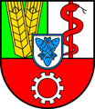
Arnsdorf
Appearance
Arnsdorf | |
|---|---|
Location of Arnsdorf within Bautzen district  | |
| Coordinates: 51°6′N 13°58′E / 51.100°N 13.967°E | |
| Country | Germany |
| State | Saxony |
| District | Bautzen |
| Subdivisions | 4 |
| Government | |
| • Mayor (2020–27) | Frank Eisold[1] (CDU) |
| Area | |
• Total | 35.80 km2 (13.82 sq mi) |
| Elevation | 290 m (950 ft) |
| Population (2022-12-31)[2] | |
• Total | 5,047 |
| • Density | 140/km2 (370/sq mi) |
| Time zone | UTC+01:00 (CET) |
| • Summer (DST) | UTC+02:00 (CEST) |
| Postal codes | 01477 |
| Dialling codes | 035200 |
| Vehicle registration | BZ, BIW, HY, KM |
| Website | www.gemeinde-arnsdorf.de |
Arnsdorf (Upper Sorbian: Warnoćicy) is a municipality in the district of Bautzen in the state of Saxony, in eastern Germany.
Arnsdorf bei Dresden railway station is located in the southern part of the village and is part of the Görlitz–Dresden railway and Kamenz–Pirna railway lines.
-
Administrative building of the historic Saxon (Royal) Hospital
-
The church, Anstaltskirche Arnsdorf
-
The village church Dorfkirche Arnsdorf, Bautzen
-
Municipal authority buildings in Arnsdorf, 2010
-
Arnsdorf bei Dresden railway station
References
- ^ Wahlergebnisse 2020, Freistaat Sachsen, accessed 10 July 2021.
- ^ "Einwohnerzahlen nach Gemeinden als Excel-Arbeitsmappe" (XLS) (in German). Statistisches Landesamt des Freistaates Sachsen. 2024.


![The church, Anstaltskirche Arnsdorf [de]](http://upload.wikimedia.org/wikipedia/commons/thumb/3/31/Arnsdorf_SK_Anstaltskirche_%2802%29.jpg/180px-Arnsdorf_SK_Anstaltskirche_%2802%29.jpg)
![The village church Dorfkirche Arnsdorf, Bautzen [de]](http://upload.wikimedia.org/wikipedia/commons/thumb/b/b0/Dorfkirche_Arnsdorf_mit_Mauerwall_und_separatem_Glockenhaus.jpg/180px-Dorfkirche_Arnsdorf_mit_Mauerwall_und_separatem_Glockenhaus.jpg)


