Moores Valley, Alabama: Difference between revisions
Appearance
Content deleted Content added
Altairisfar (talk | contribs) create stub |
m add {{Use American English}} template |
||
| (15 intermediate revisions by 10 users not shown) | |||
| Line 1: | Line 1: | ||
{{Use American English|date=September 2024}} |
|||
| ⚫ | |||
{{Use mdy dates|date=July 2023}} |
|||
| ⚫ | |||
|official_name = Moores Valley, Alabama |
|official_name = Moores Valley, Alabama |
||
|settlement_type = |
|settlement_type = [[Unincorporated area|Unincorporated community]] |
||
|image_skyline = |
|image_skyline = |
||
|imagesize = |
|imagesize = |
||
| Line 7: | Line 9: | ||
|image_seal = |
|image_seal = |
||
|image_map = |
|image_map = |
||
| |
|pushpin_map = Alabama#USA<!-- name of a location map as per Template:Location_map --> |
||
| |
|pushpin_label = Moores Valley |
||
|pushpin_label_position = <!-- position of the pushpin label: left, right, top, bottom, none --> |
|||
|image_map1 = |
|||
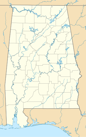
|pushpin_map_caption =Location within the state of Alabama |
|||
|mapsize1 = |
|||
| |
|pushpin_mapsize =200 |
||
|coor_pinpoint =<!-- can be used to specify exactly where/what the coordinates refer to --> |
|||
| ⚫ | |||
|coordinates = {{coord|32|3|39.53|N|87|37|48|W|display=inline}} |
|||
| ⚫ | |||
| ⚫ | |||
| ⚫ | |||
|subdivision_type2 = [[List of counties in Alabama|County]] |
|subdivision_type2 = [[List of counties in Alabama|County]] |
||
|subdivision_name = |
|subdivision_name = United States |
||
|subdivision_name1 = [[Alabama]] |
|subdivision_name1 = [[Alabama]] |
||
|subdivision_name2 = [[Marengo County, Alabama|Marengo]] |
|subdivision_name2 = [[Marengo County, Alabama|Marengo]] |
||
| Line 51: | Line 55: | ||
|website = |
|website = |
||
}} |
}} |
||
'''Moores Valley''' is an [[unincorporated area|unincorporated community]] in [[Marengo County, Alabama|Marengo County]], [[Alabama]].<ref name="GNIS">{{Gnis|156734|Moores Valley, Alabama}}</ref> |
'''Moores Valley''' is an [[unincorporated area|unincorporated community]] in [[Marengo County, Alabama|Marengo County]], [[Alabama]], United States.<ref name="GNIS">{{Gnis|156734|Moores Valley, Alabama}}</ref> |
||
==History== |
|||
Moores Valley was founded when the Frisco Railroad was extended to that point.<ref>{{cite news | url=https://news.google.com/newspapers?id=oupfAAAAIBAJ&sjid=dw4GAAAAIBAJ&pg=2951%2C3115125 | title=Settlers establish Vineland, Surginer, Moore's Valley | work=The Democrat-Reporter | date=12 October 2006 | accessdate=23 April 2015 | author=Jones, Joel D. | pages=2}}</ref> |
|||
==Geography== |
==Geography== |
||
Moores Valley is located at {{coord|32.06098|-87.63000|display=inline,title}} and has an elevation of {{convert|128|ft|m|0}}.<ref name="GNIS"/> |
Moores Valley is located at {{coord|32.06098|-87.63000|display=inline,title}} and has an elevation of {{convert|128|ft|m|0}}.<ref name="GNIS"/> |
||
==References== |
==References== |
||
| Line 60: | Line 67: | ||
{{Marengo County, Alabama}} |
{{Marengo County, Alabama}} |
||
{{authority control}} |
|||
{{Short description|Unincorporated community in Alabama, United States}} |
|||
[[Category:Unincorporated communities in Alabama]] |
[[Category:Unincorporated communities in Alabama]] |
||
[[Category:Marengo County, Alabama]] |
[[Category:Unincorporated communities in Marengo County, Alabama]] |
||
{{ |
{{MarengoCountyAL-geo-stub}} |
||
Latest revision as of 07:08, 22 September 2024
Moores Valley, Alabama | |
|---|---|
| Coordinates: 32°3′39.53″N 87°37′48″W / 32.0609806°N 87.63000°W | |
| Country | United States |
| State | Alabama |
| County | Marengo |
| Elevation | 128 ft (39 m) |
| Time zone | UTC-6 (Central (CST)) |
| • Summer (DST) | UTC-5 (CDT) |
| Area code | 334 |
Moores Valley is an unincorporated community in Marengo County, Alabama, United States.[1]
History
[edit]Moores Valley was founded when the Frisco Railroad was extended to that point.[2]
Geography
[edit]Moores Valley is located at 32°03′40″N 87°37′48″W / 32.06098°N 87.63000°W and has an elevation of 128 feet (39 m).[1]
References
[edit]- ^ a b U.S. Geological Survey Geographic Names Information System: Moores Valley, Alabama
- ^ Jones, Joel D. (October 12, 2006). "Settlers establish Vineland, Surginer, Moore's Valley". The Democrat-Reporter. p. 2. Retrieved April 23, 2015.


