Category:SVG topographic maps of Greece
Media in category "SVG topographic maps of Greece"
The following 83 files are in this category, out of 83 total.
-
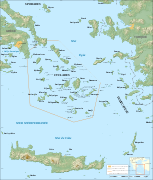
Aegean Sea map bathymetry-es.svg 3,750 × 4,560; 3.42 MB
-
Aegean Sea map bathymetry-fi.svg 3,750 × 4,560; 3.52 MB
-
Aegean Sea map bathymetry-fr.svg 3,750 × 4,560; 3.57 MB
-
Aegean Sea map bathymetry.svg 3,750 × 4,560; 3.54 MB
-
Aegina general map-de.svg 1,200 × 1,125; 934 KB
-
Aegina general map-el.svg 1,200 × 1,125; 934 KB
-
Aegina general map-en.svg 1,200 × 1,125; 933 KB
-
Ancient Regions Epirus and Macedon-es.svg 1,808 × 1,803; 3.61 MB
-
Ancient Regions Mainland Greece-es.svg 633 × 606; 3.73 MB
-
AntiguasRegionesDelPeloponeso.svg 1,292 × 1,507; 15.97 MB
-
AntiguoEpiro-es.svg 943 × 1,089; 11.55 MB
-
Argólida.svg 703 × 780; 16.91 MB
-
Artemis Orthia location-es.svg 992 × 794; 3.49 MB
-
Attica topography basemap.svg 714 × 769; 1.64 MB
-
Boeotia ancient-es.svg 778 × 478; 9.13 MB
-
Byzantine Greece ca 900 AD ZH.svg 797 × 632; 447 KB
-
Byzantine Greece ca 900 AD-es.svg 787 × 640; 17.7 MB
-
Byzantine Greece ca 900 AD-pt.svg 797 × 632; 446 KB
-
Byzantine Greece ca 900 AD.svg 797 × 632; 1.18 MB
-
CefaloniaMapaTopográfico.svg 547 × 547; 2.22 MB
-
CefaloniaMapaTopográfico2.svg 547 × 547; 2.37 MB
-
Central Greece 1820.svg 920 × 617; 3.34 MB
-
Central Greece.svg 920 × 617; 4.65 MB
-
CentralGreece (texts).svg 920 × 617; 4.58 MB
-
Chios topographic map-de.svg 1,580 × 1,150; 1.35 MB
-
Chios topographic map-en.svg 1,580 × 1,150; 1.4 MB
-
Chios topographic map-es.svg 1,580 × 1,150; 1.35 MB
-
Chios topographic map-fr.svg 1,580 × 1,150; 1.35 MB
-
Chios topographic map-nb.svg 1,580 × 1,150; 1.41 MB
-
Corfu topographic map-blank.svg 2,100 × 2,345; 2.29 MB
-
Corfu topographic map-de.svg 2,100 × 2,345; 2.43 MB
-
Corfu topographic map-el.svg 2,100 × 2,345; 2.45 MB
-
Corfu topographic map-en.svg 2,096 × 2,341; 2.19 MB
-
Corfu topographic map-es.svg 2,100 × 2,345; 2.49 MB
-
Corfu topographic map-fr.svg 2,100 × 2,345; 2.46 MB
-
Corfu topographic map-hu.svg 2,100 × 2,345; 2.47 MB
-
Corfu topographic map-mk.svg 2,100 × 2,345; 2.45 MB
-
Corfu topographic map-nb.svg 2,100 × 2,345; 2.46 MB
-
Cyclades map-fr.svg 3,680 × 4,335; 2.74 MB
-
Delphi location.svg 991 × 784; 86 KB
-
Dodona in Epirus.svg 975 × 862; 1.52 MB
-
Dodona location-es.svg 992 × 794; 3.49 MB
-
Dodona location.svg 991 × 784; 517 KB
-
Elis topographic map blank.svg 650 × 700; 728 KB
-
Environs of Athens-be.svg 910 × 1,000; 553 KB
-
Environs of Athens-ru.svg 910 × 1,000; 553 KB
-
GolfoMalíacoTermópilas.svg 1,602 × 1,028; 985 KB
-
GreciaEgeoMapaTopográfico.svg 787 × 689; 17.88 MB
-
Greece large topographic basemap.svg 2,095 × 1,971; 13.21 MB
-
Greece large topographic blank map.svg 2,095 × 1,971; 13.72 MB
-
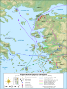
Ionian Revolt Campaign Map-el.svg 1,330 × 1,755; 1.68 MB
-
Ionian Revolt Campaign Map-en.svg 1,330 × 1,755; 1,007 KB
-
Ionian Revolt Campaign Map-hu.svg 1,330 × 1,755; 1,002 KB
-
Ionian Revolt Campaign Map-it.svg 1,331 × 1,755; 1.74 MB
-
Ionian Revolt Campaign Map-sv.svg 1,330 × 1,755; 877 KB
-
Life of Orpheus Greek Mythology (Extra Details).svg 993 × 793; 3.14 MB
-
Life of Orpheus Greek Mythology - (Español).svg 992 × 794; 3.65 MB
-
Life of Orpheus Greek Mythology - (French).svg 993 × 793; 3.23 MB
-
Life of Orpheus Greek Mythology - (German).svg 993 × 793; 3.23 MB
-
Life of Orpheus Greek Mythology - (Italian).svg 993 × 793; 3.23 MB
-
Life of Orpheus Greek Mythology - (Russian).svg 993 × 793; 3.23 MB
-
Life of Orpheus Greek Mythology - (Български).svg 993 × 793; 3.23 MB
-
Life of Orpheus Greek Mythology-pt.svg 993 × 793; 3.22 MB
-
Life of Orpheus Greek Mythology.svg 993 × 793; 3.22 MB
-
MapaTopográficoDeAlbaniaGreciaYElEgeo.svg 992 × 794; 3.44 MB
-
MapaTopográficoDeGreciaCentral.svg 920 × 617; 6.81 MB
-
MapaTopográficoDeLaÉlideAntigua.svg 962 × 1,458; 4.63 MB
-
Minoan Crete topographic map-ru.svg 3,370 × 1,600; 2.48 MB
-
Montesmitosgriegos.svg 787 × 689; 18.13 MB
-
PeloponesoNoroeste.svg 425 × 581; 5.85 MB
-
Peloponnesian War - North - Culture-es.svg 712 × 461; 9.91 MB
-
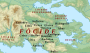
RegiónDeFócide.svg 664 × 391; 10.64 MB
-
RegióndeLócride.svg 1,025 × 581; 10.57 MB
-
RodasTopográfico.svg 1,048 × 595; 2.21 MB
-
RodasTopográfico2.svg 1,048 × 669; 2.54 MB
-
Tesalia.svg 394 × 376; 12.28 MB
-
TesaliaCiudadesYRegiones.svg 467 × 456; 10.66 MB
-
TesaliaMapaTopográfico.svg 467 × 456; 9.4 MB
-
Topographic map of Macedonia (Greece).svg 802 × 570; 3.38 MB
-
ZanteMapaTopográfico.svg 589 × 567; 2.75 MB
-
Élide-es.svg 414 × 471; 5.98 MB
-
ÉlipeMapaTopográfico.svg 414 × 471; 5.85 MB
-
Егејска Македонија топографска.svg 802 × 570; 3.93 MB


