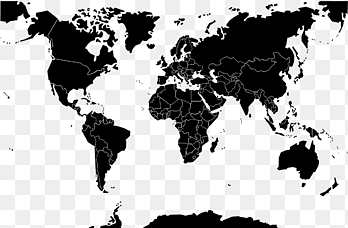
QGIS World map Shapefile Geographic Information System, cartogrpahy, world, map png
PNG keywords
- world,
- map,
- vector Map,
- world Map,
- geographic Data And Information,
- geojson,
- cartogrpahy,
- gdal,
- shapefile,
- qgis,
- point,
- openstreetmap,
- open Source Geospatial Foundation,
- natural Earth,
- map Projection,
- geographic Information System,
- line,
- area,
- png,
- sticker png,
- free download
PNG info
- Dimensions
- 1500x750px
- Filesize
- 1.14MB
- MIME type
- Image/png
resize png
width(px)
height(px)
Non-commercial use, DMCA Contact Us
Relevant png images
-

earth illustration, Geographic Information System GIS Day Geographic data and information Geography Map, Earth In, globe, world png -

Geographic Information System Geography Geospatial analysis Map, map, world, data png -

OpenStreetMap Geographic Information System Geographic data and information Open Source Geospatial Foundation, information, wikimedia Commons, road Map png -

QGIS Geographic Information System Open Source Geospatial Foundation PostGIS Computer Software, installation, text, logo png -

World map Globe Map projection, world map, globe, logo png -

Geographic Information System QGIS ArcGIS Geography GIS applications, map, grass, map png -

Geographic Information System Mastering ArcGIS Geography Geographic data and information, map, text, map png -

Geographic Information System Geography Map Cartography, gis s, angle, data png -

Globe World 3D computer graphics Visualization Map, earth, infographic, 3D Computer Graphics png -

Earth World map Globe Geography, earth, 3D Computer Graphics, world png -

ArcGIS Esri Geographic Information System Map, map, angle, map png -

QGIS Geographic Information System Computer Icons Open Source Geospatial Foundation Geographic data and information, Promotion Presentation, text, logo png -

Geography National Geographic Bee Scale Cartography Map, globe, globe, color png -

world map, Globe World map Flat Earth, asia, blue, world png -

World map Globe Flat Earth, globe, blue, globe png -

Esri ArcGIS Geographic Information System Logo Geographic data and information, city infrastructure, company, logo png -

Geographic Information System Computer Icons ArcGIS Map Geospatial analysis, map, angle, logo png -

spherical grid illustration, Globe Grid World map Meridian, sphere, symmetry, sphere png -

PostGIS Essentials Training Geographic Information System Spatial database Open Source Geospatial Foundation, postgresql logo, logo, geographic Data And Information png -

World map Globe Blank map, germ detail map, border, globe png -

Globe Geographic coordinate system Longitude Latitude, globe, symmetry, world png -

World map Globe, trade, blue, 3D Computer Graphics png -

Computer Software Cartography Map Geographic Information System Safe Software, cartogrpahy, data, map png -

Globe World map graphics, globe, globe, logo png -

Digital mapping Geographic Information System Geospatial analysis OpenStreetMap, map, service, map png -

OpenLayers Web mapping Geographic Information System GeoServer, map, rectangle, logo png -

national flags-themed planet illustration, Globe Flags of the World World Flag, flag,Flag,Countries flags,spherical, flag, symmetry png -

Geographic Information System Computer Icons Map Icon design, map, angle, logo png -

Globe Grid World Meridian, globe, symmetry, world png -

World map Globe Blank map, world map, border, globe png -

Earth Globe World Logo, earth, globe, logo png -

Philippines Philippine Declaration of Independence Shapefile Map Geographic Information System, map, police Officer, leaf png -

Globe Earth symbol World, globe, globe, eps png -

Netbook ArcGIS Laptop Esri ArcView, explorer, netbook, computer png -

Globe Geographic Information System Computer Software Systems Tool Kit, globe, 3D Computer Graphics, world png -

Technology, Blue Earth Science and Technology outline, globe illustration, blue, symmetry png -

World map Equirectangular projection, metal powder english, globe, monochrome png -

World map Globe Blank map, world map, border, wikimedia Commons png -

Globe Computer Icons Geography Map, globe icon, globe, sphere png -

Geographic Information System Geography GIS Day Geographic data and information, layer, angle, data png -

World map Globe, countries, monochrome, wikimedia Commons png -

map illustration, Geography of Pakistan Map Geography of Pakistan, pakistan, independence Day, wikimedia Commons png -

Cartography Computer Icons Map Computer Software Symbol, cartogrpahy, map, world Map png -

Treasure map Treasure hunting Piracy, map, angle, white png -

gray map illustration, World map Globe, World map, world, silhouette png -

World map Satellite ry Earth, satellite map, globe, world png -

GIS fundamentals Geographic Information System Geography Map, map, angle, text png -

Globe Latitude Geographic coordinate system Longitude World map, students boy, globe, world png -

blue and white illustration of earth, Social Science: Global Perspectives Business Supply chain Industry, Blue Earth, blue, computer Network png -

planet earth artwork, Esri ArcGIS Server Geographic Information System Computer Software, previous icon, symmetry, sphere png


