Nothing Special   »   [go: up one dir, main page]

About tags on Geograph
Public Tags
Related Tags | Coverage Map
Prefix: postcode area    Tag:  AB31  
Other tags: AB31     area postcode:AB31    

Showing latest 50 of 785 images tagged with postcode area:AB31 tag.

View all tagged images - In Browser
:

NJ5703 : Old Schoolhouse by Stanley Howe Old Schoolhouse by Stanley Howe
geograph for square NJ5703
Roadside of Lumphanan.
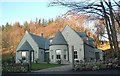
Tags: postcode area:AB31   top:Educational SitesX   type:GeographX   place:LumphananX   Minor RoadX   Old School HouseX   Postcode Area AB31X   top:Roads, Road TransportX   subject:SchoolX  
NO6998 : Briggs Cottage by Stanley Howe Briggs Cottage by Stanley Howe
geograph for square NO6998
Raemoir, Crathes, BANCHORY AB31 4EU.
NO6497 : Signpost at junction near Sunnyview by Stanley Howe Signpost at junction near Sunnyview by Stanley Howe
geograph for square NO6497
Seen as arriving from Glassel. The present unclassified Bridge of Canny to... (more)
NJ6201 : A preserved WW2 Light Gun Combination by Stanley Howe A preserved WW2 Light Gun Combination by Stanley Howe
geograph for square NJ6201
In William Street, Torphins. Comprising tow vehicle, ammunition trailer and gun.
Tags: AB31   postcode area:AB31   ArtilleryX   Military VehicleX   StreetX   place:TorphinsX   top:Village, Rural SettlementX  
NJ6201 : South end of Kinnairdy Terrace by Stanley Howe South end of Kinnairdy Terrace by Stanley Howe
geograph for square NJ6201
T-junction vehicle turning area for the housing estate.
Tags: postcode area:AB31   subject:RoadX   top:Roads, Road TransportX   T JunctionX   place:TorphinsX   Turning AreaX   top:Village, Rural SettlementX  
NJ6404 : Field pattern west of Corquhittachie by Stanley Howe Field pattern west of Corquhittachie by Stanley Howe
geograph for square NJ6404
Seen from B993 (downhill through a recently clear-felled woodland area).
NO7492 : Blairydryne stock yard by Stanley Howe Blairydryne stock yard by Stanley Howe
geograph for square NO7492
On Sheeoch haughs.
Tags: postcode area:AB31   place:BanchoryX   subject:FarmX   top:Farm, Fishery, Market GardeningX   type:GeographX   top:GrasslandX   Haugh FieldsX   top:Rivers, Streams, DrainageX   Stock Collecting AreaX   TreesX  
NO7396 : Path from Crathes Castle car park to Denwood Belt by Stanley Howe Path from Crathes Castle car park to Denwood Belt by Stanley Howe
geograph for square NO7396
Across a grassed area with picnic tables.
Tags: postcode area:AB31   place:BanchoryX   Car ParkX   subject:Car ParkX   top:Country EstatesX   Crathes Castle EstateX   type:GeographX   top:GrasslandX   top:PathsX   Picnic Tables & SeatsX   Shelter BeltX   top:Sport, LeisureX  
NO7397 : 'Go Ape' area, Ley Wood by Stanley Howe 'Go Ape' area, Ley Wood by Stanley Howe
geograph for square NO7397
Crathes Castle Estate.
Tags: postcode area:AB31   place:BanchoryX   top:Country EstatesX   type:GeographX   place:Go Ape Crathes CastleX   top:Sport, LeisureX   TreesX   subject:WoodlandX   top:Woodland, ForestX  
NO7397 : An entrance to Ley Wood by Stanley Howe An entrance to Ley Wood by Stanley Howe
geograph for square NO7397
From the Keeper's Cottage; through the recently developed 'Go... (more)
Tags: postcode area:AB31   place:BanchoryX   type:GeographX   place:Go Ape Crathes CastleX   Keepers CottageX   Private RoadX   top:Roads, Road TransportX   top:Sport, LeisureX   subject:WoodlandX   top:Woodland, ForestX  
NJ6202 : Livestock access to Gownie Burn by Stanley Howe Livestock access to Gownie Burn by Stanley Howe
geograph for square NJ6202
A fenced drinking area, spanning the Gownie Burn at the edge of Torphins Wood.
Tags: postcode area:AB31   BurnX   type:GeographX   top:GrasslandX   top:Rivers, Streams, DrainageX   subject:StreamX   place:TorphinsX   Woodland EdgeX   top:Woodland, ForestX  
NJ5703 : Mature trees sheltering Lumphanan Sewage Works (in August) by Stanley Howe Mature trees sheltering Lumphanan Sewage Works (in August) by Stanley Howe
geograph for square NJ5703
Compare a view of the same area on the west side of Lumphanan in January 2008... (more)
Tags: postcode area:AB31   type:GeographX   place:LumphananX   Mature TreesX   top:Roads, Road TransportX   subject:TreeX   top:Waste, Waste ManagementX   top:Woodland, ForestX  
NO6580 : A final pusch! by Stanley Howe A final pusch! by Stanley Howe
geograph for square NO6580
The last short climb up the B974 from the carpark viewpoint to the summit cairn.
Tags: postcode area:AB31   B974X   place:Cairn O MountX   CarparkX   subject:RoadX   top:Roads, Road TransportX   Summit AreaX   top:UplandsX   ViewpointX  
NO6097 : Potarch Hotel awaiting redevelopment (Sep 2014) by Stanley Howe Potarch Hotel awaiting redevelopment (Sep 2014) by Stanley Howe
geograph for square NO6097
By B993; close to Potarch bridge over the River Dee.
Tags: postcode area:AB31   Area Under DevelopmentX   road:B993X   top:Construction, DevelopmentX   subject:HotelX   former:HotelX  
NO6097 : Potarch Inn awaiting redevelopment (Sep 2014) by Stanley Howe Potarch Inn awaiting redevelopment (Sep 2014) by Stanley Howe
geograph for square NO6097
The former Inn by the River Dee has stood unused for some months.
NJ6201 : Fenced 'utilities' enclosure by Stanley Howe Fenced 'utilities' enclosure by Stanley Howe
geograph for square NJ6201
Connected with some underground network; but what? Sewage Pumping Station??
Tags: postcode area:AB31   top:Business, Retail, ServicesX   subject:CompoundX   Fenced-Off AreaX   place:TorphinsX   Utility InstallationX  
NJ6300 : View to copse on Hill of Beltie by Stanley Howe View to copse on Hill of Beltie by Stanley Howe
geograph for square NJ6300
Tags: postcode area:AB31   CopseX   Hill Summit AreaX   place:TorphinsX   subject:WoodlandX   top:Woodland, ForestX  
NJ6300 : View of Gallows Hill summit by Stanley Howe View of Gallows Hill summit by Stanley Howe
geograph for square NJ6300
From near Gallows Cairn.
Tags: postcode area:AB31   Gallows SiteX   top:GrasslandX   Hill Summit AreaX   subject:HillsideX   place:TorphinsX  
NJ6201 : Access to a pair of old  terraced cottages with a shared garden by Stanley Howe Access to a pair of old terraced cottages with a shared garden by Stanley Howe
geograph for square NJ6201
Still extant, they appear on an 1866 OS Survey as 'Poor Houses';... (more)
Tags: postcode area:AB31   subject:CottagesX   top:Housing, DwellingsX   LychgateX   Old Poor HousesX   Shared GardenX   place:TorphinsX   top:Village, Rural SettlementX  
NO7095 : Bench seats and red bin by Stanley Howe Bench seats and red bin by Stanley Howe
geograph for square NO7095
By the River Dee in Banchory.
Tags: postcode area:AB31   place:BanchoryX   Bench SeatsX   LawnX   Litter BinX   subject:Open AreaX   top:Park and Public GardensX  
NJ7500 : Entrance to Candyglirach by Stanley Howe Entrance to Candyglirach by Stanley Howe
geograph for square NJ7500
Category: Driveway
From the Hirn road.
Tags: postcode area:AB31  
NO6597 : House on A93 by Stanley Howe House on A93 by Stanley Howe
geograph for square NO6597
Category: House
Across the Burn of Canny from Waulkmill.
Tags: A93X   postcode area:AB31   VillaX  
NO6696 : Bridgefoot bridge over Burn of Canny by Stanley Howe Bridgefoot bridge over Burn of Canny by Stanley Howe
geograph for square NO6696
Category: Bridge
Double-arch stone bridge over the burn.
Tags: postcode area:AB31   Road Bridge Over BurnX  
NJ6102 : Old railway bridge abutment, Wester Beltie by Stanley Howe Old railway bridge abutment, Wester Beltie by Stanley Howe
for square NJ6102
Category: Railway (disused)
On Learney road
Tags: postcode area:AB31  
NO6193 : Tillycroy by Stanley Howe Tillycroy by Stanley Howe
geograph for square NO6193
Category: Farmhouse
Viewed from B976.
Tags: postcode area:AB31  
NO7796 : Entering Kirkton of Durris by Stanley Howe Entering Kirkton of Durris by Stanley Howe
geograph for square NO7796
On the B9077 from the west. Speed limit signs 50mph.
NO7696 : Overhead power lines near Kirkton of Durris by Stanley Howe Overhead power lines near Kirkton of Durris by Stanley Howe
geograph for square NO7696
Seen from the B9077 as approaching the village from the west. Clouds gathering... (more)
NO6998 : Minor Road from A980 towards Hawthorn Wood by Stanley Howe Minor Road from A980 towards Hawthorn Wood by Stanley Howe
geograph for square NO6998
Stone wall and pine trees just east of C19 Briggs Cottage. A... (more)
NJ6201 : Renovated cottage policy 2019 by Stanley Howe Renovated cottage policy 2019 by Stanley Howe
geograph for square NJ6201
On Craigour Road (A980); seen from a junction across the A980.
NJ6201 : Wind-felled Willow by Beltie Burn by Stanley Howe Wind-felled Willow by Beltie Burn by Stanley Howe
geograph for square NJ6201
Seen from B993 south of Torphins. Cf. NJ6201 : Tree by Beltie Burn in June .
NJ6200 : New build and access track near Birley by Stanley Howe New build and access track near Birley by Stanley Howe
geograph for square NJ6200
Off B993 at Mid-Beltie.
NJ6301 : New Villa in Church Wood by Stanley Howe New Villa in Church Wood by Stanley Howe
geograph for square NJ6301
Near Gallowcairn, Torphins.
Tags: postcode area:AB31   Church WoodX   subject:DwellingX   type:GeographX   top:Housing, DwellingsX   top:Roads, Road TransportX   place:TorphinsX   Triple GarageX   building type:VillaX   top:Village, Rural SettlementX  
NO6899 : View NNE over Brockton from A980 near Raemoir by Stanley Howe View NNE over Brockton from A980 near Raemoir by Stanley Howe
geograph for square NO6899
With the ruined Cluny Crichton Castle in a field behind, and a snow-covered Hill... (more)
NJ5404 : Minor road between Wartle and Loanhead by Stanley Howe Minor road between Wartle and Loanhead by Stanley Howe
geograph for square NJ5404
Stone walled edging on both sides of road; with a gorse bank and water course on the left.
Tags: postcode area:AB31   type:GeographX   Gorse BankX   Low Stone WallX   place:LumphananX   Minor RoadX   subject:RoadX   top:Roads, Road TransportX  
NJ5404 : Field access gate by Stanley Howe Field access gate by Stanley Howe
geograph for square NJ5404
A 6-bar steel gate sited at a dogleg bend in the minor road between Wartle and Loanend.
NJ5404 : View north towards Wartle by Stanley Howe View north towards Wartle by Stanley Howe
geograph for square NJ5404
From the minor road below.
Tags: postcode area:AB31   top:Farm, Fishery, Market GardeningX   FarmsteadX   FieldX   type:GeographX   place:LumphananX   Minor RoadX   Post and Wire FenceX   top:Roads, Road TransportX   subject:ViewX  
NJ5404 : Looking upstream of a headwater near Wartle by Stanley Howe Looking upstream of a headwater near Wartle by Stanley Howe
geograph for square NJ5404
- - which (fed by drains) ultimately finds its way (via several confluences)... (more)
Tags: postcode area:AB31   type:GeographX   HeadwaterX   place:LumphananX   Minor RoadX   top:Rivers, Streams, DrainageX   top:Roads, Road TransportX   subject:StreamX   Upstream ViewX  
NJ5404 : Road downhill; south of Wartle by Stanley Howe Road downhill; south of Wartle by Stanley Howe
geograph for square NJ5404
The ridge of wooded hills ahead isolates this upper glen's minor road from... (more)
Tags: postcode area:AB31   type:GeographX   place:LumphananX   Minor RoadX   subject:RoadX   top:Roads, Road TransportX   top:UplandsX   Wooded RidgeX  
NJ5404 : Access to fields SE of Wartle Farm by Stanley Howe Access to fields SE of Wartle Farm by Stanley Howe
geograph for square NJ5404
Off the minor road; on a frosty day with a bright blue sky.
Tags: postcode area:AB31   top:Air, Sky, WeatherX   type:GeographX   place:LumphananX   Minor RoadX   top:Roads, Road TransportX   subject:WeatherX  
NJ5404 : Farmhouse at Wartle by Stanley Howe Farmhouse at Wartle by Stanley Howe
geograph for square NJ5404
As seen from the minor road passing through the farmyard.
Tags: postcode area:AB31   top:Farm, Fishery, Market GardeningX   FarmhouseX   subject:FarmhouseX   type:GeographX   place:LumphananX   Minor RoadX   top:Roads, Road TransportX  
NJ5404 : Finger post sign at start of Footpath from near Wartle  to Tarland by Stanley Howe Finger post sign at start of Footpath from near Wartle to Tarland by Stanley Howe
for square NJ5404
Routed via Lochmanse.
Tags: postcode area:AB31   type:Close LookX   Footpath FingerpostX   Junction of Footpath and Minor RoadX   place:LumphananX   subject:PathX   top:PathsX   top:Roads, Road TransportX  
NJ5404 : A longrange view towards the farmyard at Whitehouse by Stanley Howe A longrange view towards the farmyard at Whitehouse by Stanley Howe
geograph for square NJ5404
From near the dogleg bend in the minor road north of Wartle.
Tags: postcode area:AB31   type:GeographX   place:LumphananX   Minor RoadX   top:Roads, Road TransportX   subject:ViewX   View Down ValleyX  
NJ5404 : Approach to Wartle from Tulloch by Stanley Howe Approach to Wartle from Tulloch by Stanley Howe
geograph for square NJ5404
A footpath signed to Tarland on the right.
Tags: postcode area:AB31   top:Farm, Fishery, Market GardeningX   Footpath SignX   type:GeographX   place:LumphananX   Minor RoadX   subject:RoadX   top:Roads, Road TransportX   Snow PatchesX  
NJ5504 : Minor road WNW from Whitehouse by Stanley Howe Minor road WNW from Whitehouse by Stanley Howe
geograph for square NJ5504
Towards Tulloch. Craiglich on skyline ahead.
Tags: postcode area:AB31   type:GeographX   place:LumphananX   Minor RoadX   subject:RoadX   top:Roads, Road TransportX  
NJ5504 : Farmyard at Whitehouse by Stanley Howe Farmyard at Whitehouse by Stanley Howe
geograph for square NJ5504
Farm equipment and outbuilding by minor road to Tulloch.
NJ5504 : Farmstead at Whitehouse by Stanley Howe Farmstead at Whitehouse by Stanley Howe
geograph for square NJ5504
By minor road to Wartle.
Tags: postcode area:AB31   Farm BuildingsX   top:Farm, Fishery, Market GardeningX   subject:FarmyardX   type:GeographX   place:LumphananX   Minor RoadX   top:Roads, Road TransportX  
NJ5504 : An historic whetstone at Whitehouse by Stanley Howe An historic whetstone at Whitehouse by Stanley Howe
for square NJ5504
Hand-powered device for sharpening cutting implements. This one now appears to... (more)
NJ5504 : The farmhouse called WHITEHOUSE by Stanley Howe The farmhouse called WHITEHOUSE by Stanley Howe
geograph for square NJ5504
On the SW flank of Blelack Hill; by the minor road between Blelack and Tulloch.
NJ5504 : Approach to Whitehouse from Blelack by Stanley Howe Approach to Whitehouse from Blelack by Stanley Howe
geograph for square NJ5504
Craiglich on the horizon at far left.
Tags: postcode area:AB31   subject:Farm BuildingX   top:Farm, Fishery, Market GardeningX   FarmsteadX   type:GeographX   place:LumphananX   Minor RoadX   top:Roads, Road TransportX  
NJ5504 : Minor road between Blelack and Whitehouse  (230m asl) by Stanley Howe Minor road between Blelack and Whitehouse (230m asl) by Stanley Howe
geograph for square NJ5504
With wooded Craiglich (476m asl) ahead on the horizon.
Tags: postcode area:AB31   type:GeographX   place:LumphananX   Minor RoadX   subject:RoadX   top:Roads, Road TransportX   SnowsceneX   top:UplandsX  
View more in the Image Search or in Browser
View images matching 'AB31' anywhere in the tags
Don't click these: PotMel 1 PotMel 2
You are not logged in | login | register