Nothing Special   »   [go: up one dir, main page]

2023

TM4076 : Mells gauging station on the River Blyth

taken 2 years ago, near to Mells, Suffolk, England
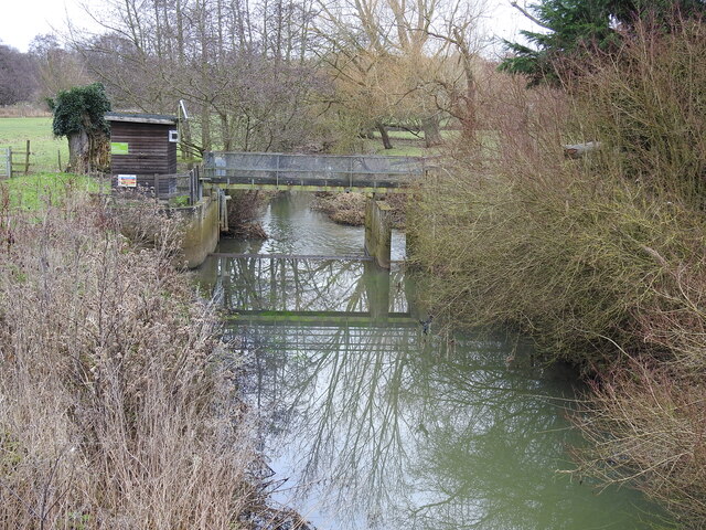
Mells gauging station on the River Blyth
Taken from the road bridge, the river is shallow at the moment and the water murky with the banks overgrown and neglected
The Blyth Navigation

Temporarily borrowed from Wikipedia.
The Blyth Navigation was a canal in Suffolk, England, running 7 miles (11 km) from Halesworth to the North Sea at Southwold. It opened in 1761, and was insolvent by 1884. Its demise was accelerated by an attempt to reclaim saltings at Blythburgh, which resulted in the estuary silting up. It was used sporadically until 1911, and was not formally abandoned until 1934.
LinkExternal link


Creative Commons Licence [Some Rights Reserved]   © Copyright Adrian S Pye and licensed for reuse under this Creative Commons Licence.
Geographical Context: Rivers, Streams, Drainage Roads, Road transport River: River Blyth other tags: River Blyth Click a tag, to view other nearby images.
1:50,000 Modern Day Landranger(TM) Map © Crown Copyright
+
+
1:50,000 Modern Day Landranger(TM) Map © Crown Copyright
TIP: Click the map for more Large scale mapping
Grid Square
TM4076, 33 images   (more nearby 🔍)
Photographer
Adrian S Pye   (more nearby)
Date Taken
Saturday, 4 February, 2023   (more nearby)
Submitted
Saturday, 4 February, 2023
Subject Location
OSGB36: geotagged! TM 4062 7687 [10m precision]
WGS84: 52:20.2257N 1:31.8374E
Camera Location
OSGB36: geotagged! TM 4059 7687
View Direction
East-northeast (about 67 degrees)
Clickable map
+
NW N NE
W Go E
SW S SE
Image Type (about): geograph 
This page has been viewed about 37 times
You are not logged in | login | register