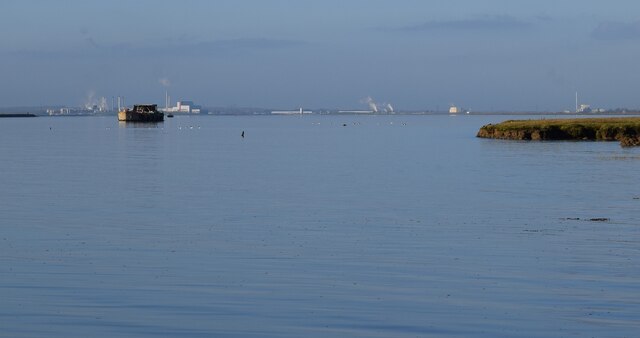
TQ9266 : View westwards along The Swale to Kemsley Marshes
taken 2 years ago, near to Kemsley, Kent, England

The Isle of Sheppey is the second largest island off the coast of England (after the Isle of Wight). It is within the Swale district of Kent, named after the stretch of sea which separates the island from the mainland. Two bridges link Sheppey to the mainland, the older Kingsferry Bridge, a lifting bridge (able to lift both road and the railway lines to allow ships to pass beneath it) was built in 1959. The modern Sheppey Crossing takes the A249 as a dual-carriageway to the island. It was opened on 3rd July 2006 with a maximum height of 95' (29m) (at MHWS) above the Swale, sufficient height to allow ships to pass under it without the need for lifting.
The south-eastern portion of the Isle of Sheppey is actually another smaller island, the Isle of Harty, though it is effectively a part of the larger island with only a bridged stream separating them these days.
The area of the Isle of Sheppey (including Harty) is c. 36 milesē (93 kmē) {about a quarter of the size of the Isle of Wight}
Its population is a little over 40,000 almost all of whom live in the north of the island, mostly in Minster and Sheerness both in the northwest of the island.
Sheppey is the third most populated island off the English coast (after Portsea and Wight).
Minster contains an ancient abbey church (see Link) dating back to Saxon times, and the gatehouse of the former abbey (see Link
)
Sheerness and the smaller town of Queenborough have historic dock connections, particularly the former around its Bluetown area. Much of this area could do with substantial development and funding [as of 2023].
The southern half of the island is all marshland and reclaimed land for farming with very little of the population living there. It contains the Elmley Nature Reserve on yet another sub-island (Elmley) - see Link
The Swale is a strip of sea that separates the Isle of Sheppey from the mainland of Kent. It is an important wildlife location and is both a Nature reserve and Special protection area. It is also an important channel for shipping.
Wikipedia: Link
The oldest parts of the Ferry House Inn date from the C18th. It has had many additional buildings added to its original core and is now a popular wedding destination as well as having treatment rooms and 11 bedrooms, five of which are in the original building. I think that few would argue against the assertion that this is the most upmarket pub on the Isle of Sheppey and probably its best eating place as it has a very good restaurant - these are of course my own opinions.
See their own website here: Link
The original inn is EH Grade II listed: Link
It is quite remarkable that this inn has survived and thrived as a hostelry considering that the ferry after which it is named ceased running at least 75 years ago. As such the inn's passing trade is effectively zero - other than perhaps the odd small boat passing along The Swale. There is an advertising sign for the inn facing out onto The Swale adjacent to the old ferry jetty, so perhaps the occasional mariner does pause for a pint.
Just when the ferry ceased plying the route between Harty and Oare on the North Kent coast seems to be open to conjecture. It is generally stated that the last ferry ran in 1946, however another source suggests that the ferry "fell apart" in 1941. Yet another suggestion is that there was no regular ferry service after the First World War.
The landlord of the inn apparently owns the rights to operate the ferry, and in 1970 a brief flirtation with running a hovercraft across the short stretch of water was actioned. This idiosyncratic service was apparently abandoned after just a few weeks however.
There are remains of the concrete jetty for the ferry on both sides of The Swale - at Harty on Sheppey just south of the inn, and on the mainland side poking out from Oare Marshes. A minor road still runs north from the village of Oare to this site and there is now a car park and visitor centre (for Oare Marshes Nature Reserve) there.