Nothing Special   »   [go: up one dir, main page]

2022

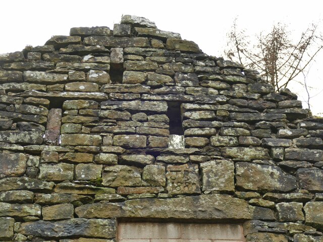
SJ9672 : Ruined building at Dimples - datestone

taken 2 years ago, near to Macclesfield Forest, Cheshire East, England

Ruined building at Dimples - datestone
The datestone has the initials JB and the date 1880. An interpretation board explains the initials as those of James Bullock who lived here until his death in 1892, after which the family moved away and the remote farm presumably became uninhabited thereafter. See SJ9672 : Ruined building at Dimples for context.

Creative Commons Licence [Some Rights Reserved]   © Copyright Stephen Craven and licensed for reuse under this Creative Commons Licence.
Geographical Context: Derelict, Disused Date: 1880 other tags: Ruined Farmhouse Click a tag, to view other nearby images.
This photo is linked from: Automatic Clusters: · Farm [4] · Ruined Building at Dimples [2] ·
1:50,000 Modern Day Landranger(TM) Map © Crown Copyright
+
+
1:50,000 Modern Day Landranger(TM) Map © Crown Copyright
TIP: Click the map for more Large scale mapping
Grid Square
SJ9672, 41 images   (more nearby 🔍)
Photographer
Stephen Craven   (more nearby)
Date Taken
Thursday, 29 December, 2022   (more nearby)
Submitted
Tuesday, 3 January, 2023
Subject Location
OSGB36: geotagged! SJ 9619 7261 [10m precision]
WGS84: 53:15.0294N 2:3.5136W
Camera Location
OSGB36: geotagged! SJ 9620 7261
View Direction
Northwest (about 315 degrees)
Clickable map
+
NW N NE
W Go E
SW S SE
Image Type (about): close look 
This page has been viewed about 21 times
You are not logged in | login | register