Nothing Special   »   [go: up one dir, main page]

2022

TL2722 : Disused pub, Aston, near Stevenage

taken 2 years ago, near to Aston, Hertfordshire, England
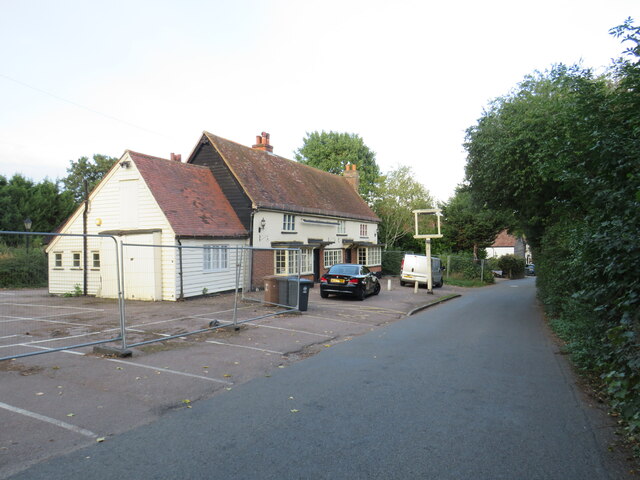
Disused pub, Aston, near Stevenage
The former Rose & Crown pub in Aston, near Stevenage. The pub had been closed for several years when this photo was taken. However, it is likely that the building was still occupied as its windows haven't been boarded up.

See other images of Rose & Crown pubs
Rose and Crown pubs

King Edward III used a golden rose as a personal badge, and two of his sons adapted it by changing the colour: John of Gaunt, 1st Duke of Lancaster, used a red rose, and Edmund of Langley, 1st Duke of York, used a white rose. The dynastic conflicts between their descendants are collectively called the Wars of the Roses. In 1485 Henry Tudor, a descendant of Lancaster, defeated Richard III of the York dynasty and married Richard's niece Elizabeth of York. Since then the combined red-and-white Tudor rose, often crowned, has been a symbol of the monarchy of England.


Creative Commons Licence [Some Rights Reserved]   © Copyright Malc McDonald and licensed for reuse under this Creative Commons Licence.
Geographical Context: Village, Rural settlement Derelict, Disused Near: Stevenage County: Hertfordshire Place: Aston Primary Subject: Public House other tags: Disused Pub Disused Public House Public House (Disused) Former Pub Former Village Pub Click a tag, to view other nearby images.
This photo is linked from: Automatic Clusters: · Window [3] · Near Stevenage [3] · Rose Crown [2] ·
1:50,000 Modern Day Landranger(TM) Map © Crown Copyright
+
+
1:50,000 Modern Day Landranger(TM) Map © Crown Copyright
TIP: Click the map for more Large scale mapping
Grid Square
TL2722, 46 images   (more nearby 🔍)
Photographer
Malc McDonald   (more nearby)
Date Taken
Sunday, 25 September, 2022   (more nearby)
Submitted
Sunday, 9 October, 2022
Subject Location
OSGB36: geotagged! TL 2740 2272 [10m precision]
WGS84: 51:53.3092N 0:9.0123W
Camera Location
OSGB36: geotagged! TL 2738 2270
View Direction
North-northeast (about 22 degrees)
Clickable map
+
NW N NE
W Go E
SW S SE
Image Type (about): geograph 
This page has been viewed about 46 times
You are not logged in login | register