Nothing Special   »   [go: up one dir, main page]

2022

TQ4416 : River Ouse near Barcombe Cross

taken 2 years ago, near to Isfield, East Sussex, England

This is 1 of 26 images, with title starting with River in this square
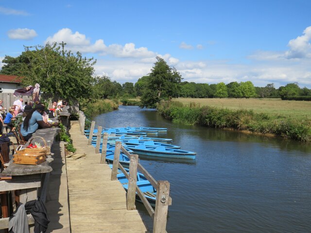
River Ouse near Barcombe Cross
A view of the River Ouse in East Sussex, as it flows past the Anchor Inn. The blue boats belong to a boat hire business which operates here.
River Ouse (Sussex)

The Ouse rises at Lower Beeding and flows generally southwards to reach the English Channel at Newhaven, a distance of approximately 33 miles. The Sussex Ouse Valley Way follows its route from source to mouth. The River is one of four rivers to cut through the South Downs, an example of Superimposed drainage.
Wikipedia: LinkExternal link


Creative Commons Licence [Some Rights Reserved]   © Copyright Malc McDonald and licensed for reuse under this Creative Commons Licence.
Geographical Context: Rivers, Streams, Drainage River: River Ouse Ouse (Sussex) Near: Uckfield Lewes Barcombe Cross Primary Subject: River other tags: Boat Hire Hire Boat Fleet Hire Boats Click a tag, to view other nearby images.
This photo is linked from: Automatic Clusters: · Near Barcombe Cross [5] ·
1:50,000 Modern Day Landranger(TM) Map © Crown Copyright
+
+
1:50,000 Modern Day Landranger(TM) Map © Crown Copyright
TIP: Click the map for more Large scale mapping
Grid Square
TQ4416, 131 images   (more nearby 🔍)
Photographer
Malc McDonald   (more nearby)
Date Taken
Monday, 29 August, 2022   (more nearby)
Submitted
Saturday, 3 September, 2022
Subject Location
OSGB36: geotagged! TQ 4423 1603 [10m precision]
WGS84: 50:55.5422N 0:3.0498E
Camera Location
OSGB36: geotagged! TQ 4423 1602
View Direction
North-northeast (about 22 degrees)
Clickable map
+
NW N NE
W Go E
SW S SE
Image Type (about): geograph 
This page has been viewed about 37 times
You are not logged in login | register