2022
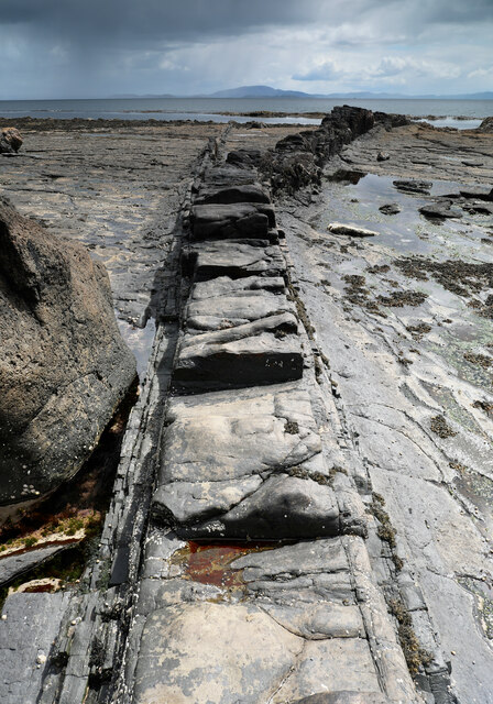
NM5521 : Forking dyke at Carraig Mhòr
taken 3 years ago, near to Carsaig, Isle of Mull, Argyll And Bute, Scotland

Forking dyke at Carraig Mhòr
This dyke doesn't seem to have been thought big enough to map on the 1:50000 1992 Geological sheet 44 but seems to be parallel to a fault which marks the boundary between lava flows to the east downfault past the Lower Jurassic Strata exposed either side of the dyke. On the aerial view it appears very curved, but seen here close up, the main dyke indeed curves west, but a subsidiary dyke, on the left in this view, and much more jointed, suggesting more rapid cooling, splits off from the main one and continues straight down towards the tide line. For anyone wanting to get across the slippery weed-covered tidal rocks to reach the tiny bit of land in the square to the south, the dyke forms a convenient walkway, for the most part remaining high enough not to have been colonised by the seaweed.