Nothing Special   »   [go: up one dir, main page]

2024

SK4446 : Footpath on the line of a former tramway

taken 5 months ago, near to Langley Mill, Derbyshire, England
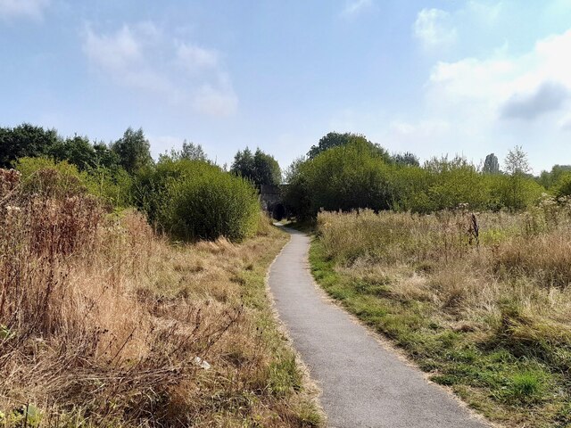
Footpath on the line of a former tramway
This stretch of footpath is on the line of an old tramway, which ran from Loscoe Colliery to wharves on the Erewash and Nottingham Canals, near the Anchor Inn. It is marked on the Ordnance Survey First Series map of 1836. By 1880, the western part of the tramway had been replaced by the Midland Railway Heanor Branch. This railway retained a junction with the remaining eastern part of the tramway, which still served the canals. By 1900, the remaining tramway had disappeared and this stretch is marked as a footpath.

Creative Commons Licence [Some Rights Reserved]   © Copyright Ian Calderwood and licensed for reuse under this Creative Commons Licence.
Geographical Context: Paths Suburb, Urban fringe Railways Derelict, Disused Industry Former: Tramway Mineral Line Primary Subject: Path other tags: Footpath Click a tag, to view other nearby images.
This photo is linked from: Automatic Clusters: · Footpath [3] · Midland Railway [2] ·
1:50,000 Modern Day Landranger(TM) Map © Crown Copyright
+
+
1:50,000 Modern Day Landranger(TM) Map © Crown Copyright
TIP: Click the map for more Large scale mapping
Grid Square
SK4446, 152 images   (more nearby 🔍)
Photographer
Ian Calderwood   (more nearby)
Date Taken
Friday, 6 September, 2024   (more nearby)
Submitted
Monday, 9 September, 2024
Subject Location
OSGB36: geotagged! SK 4496 4670 [10m precision]
WGS84: 53:0.9433N 1:19.8768W
Camera Location
OSGB36: geotagged! SK 4492 4671
View Direction
East-southeast (about 112 degrees)
Clickable map
+
NW N NE
W Go E
SW S SE
Image Type (about): geograph 
This page has been viewed about 20 times
You are not logged in login | register