Nothing Special   »   [go: up one dir, main page]

2013

SJ3166 : Mancott Presbyterian Church and church hall

taken 12 years ago, near to Mancot Royal, Flintshire/Sir y Fflint, Wales
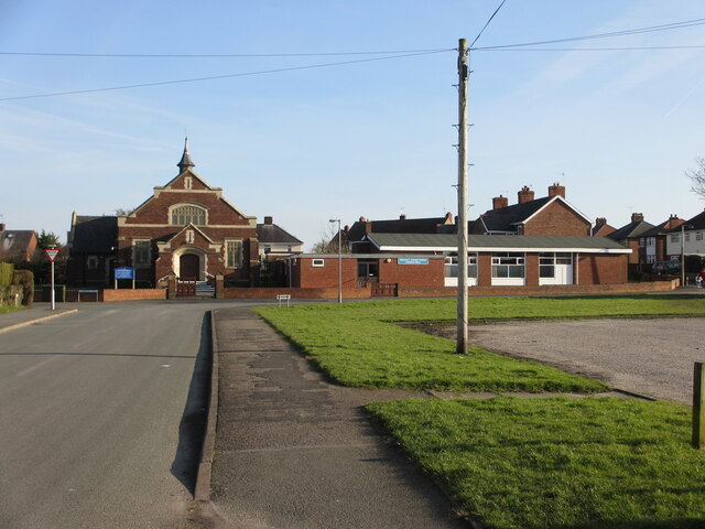
Mancott Presbyterian Church and church hall
Looking along Mancot Lane towards Mancott Presbyterian Church and church hall. For some reason the church and the village names are spelt differently; also since this photo was taken in 2013 houses have been built on the former library car park on the right. There is an Ordnance Survey benchmark on the right hand corner of the church: SJ3166 : Benchmark on Mancott Presbyterian Church, Mancot

Creative Commons Licence [Some Rights Reserved]   © Copyright John S Turner and licensed for reuse under this Creative Commons Licence.
Geographical Context: Historic sites and artefacts Paths Religious sites Roads, Road transport Primary Subject: Church other tags: Presbyterian Church Road Path Church Hall Benchmark Click a tag, to view other nearby images.
This photo is linked from: Automatic Clusters: · Mancot [6] · Mancott Presbyterian Church [2] Other Photos: · Benchmark on Mancott Presbyterian Church, Mancot ·
1:50,000 Modern Day Landranger(TM) Map © Crown Copyright
+
+
1:50,000 Modern Day Landranger(TM) Map © Crown Copyright
TIP: Click the map for more Large scale mapping
Grid Square
SJ3166, 28 images   (more nearby 🔍)
Photographer
John S Turner   (more nearby)
Date Taken
Sunday, 17 February, 2013   (more nearby)
Submitted
Wednesday, 3 July, 2024
Subject Location
OSGB36: geotagged! SJ 3196 6686 [10m precision]
WGS84: 53:11.6671N 3:1.1925W
Camera Location
OSGB36: geotagged! SJ 3192 6688
View Direction
East-southeast (about 112 degrees)
Clickable map
+
NW N NE
W Go E
SW S SE
Image Type (about): geograph 
This page has been viewed about 20 times
You are not logged in login | register