Nothing Special   »   [go: up one dir, main page]

2024

NS5270 : Signs at the station

taken 11 months ago, near to Drumchapel, Glasgow, Scotland
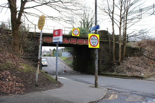
Signs at the station
The road exits from Drumchapel Station onto Garscadden Road. To the left it goes under the railway bridge, which has a height restriction of 4.0m (13'0"). All buses are instructed to turn right (just in case!).

Note the cone in the large pothole under the bridge.

Creative Commons Licence [Some Rights Reserved]   © Copyright Richard Sutcliffe and licensed for reuse under this Creative Commons Licence.
Geographical Context: Roads, Road transport Railways Primary Subject: Sign other tags: Railway Station Traffic Cone Pothole Railway Bridge Over Road Height Restriction Signs Click a tag, to view other nearby images.
This photo is linked from: Automatic Clusters: · Garscadden Road [29] · Drumchapel Railway Station [16] · Sign [5] ·
1:50,000 Modern Day Landranger(TM) Map © Crown Copyright
+
1:50,000 Modern Day Landranger(TM) Map © Crown Copyright
TIP: Click the map for more Large scale mapping
Grid Square
NS5270, 130 images   (more nearby 🔍)
Photographer
Richard Sutcliffe   (more nearby)
Date Taken
Monday, 18 March, 2024   (more nearby)
Submitted
Wednesday, 20 March, 2024
Subject Location
OSGB36: geotagged! NS 5230 7051 [10m precision]
WGS84: 55:54.2979N 4:21.8501W
Camera Location
OSGB36: geotagged! NS 5230 7051
View Direction
South-southwest (about 202 degrees)
Clickable map
+
NW N NE
W Go E
SW S SE
Image Type (about): geograph 
This page has been viewed about 12 times
You are not logged in | login | register