Nothing Special   »   [go: up one dir, main page]

2023

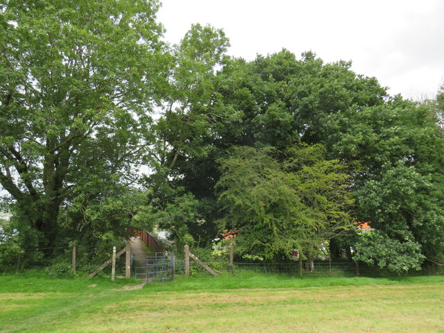
SH9234 : Cross Britain Way, Bala

taken 1 year ago, near to Y Bala, Gwynedd, Wales
Cross Britain Way, Bala
A public footpath passing through a kissing gate and onto a bridge which carries it across the Bala Lake Railway on the outskirts of Bala, in Snowdonia National Park.

This path is on the route of the Cross Britain Way.
The Cross Britain Way (Macmillan Way)

The Cross Britain Way is a 279 mile, east-west trail across England and Wales, created to help raise money for Macmillan Cancer Support. Starting at Boston (where the original Macmillan Way starts), it crosses the Fens, the Vale of Belvoir, the Leicestershire/Nottinghamshire Wolds, the National Forest, Cannock Chase, East Shropshire along the Iron Bridge Gorge, the Shropshire Hills, the hills of mid Wales, the Berwyn Mountains, and Snowdonia National Park, to its end at Barmouth. LinkExternal link

Eryri :: SH5646

Parc Cenedlaethol Eryri (Eryri National Park) (was formerly known in English as 'Snowdonia' National Park) lies within two counties of Wales (Gwynedd and Conwy) and was created in 1951. LinkExternal link


Creative Commons Licence [Some Rights Reserved]   © Copyright Malc McDonald and licensed for reuse under this Creative Commons Licence.
Geographical Context: Paths Long Distance Path: Cross Britain Way Gate: Kissing Gate Metal Kissing Footpath Gate: Metal Kissing Metal Country: Wales Place: Y Bala Bala County: Gwynedd Area: Snowdonia National Park Primary Subject: Path other tags: Public Footpath Kissing Gate Metal Kissing Gate Public Footpath Gate Click a tag, to view other nearby images.
1:50,000 Modern Day Landranger(TM) Map © Crown Copyright
+
+
1:50,000 Modern Day Landranger(TM) Map © Crown Copyright
TIP: Click the map for more Large scale mapping
Grid Square
SH9234, 65 images   (more nearby 🔍)
Photographer
Malc McDonald   (more nearby)
Date Taken
Friday, 11 August, 2023   (more nearby)
Submitted
Saturday, 2 September, 2023
Subject Location
OSGB36: geotagged! SH 9290 3493 [10m precision]
WGS84: 52:54.0662N 3:35.6218W
Camera Location
OSGB36: geotagged! SH 9291 3492
View Direction
NORTH (about 0 degrees)
Clickable map
+
NW N NE
W Go E
SW S SE
Image Type (about): geograph 
This page has been viewed about 42 times
You are not logged in login | register