Nothing Special   »   [go: up one dir, main page]

2023

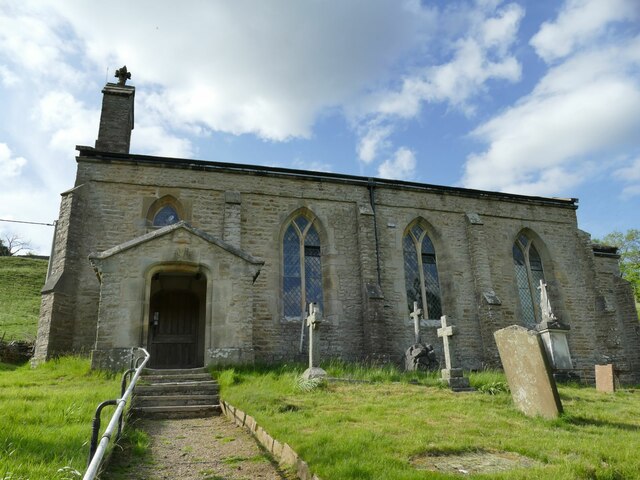
SD9898 : Melbecks Holy Trinity: south side

taken 2 years ago, near to Feetham, North Yorkshire, England

Melbecks Holy Trinity: south side
Approach to the church is by a steep path with steps, but making it 'accessible' would be a challenge.
Church of Holy Trinity, Melbecks (Low Row)

The parish name was historically Melbecks but the village is now known as Low Row. The church dates from the early 19th century; on the earliest OS map of the 1840s it is named as 'Trinity Church (perpetual curacy)'. It is now one of four in the large combined parish of Upper Swaledale with Arkengarthdale. The church dates from 1840 and is grade II listed (list entry 1318631). As of 2023 it was on English Heritage's 'Heritage at Risk Register'.


Creative Commons Licence [Some Rights Reserved]   © Copyright Stephen Craven and licensed for reuse under this Creative Commons Licence.
Geographical Context: Village, Rural settlement Religious sites Date: 1840 other tags: Grade II Listed Anglican Church Click a tag, to view other nearby images.
This photo is linked from: Automatic Clusters: · Holy Trinity Church [19] · South [4] · Path [3] Other Photos: · The Gables, near Crackpot in Swaledale ·
1:50,000 Modern Day Landranger(TM) Map © Crown Copyright
+
+
1:50,000 Modern Day Landranger(TM) Map © Crown Copyright
TIP: Click the map for more Large scale mapping
Grid Square
SD9898, 125 images   (more nearby 🔍)
Photographer
Stephen Craven   (more nearby)
Date Taken
Saturday, 27 May, 2023   (more nearby)
Submitted
Tuesday, 6 June, 2023
Subject Location
OSGB36: geotagged! SD 9864 9842 [10m precision]
WGS84: 54:22.8764N 2:1.3467W
Camera Location
OSGB36: geotagged! SD 9865 9839
View Direction
North-northwest (about 337 degrees)
Clickable map
+
NW N NE
W Go E
SW S SE
Image Type (about): geograph 
This page has been viewed about 25 times
You are not logged in | login | register