Nothing Special   »   [go: up one dir, main page]

2020

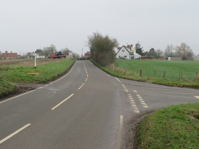
TL4925 : Road junction near Manuden

taken 5 years ago, near to Manuden, Essex, England
Road junction near Manuden
A road junction in the north Essex countryside, near the village of Manuden. A traditional wooden signpost shows directions.

The roads ahead and to the right are on the route of National Cycle Network route 11.
National Cycle Route 11

NCN Route 11 is a Sustrans National Cycle Route connecting Harlow in Essex to King's Lynn in Norfolk, via Cambridge.

The National Cycle Network

The National Cycle Network is a network of cycle routes. It was created by the charity Sustrans LinkExternal link (Sustainable Transport), aided by a National Lottery grant.

Many routes aim to minimise contact with motor traffic, though 70% of them are on roads. In some cases the NCN uses pedestrian routes, disused railways, minor roads, canal towpaths, or traffic-calmed routes in towns and cities.


Creative Commons Licence [Some Rights Reserved]   © Copyright Malc McDonald and licensed for reuse under this Creative Commons Licence.
This photo is linked from: Automatic Clusters: · Road Near Manuden [4] · Road Junction [2] Other Photos: · Direction Sign – Signpost south of Manuden village ·
1:50,000 Modern Day Landranger(TM) Map © Crown Copyright
+
+
1:50,000 Modern Day Landranger(TM) Map © Crown Copyright
TIP: Click the map for more Large scale mapping
Grid Square
TL4925, 7 images   (more nearby 🔍)
Photographer
Malc McDonald   (more nearby)
Date Taken
Saturday, 25 January, 2020   (more nearby)
Submitted
Sunday, 26 January, 2020
Subject Location
OSGB36: geotagged! TL 4922 2599 [10m precision]
WGS84: 51:54.7474N 0:10.0824E
Camera Location
OSGB36: geotagged! TL 4922 2598
View Direction
NORTH (about 0 degrees)
Clickable map
+
NW N NE
W Go E
SW S SE
Image Type (about): geograph 
This page has been viewed about 60 times
You are not logged in login | register