Nothing Special   »   [go: up one dir, main page]

2019

NS2842 : A78 approaching Pennyburn Roundabout

taken 5 years ago, near to Stevenston, North Ayrshire, Scotland
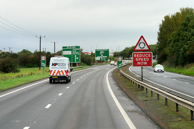
A78 approaching Pennyburn Roundabout
The A78 runs for 42 miles between Greenock and Prestwick. For much of its route, it follows the northern section of the Ayrshire coast. Although it is classified as a primary road throughout its length, the standard varies. Much of the road is single carriageway, both for a short distance through Greenock and a 21-mile stretch between Inverkip and Ardrossan. The rest is dual carriageway; between the Eglinton and Warrix interchanges there are in fact 3 lanes in each direction, and the road is constructed to motorway standard (with full grade separation at junctions) except for a lack of hard shoulders.

See other images of The A78 Road

Creative Commons Licence [Some Rights Reserved]   © Copyright David Dixon and licensed for reuse under this Creative Commons Licence.
This photo is linked from: Automatic Clusters: · A78 [5] · Approaching [4] · Pennyburn Roundabout [3] ·
1:50,000 Modern Day Landranger(TM) Map © Crown Copyright
+
+
1:50,000 Modern Day Landranger(TM) Map © Crown Copyright
TIP: Click the map for more Large scale mapping
Grid Square
NS2842, 49 images   (more nearby 🔍)
Photographer
David Dixon   (more nearby)
Date Taken
Monday, 23 September, 2019   (more nearby)
Submitted
Thursday, 12 December, 2019
Subject Location
OSGB36: geotagged! NS 283 425 [100m precision]
WGS84: 55:38.7387N 4:43.7314W
Camera Location
OSGB36: geotagged! NS 285 424
View Direction
West-northwest (about 292 degrees)
Clickable map
+
NW N NE
W Go E
SW S SE
Image Type (about): geograph 
This page has been viewed about 122 times
You are not logged in login | register