Nothing Special   »   [go: up one dir, main page]

2019

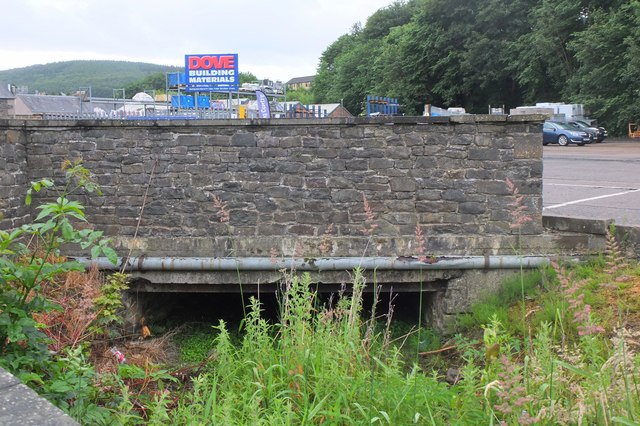
NT4836 : Old mill lade, Galashiels (10)

taken 6 years ago, near to Galashiels, Scottish Borders, Scotland

Old mill lade, Galashiels (10)
Here the lade disappears under the builders' supplies yard for a stretch, turning south towards Hall Street.
Galashiels mill lade

Galashiels expanded from a village to a textile town in the early 19th century. Water wheels powered the mills, supplied from a cauld (weir) on the Gala Water, flowing in a mill lade or channel built to take water from mill to mill. The lade ran southeastwards from the cauld to rejoin the Gala Water about 2km downstream. It is marked as 'Mill Lead' on the OS 6" map of the town published in 1900.


Creative Commons Licence [Some Rights Reserved]   © Copyright Jim Barton and licensed for reuse under this Creative Commons Licence.
Geographical Context: Historic sites and artefacts City, Town centre Derelict, Disused Industry Former: Mill Lade other tags: Industrial Archaeology Click a tag, to view other nearby images.
This photo is linked from: Automatic Clusters: · Old Mill Lade [15] · Hall Street [6] ·
1:50,000 Modern Day Landranger(TM) Map © Crown Copyright
+
+
1:50,000 Modern Day Landranger(TM) Map © Crown Copyright
TIP: Click the map for more Large scale mapping
Grid Square
NT4836, 284 images   (more nearby 🔍)
Photographer
Jim Barton   (more nearby)
Date Taken
Tuesday, 9 July, 2019   (more nearby)
Submitted
Wednesday, 10 July, 2019
Subject Location
OSGB36: geotagged! NT 4877 3656 [10m precision]
WGS84: 55:37.1948N 2:48.8999W
Camera Location
OSGB36: geotagged! NT 4877 3658
View Direction
South-southwest (about 202 degrees)
Clickable map
+
NW N NE
W Go E
SW S SE
Image Type (about): geograph 
This page has been viewed about 68 times
You are not logged in | login | register