2021
TL4459 : A Warboys brick
taken 3 years ago, near to Chesterton, Cambridgeshire, England

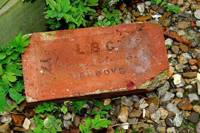
A Warboys brick
Lying in a back alley in the inner suburbs of Cambridge, this brick may be dated to some time between the late 1930s and early 1950s. The brickworks at Warboys TL3079 in Huntingdonshire (absorbed into Cambridgeshire in 1974) operated between 1893 and 1984, extracting and firing the Upper Oxford clay from the local beds. Their most famous product was the so-called Warboys White, millions of which were shipped to build houses in nearby towns and as far afield as Nottinghamshire. Originally they were exported by rail, using the Great Northern & Great Eastern Joint line which ran adjacent to the works, but by 1930 road transport was used for most loads.
In the 1930s Warboys, like many small brickyards across the country, was taken over by the London Brick Company. Activity was paused during the war years, probably to avoid interference with operations at the neighbouring RAF Warboys. From the 1950s production was concentrated on drainage articles rather than building bricks. Becoming increasingly uneconomic, the works were taken over by the Hanson Trust but finally closed in August 1984.
In the 1930s Warboys, like many small brickyards across the country, was taken over by the London Brick Company. Activity was paused during the war years, probably to avoid interference with operations at the neighbouring RAF Warboys. From the 1950s production was concentrated on drainage articles rather than building bricks. Becoming increasingly uneconomic, the works were taken over by the Hanson Trust but finally closed in August 1984.