2021
TG0511 : Mattishall village sign (2)
taken 4 years ago, near to Mattishall, Norfolk, England

Mattishall village sign (2)
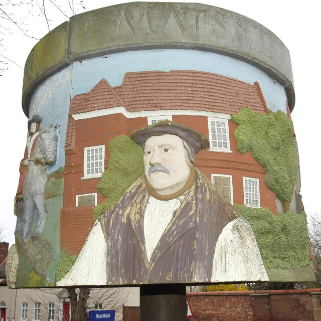
A sign in the round in four parts. (1) The silver coins represent the hoard of 1100 Roman coins found in January 1968, discovered while digging at the side of a driveway to a new bungalow in the village. (2) The man in hat and robes is Matthew Parker, the first Archbishop appointed by Elizabeth I. He was born in Norwich in 1504, Margaret Harlestone, his wife was born in Mattishall. (3) The coat of arms is that of Gonville and Caius College, Cambridge which had income from the Great Tithes of Mattishall Church and with the Advowson. Also represented on this panel is a wool dealer, some of whom bought wool from the west of the county and sold through Norwich market. Those that circumvented the system and avoided taxes were known as "Mattishall wool Broggers". (4) Finally the panel with the cart shows a Dobbs Brothers' tumbril painted in their particular colours. The Dobbs family lived and worked in Mattishall for well over 100 years, manufacturing tumbrils, carts and harrows. Link
Village Signs of East Anglia
Village signs are typically placed along the principal road or in a prominent location such as a village green or close by the church. The design often depicts a particularly feature of the village or a scene from its history, heritage, or culture. They are typically made of wood or metal or a combination of both, the designs are often made by the local community.
Although they do appear in villages and towns all over the country they are more prominent in East Anglia than elsewhere in the country.