Nothing Special   »   [go: up one dir, main page]

2021

ST1598 : Bargoed Gauging Station, River Rhymney, Gilfach

taken 4 years ago, near to Pengam, Caerphilly/Caerffili, Wales
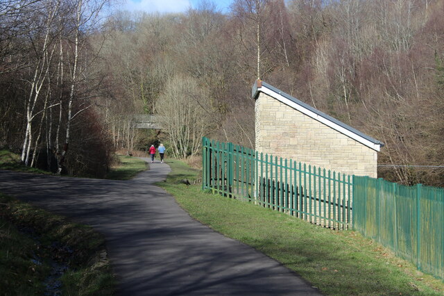
Bargoed Gauging Station, River Rhymney, Gilfach
The associated weir is to the right, out of shot.
Bargoed Woodland Park

The country park is a green space in the Rhymney Valley between Bargoed and Aberbargoed on the landscaped site of three former collieries and colliery waste. The Rhymney River runs through the linear park and the waste has been planted with thousands of trees and wild flowers.


Creative Commons Licence [Some Rights Reserved]   © Copyright M J Roscoe and licensed for reuse under this Creative Commons Licence.
Geographical Context: Paths Boundary, Barrier Park and Public Gardens Woodland, Forest Primary Subject: Path Junction other tags: Tarmac Path Green Metal Railings Trees in Spring River Gauging Station Click a tag, to view other nearby images.
1:50,000 Modern Day Landranger(TM) Map © Crown Copyright
+
+
1:50,000 Modern Day Landranger(TM) Map © Crown Copyright
TIP: Click the map for more Large scale mapping
Grid Square
ST1598, 213 images   (more nearby 🔍)
Photographer
M J Roscoe   (more nearby)
Date Taken
Tuesday, 16 March, 2021   (more nearby)
Submitted
Thursday, 18 March, 2021
Subject Location
OSGB36: geotagged! ST 1559 9837 [10m precision]
WGS84: 51:40.6638N 3:13.3319W
Camera Location
OSGB36: geotagged! ST 1558 9834
View Direction
North-northeast (about 22 degrees)
Clickable map
+
NW N NE
W Go E
SW S SE
Image Type (about): geograph 
This page has been viewed about 47 times
You are not logged in | login | register