Nothing Special   »   [go: up one dir, main page]

2021

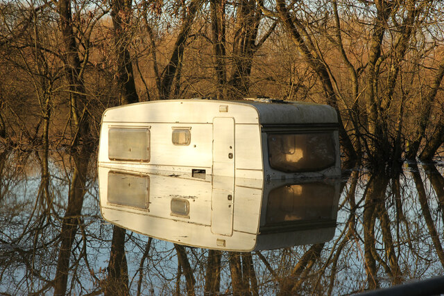
SK8266 : Girton Grasslands - flooded

taken 4 years ago, near to Girton, Nottinghamshire, England

Girton Grasslands - flooded
A caravan in one of the meadows between Girton and the A1133, deep in floodwater from The Fleet in February 2021
Girton Grasslands

Nottinghamshire Wildlife Trust site LinkExternal link an excellent example of Trent Valley floodplain meadows, thought to have been created after the Great Flood of 1795 as a floodwater storage to help protect the village. The grasslands regularly flood and provide a diverse wildlife habitat.


Creative Commons Licence [Some Rights Reserved]   © Copyright Richard Croft and licensed for reuse under this Creative Commons Licence.
Geographical Context: Grassland Rivers, Streams, Drainage Place: Girton other tags: Flooded Fields Click a tag, to view other nearby images.
This photo is linked from: Articles: · Images shortlisted for POTY 2021 Automatic Clusters: · Fleet [6] · Girton Grasslands [5] · Fleet in Flood [4] Title Clusters: · Girton Grasslands - flooded [2] ·
1:50,000 Modern Day Landranger(TM) Map © Crown Copyright
+
+
1:50,000 Modern Day Landranger(TM) Map © Crown Copyright
TIP: Click the map for more Large scale mapping
Grid Square
SK8266, 75 images   (more nearby 🔍)
Photographer
Richard Croft   (more nearby)
Date Taken
Monday, 1 February, 2021   (more nearby)
Submitted
Wednesday, 3 February, 2021
Subject Location
OSGB36: geotagged! SK 8274 6604 [10m precision]
WGS84: 53:11.1019N 0:45.7963W
Camera Location
OSGB36: geotagged! SK 8275 6602
View Direction
North-northwest (about 337 degrees)
Clickable map
+
NW N NE
W Go E
SW S SE
Image Type (about): geograph 
This page has been viewed about 115 times
You are not logged in login | register