Nothing Special   »   [go: up one dir, main page]

2020

SK3721 : Route of the Dimsdale branch, Ticknall tramway

taken 5 years ago, near to Calke, Derbyshire, England
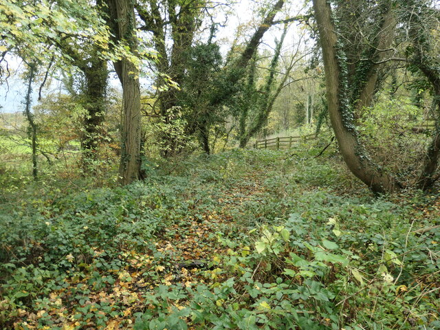
Route of the Dimsdale branch, Ticknall tramway
Most of the branch is a permissive footpath, but this bit has been abandoned, to make the crossing of Heath Lane less dangerous. The horse-drawn Ticknall tramway opened in 1802, to carry lime and other minerals from kilns in Ticknall to Willesley basin on the Ashby Canal. It officially closed in 1915. This branch to Dimminsdale opened in 1830 and closed in 1891.

Creative Commons Licence [Some Rights Reserved]   © Copyright Christine Johnstone and licensed for reuse under this Creative Commons Licence.
Geographical Context: Railways other tags: Line of Former Tramway Former Mineral Tramway Click a tag, to view other nearby images.
1:50,000 Modern Day Landranger(TM) Map © Crown Copyright
+
+
1:50,000 Modern Day Landranger(TM) Map © Crown Copyright
TIP: Click the map for more Large scale mapping
Grid Square
SK3721, 41 images   (more nearby 🔍)
Photographer
Christine Johnstone   (more nearby)
Date Taken
Tuesday, 3 November, 2020   (more nearby)
Submitted
Monday, 23 November, 2020
Subject Location
OSGB36: geotagged! SK 3705 2152 [10m precision]
WGS84: 52:47.3991N 1:27.1225W
Camera Location
OSGB36: geotagged! SK 3711 2151
View Direction
WEST (about 270 degrees)
Clickable map
+
NW N NE
W Go E
SW S SE
Image Type (about): geograph 
This page has been viewed about 36 times
You are not logged in | login | register