Nothing Special   »   [go: up one dir, main page]

2020

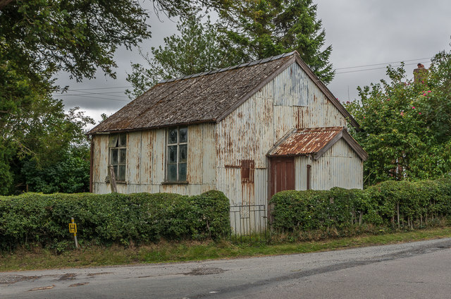
SO5974 : Former Primitive Methodist Chapel

taken 5 years ago, near to Knowle, Shropshire, England

Former Primitive Methodist Chapel
A "tin tabernacle" built in 1879 and closed in 1917 when it was replaced by a more permanent building (see SO5973 : 4 and 5 Tenbury Road). Even so, whilst showing some signs of rust, it would appear to remain in reasonable condition.
Tin tabernacles

"Tin tabernacles" (or more properly "iron churches") were produced in large numbers from the mid 19th Century into the early 20th Century. They were built with a timber frame, clad with galvanised and corrugated iron, and lined with tongue and groove boarding. Prepared as prefabricated kits, they were also exported to many countries overseas.


Creative Commons Licence [Some Rights Reserved]   © Copyright Ian Capper and licensed for reuse under this Creative Commons Licence.
Geographical Context: Village, Rural settlement Religious sites Place: Knowle other tags: Tin Tabernacle Primitive Methodist Chapel Click a tag, to view other nearby images.
This photo is linked from: Automatic Clusters: · Primitive Methodist Chapel [2] Other Photos: · 4 and 5 Tenbury Road · Two tin tabernacles · 11 and 13 Lion Lane Title Clusters: · Former Primitive Methodist Chapel [2] ·
1:50,000 Modern Day Landranger(TM) Map © Crown Copyright
+
+
1:50,000 Modern Day Landranger(TM) Map © Crown Copyright
TIP: Click the map for more Large scale mapping
Grid Square
SO5974, 50 images   (more nearby 🔍)
Photographer
Ian Capper   (more nearby)
Date Taken
Thursday, 6 August, 2020   (more nearby)
Submitted
Sunday, 20 September, 2020
Subject Location
OSGB36: geotagged! SO 597 740 [100m precision]
WGS84: 52:21.7633N 2:35.5245W
Camera Location
OSGB36: geotagged! SO 597 740
View Direction
East-southeast (about 112 degrees)
Clickable map
+
NW N NE
W Go E
SW S SE
Image Type (about): geograph 
This page has been viewed about 71 times
You are not logged in | login | register