Nothing Special   »   [go: up one dir, main page]

2017

SK5447 : Path into Leen Valley Country Park

taken 8 years ago, near to Bestwood Village, Nottinghamshire, England
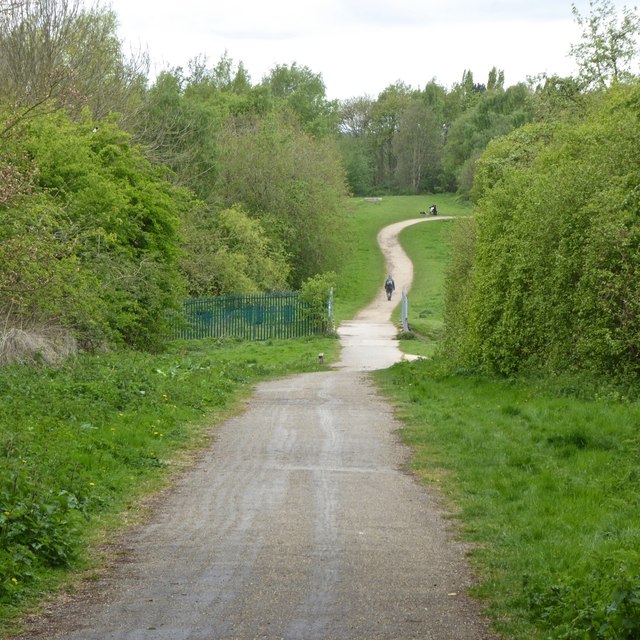
Path into Leen Valley Country Park
This forms part of both the Robin Hood Way and NCN route 6
National Cycle Network Route 6

National Route 6 of the National Cycle Network passes through Watford, Luton, Milton Keynes, Northampton, Market Harborough, Leicester, Derby, Nottingham, Worksop, Sheffield, Manchester, Blackburn, Preston, Lancaster, Kendal and Windermere, and will connect London and Threlkeld (nr. Keswick) in Cumbria when complete.

LinkExternal link National Route 6 on the Sustrans web site.

Robin Hood Way

The Robin Hood Way is a long distance waymarked footpath in Nottinghamshire, which makes use of a number of footpaths, bridleways, and roads to provide a walking route linking locations associated with the Robin Hood legend. 84 miles long at its inception in 1985, it has since been extended to about 105 miles in order to include more places of interest. The Robin Hood Way Association publish a guidebook to the route, and provide further information about it on their website: LinkExternal link


Creative Commons Licence [Some Rights Reserved]   © Copyright David Lally and licensed for reuse under this Creative Commons Licence.
Geographical Context: Paths Park and Public Gardens Suburb, Urban fringe other tags: NCN Route 6 Robin Hood Way Click a tag, to view other nearby images.
This photo is linked from: Automatic Clusters: · Path [13] · Part of the Robin Hood Way [7] ·
1:50,000 Modern Day Landranger(TM) Map © Crown Copyright
+
+
1:50,000 Modern Day Landranger(TM) Map © Crown Copyright
TIP: Click the map for more Large scale mapping
Grid Square
SK5447, 72 images   (more nearby 🔍)
Photographer
David Lally   (more nearby)
Date Taken
Thursday, 27 April, 2017   (more nearby)
Submitted
Friday, 28 April, 2017
Subject Location
OSGB36: geotagged! SK 5477 4753 [10m precision]
WGS84: 53:1.3362N 1:11.0957W
Camera Location
OSGB36: geotagged! SK 54839 47445
View Direction
Northwest (about 315 degrees)
Clickable map
+
NW N NE
W Go E
SW S SE
Image Type (about): geograph 
This page has been viewed about 165 times
You are not logged in login | register