Nothing Special   »   [go: up one dir, main page]

2016

ST4948 : What Somerset used to look like?

taken 9 years ago, near to Westbury-Sub-Mendip, Somerset, England
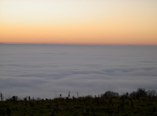
What Somerset used to look like?
A day of freezing fog and minimal winds have brought some dense fog to cover the low levels of the old county. Once the county's lower parts would have been under water, or at least marshy and would have perhaps looked not unlike this.

Creative Commons Licence [Some Rights Reserved]   © Copyright Neil Owen and licensed for reuse under this Creative Commons Licence.
Geographical Context: Lowlands Flat landscapes Primary Subject: Valley other tags: Somerset Levels Fog Dusk Click a tag, to view other nearby images.
1:50,000 Modern Day Landranger(TM) Map © Crown Copyright
+
+
1:50,000 Modern Day Landranger(TM) Map © Crown Copyright
TIP: Click the map for more Large scale mapping
Grid Square
ST4948, 34 images   (more nearby 🔍)
Photographer
Neil Owen   (more nearby)
Date Taken
Thursday, 1 December, 2016   (more nearby)
Submitted
Thursday, 1 December, 2016
Subject Location
OSGB36: geotagged! ST 496 484 [100m precision]
WGS84: 51:13.9748N 2:43.3346W
Camera Location
OSGB36: geotagged! ST 518 492
View Direction
West-southwest (about 247 degrees)
Clickable map
+
NW N NE
W Go E
SW S SE
Image Type (about): cross grid 
This page has been viewed about 33 times
You are not logged in | login | register