Nothing Special   »   [go: up one dir, main page]

2016

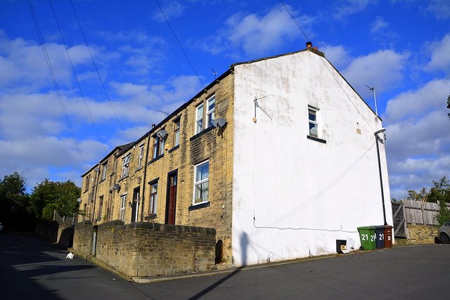
SE2135 : Low Bank Street, Farsley, Leeds

taken 8 years ago, near to Farsley, Leeds, England

Low Bank Street, Farsley, Leeds
Link the street sign just next to the Sky dish near the white wall.
Postcode LS28

All these pics were taken in the postcode LS28 which happened to be the postcode I was working in at the time.
Some of the pics are views of the surrounding area. All 29 postcodes will be covered eventually.


Creative Commons Licence [Some Rights Reserved]   © Copyright Mark Stevenson and licensed for reuse under this Creative Commons Licence.
Geographical Context: Housing, Dwellings
This photo is linked from: Automatic Clusters: · Low Bank Street [6] Other Photos: · Low Bank Street, Farsley, Leeds Title Clusters: · Low Bank Street, Farsley, Leeds [4] ·
1:50,000 Modern Day Landranger(TM) Map © Crown Copyright
+
+
1:50,000 Modern Day Landranger(TM) Map © Crown Copyright
TIP: Click the map for more Large scale mapping
Grid Square
SE2135, 476 images   (more nearby 🔍)
Photographer
Mark Stevenson   (more nearby)
Date Taken
Thursday, 6 October, 2016   (more nearby)
Submitted
Thursday, 13 October, 2016
Subject Location
OSGB36: geotagged! SE 2151 3529 [10m precision]
WGS84: 53:48.8073N 1:40.4881W
Camera Location
OSGB36: geotagged! SE 2153 3528
View Direction
Northwest (about 315 degrees)
Clickable map
+
NW N NE
W Go E
SW S SE
Image Type (about): geograph 
This page has been viewed about 32 times
You are not logged in | login | register