Nothing Special   »   [go: up one dir, main page]

2016

NF9379 : TRENCH starboard buoy

taken 9 years ago, near to Borgh, North Uist & Berneray, Na h-Eileanan an Iar, Scotland
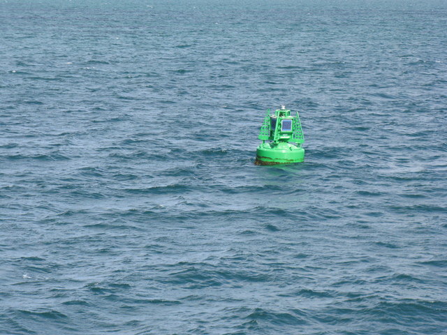
TRENCH starboard buoy
On the approach to Berneray/Bearnaraigh.
A passage from Leverburgh to Berneray

Images of buoys, beacon, rocks and skerries seen on the CalMac ferry from Harris across the Sound of Harris to Berneray and the southern Outer Hebrides. A small gap of 11.6km as the guillemot might fly, but the ferry has to take a much more devious route to navigate through the shallow passage - about 16.5km along the route shown on Google Earth, which seems very close to the route on the day. No regular ferry time-tabling for the ferries is possible, because of the changing tide times through the lunar cycle - passages at low tides are not wise! The precise location of the named buoys was obtained from listings in the Aids to Navigation Review 2015-2020, [obtainable at nlb.org.uk [Policies/Documents/GLA-AtoN-Review-2015], but I have been unable to find a direct link to the pdf. Published 2015 © Commissioners of Northern Lighthouses, Trinity House, Commissioners of Irish Lights]. They were plotted on the Google Earth map and the locations of the other images calculated by the time intervals between the known points of the buoys, and GPS observations made en route.


Creative Commons Licence [Some Rights Reserved]   © Copyright M J Richardson and licensed for reuse under this Creative Commons Licence.
Geographical Context: Coastal Docks, Harbours Estuary, Marine Primary Subject: Buoy Place: Sound of Harris/Caolas Na Hearadh other tags: Northern Lighthouse Board Na H-Eileanan an Iar/Outer Hebrides Click a tag, to view other nearby images.
1:50,000 Modern Day Landranger(TM) Map © Crown Copyright
+
+
1:50,000 Modern Day Landranger(TM) Map © Crown Copyright
TIP: Click the map for more Large scale mapping
Grid Square
NF9379, 6 images   (more nearby 🔍)
Photographer
M J Richardson   (more nearby)
Date Taken
Thursday, 2 June, 2016   (more nearby)
Submitted
Tuesday, 30 August, 2016
Subject Location
OSGB36: geotagged! NF 932 792 [100m precision]
WGS84: 57:41.8886N 7:9.0078W
Camera Location
OSGB36: geotagged! NF 932 791
View Direction
North-northeast (about 22 degrees)
Clickable map
+
NW N NE
W Go E
SW S SE
Image Type (about): geograph 
This page has been viewed about 50 times
You are not logged in | login | register