SK4351 : Ironville Bridge, Cromford Canal
taken 6 years ago, near to Ironville, Derbyshire, England
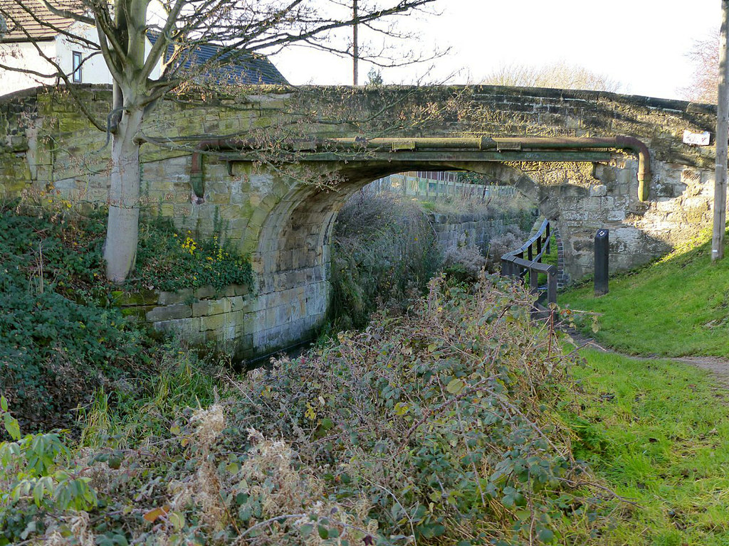
The Cromford Canal ran 14.5 miles from Langley Mill (where there was a connection to the Erewash and Nottingham Canals) to Cromford on the edge of the Peak District. It was opened in 1794 and for many years traded profitably carrying mainly coal, limestone, iron ore and lead. As with many other canals, however, it suffered from railway competition and was dealt a major blow when Butterley Tunnel had to be closed permanently in 1900 due to subsidence. The southern stretch remained open until 1944 when it was formally abandoned (except for a short distance at Langley Mill). Today there is an active restoration society, the Friends of the Cromford Canal, that hopes eventually to reopen the canal for navigation.
Listed buildings and structures are officially designated as being of special architectural, historical or cultural significance. There are over half a million listed structures in the United Kingdom, covered by around 375,000 listings.
Listed status is more commonly associated with buildings or groups of buildings, however it can cover many other structures, including bridges, headstones, steps, ponds, monuments, walls, phone boxes, wrecks, parks, and heritage sites, and in more recent times a road crossing (Abbey Road) and graffiti art (Banksy 'Spy-booth') have been included.
In England and Wales there are three main listing designations;
Grade I (2.5%) - exceptional interest, sometimes considered to be internationally important.
Grade II* (5.5%) - particularly important buildings of more than special interest.
Grade II (92%) - nationally important and of special interest.
There are also locally listed structures (at the discretion of local authorities) using A, B and C designations.
In Scotland three classifications are also used but the criteria are different. There are around 47,500 Listed buildings.
Category A (8%)- generally equivalent to Grade I and II* in England and Wales
Category B (51%)- this appears generally to cover the ground of Grade II, recognising national importance.
Category C (41%)- buildings of local importance, probably with some overlap with English Grade II.
In Northern Ireland the criteria are similar to Scotland, but the classifications are:
Grade A (2.3%)
Grade B+ (4.7%)
Grade B (93%)
Read more at Wikipedia Link
- Grid Square
- SK4351, 81 images (more nearby 🔍)
- Photographer
- Alan Murray-Rust (more nearby)
- Date Taken
- Friday, 30 November, 2018 (more nearby)
- Submitted
- Monday, 3 December, 2018
- Subject Location
-
OSGB36:
SK 4380 5168 [10m precision]
WGS84: 53:3.6348N 1:20.8737W - Camera Location
-
OSGB36:
- View Direction
- Southwest (about 225 degrees)